Showing posts with label annapurna. Show all posts

Sunday, July 2, 2023

Mulde View Point, Dobato and Poon Hill Route and Timings March 2023


Mulde View Point and Poon Hill Trek Route and Timings

With a view to extend the Poon Hill trek by a few days we decided to go a recce of a new route to Dobato and Muldai View Point – the Muldai route can be extended to Khopra Ridge as well.

February 28th 2023 - Flight Kathmandu to Pokhara drive to Ghandrung 

Our Buddha Air flight to Pokhara was at 7.55 am but when we reached the airport we were told that there are not enough passengers for two flights so they sent us on the earlier flight at 7 30 pm. The flight was uneventful with views of Langtang, Ganesh Himal and then Himalchuli and the Manaslu group. Finally just before Pokhara the Annapurnas and Macchapuchare came into view through the early morning fog. We landed at the new Pokhara airport which is big and very swanky with all the modern amenities and facilities. Our jeep ride to Kimche below Ghandrung took around 1 hr 45 min and we then started the walk to Ghandrung. Kimche is around 1700 metres and in an hour we reached Ghandrung which is 1980 metres. I was quite shocked to see the rapid urbanization of this beautiful village. Gone are the slate roofed houses and lodges - ugly new brick and concrete constructions are mushrooming all over the village some three storeys high- there is construction materials piled up everywhere destroying the old charm and beauty of this once upon a time Himalayan village. We walked up past our earlier lodges Milan and Gurung Cottage both which seemed to be quite congested and surrounded by new buildings in a state of semi construction and decided to stay at the Ghandrung Eco Lodge which thankfully had a better view and an open aspect - tomorrow we walk to Tadapani.

Pokhara to Kimche by jeep 1 hour 45 min to 2 hours; Kimche to Ghandrung trek 1 hour ; Ghandrung 2032m 28 22 34N 83 48 26 E

Ncell and NTC both working at Ghandrung 4G reception; Dal Bhat Rs 500 Black Tea Rs 80

Tuesday, March 14, 2023

New Roads in the Annapurna Region | Nepal


In the last few years a large number of new roads have come up in the Annapurna region (most of them remain as dirt tracks for four wheel drive jeeps) and these roads can reduce the trekking days for popular treks in the region. I list some of these roads below and give the cost of a reserved jeep in some cases where I have used them.

 Pokhara to Kimche

Kimche is about 1 hours walking below Ghandrung and this road goes upto Nayapul (black top) and then on a dirt track to Kimche – the black top section is quite good now and the whole journey by jeep takes about 2 hours. There are also buses running from the Pokhara bus park.  NPR 9000/-

 Pokhara to Ghandrung

It is possible now to go all the way upto Ghandrung by taking a lower road (not the Kimche one) by jeep and it would take about 2.5 hours to reach Ghandrung. An early departure from Pokhara would make it possible to trek to Tadapani the same day. NPR 10,000/-

 Pokhara to Kimrong Danda

The same road which goes to Ghandrung carries on further to Kimrong Danda possibly a 30 minutes drive from Ghandrung.

 Pokhara to Landrung

The approach to the Annapurna Base Camp trek would be shortened by a day or more by driving to Landrung in about 3 hours and heading up to Jhinu Danda the same day. But there is also now a road which is ending below Jhinu so for ABC trekkers looking to save time this would be the better option (see below). NPR 12,000/-

 Pokhara to below Jhinu Danda

This road goes near Jhinu Danda in about 3-3.5 hours from Pokhara so from here you could walk to Chomrong the same day.  NPR 12,000/-

 Pokhara to Dhampus

This walk from Phedi is now effectively over as the road goes all the way to Dhampus in about 1 hour minutes from Pokhara. You could do a day trek in this region walking from Dhampus to Australian Camp and then down to Kande to meet the road and back to Pokhara.

 Pokhara to Pitam Deorali

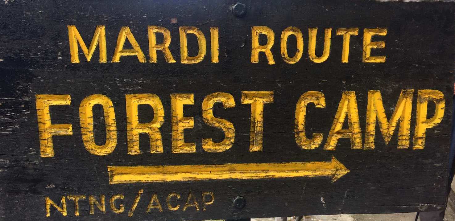
Pitam Deorali is the usual first day’s stop for the Mardi Himal trek but now it is possible to drive here in about 2 to 2.5 hours and go to Forest Camp the same day if you can leave Pokhara by 7 am.

 Mardi Himal Roads

There are the following options for the Mardi trek depending on where you enter or exit the trek:

Pokhara to Siding 2 hours NPR 8000/-

Pokhara to Kalimati  1 hour 30 min

Pokhara to Lawang 1 hour 30 min

 Ghorepani Trek

The road now goes upto Banthanti and it is being steadily pushed towards Ghorepani. From Banthanti to Nayapul would be about 50 min and 1 hour 15 min to Pokhara from there. NPR 10,000/-

 Khopra Trek

There are different approaches and exits for this trek but if you walk from Khopra to Swanta you can get a jeep from here to Pokhara via Beni which takes 4-5 hours. NPR 18,000/-

 Annapurna Circuit Roads

The Annapurna Circuit trek has been impacted by roads on both sides – along the Marsyandi from Besisahar to Manang and along the Kali Gandaki from Pokhara-Beni-Jomsom-Muktinath. The dirt track from Jomsom goes past Kagbeni all the way to Lo Manthang in Upper Mustang possibly changing the standard Mustang trek to a jeep safari. Regarding the circuit the upper route from Pisang to Manang is still spectacular and after two day acclimatisation in Manang you could attempt Tilicho/ Thorung La.  However some alternative walking trails have been built on the other side of the river (referred to as the NAAT trails) and these do by pass the roads to a great extent. The only thing is that th trekking experience in not so enjoyable as you can hear the cars and motorbikes on the other side.

 For more information on our treks and workshops please visit www.southcol.com or contact sujoyrdas@gmail.com 


Friday, January 7, 2022

Mardi Himal Trek Nepal December 2021 | Route and Timings


A South Col team walked to Mardi Himal in December 2021 in perfect weather. Here is the detailed description of the route and the timings. 


December 6th 2021 Pokhara to Kande by road and walk to Pitam Deorali 

We left Kathmandu for Pokhara by the 8 30 am flight - luckily for us the weather was good this morning and we reached Pokhara by 10 am - a micro bus was waiting for us and we drove upto   Kande in a hour - the road was very good upto Kande and had been newly resurfaced. We started out from Kande at 11 15 am and climbed steeply for the first 45 minutes mainly on steps; there were very few trekkers on the route - we got to Australian camp in an hour and 15 min - the clouds had come in by noon and the famous view from there  we did not see this time.  We  took a short break and then walked down to Pothana in 25 minutes through a beautiful forested section. We stopped for lunch at Heaven’s Gate, our usual lodge, in the sunshine.  From Pothana the trail to Pitam Deorali had large sections where a new road is being built and there are signs in yellow pointing the trekker to the forest trail which criss-crosses the road - on the way soon after Pothana a new lodge was being built in the forest sadly cutting a number of trees - a lodge so close to Pothana did not make sense as Pothana has a number of good lodges.  Again just before Pitam Deorali there is a new lodge which has been built in a clearing again by cutting down part of the forest. The weather was breaking when we reached Deorali and in the evening there was a heavy thunderstorm with lightning and thunder and rain for around two hours which would have deposited a lot of snow in the higher altitudes around Mardi High camp - in the evening after the rain we could see all the lights of Pokhara valley and on the other side across the valley the lights of Ghandrung as well - the stars were just coming out in the sky and clouds studded across the rapidly clearing sky.

 Kande to Australian Camp  2050m  28 18 13N 83 49 40E  1 hr 15 min to 30 min Australian Camp to Pothana 25 min 1950m 28 18 47 N 83 49 49E
Pothana to Pitam Deorali 1 hour 2140m 28 19 48N 83 49 47E 2100 metres

Thursday, January 28, 2021

THE FANTASTICAL KINGDOM OF LO | Guest Post by Persis Anklesaria


Persis Anklesaria, is a veteran South Col trekker, keen photographer and gifted writer. In this post she recounts her journey to the once forbidden kingdom of Mustang  - a fascinating part of the Himalayan rain shadow.


Wedged between the Himalayas and shuttered Tibet, lies an ancient Buddhist kingdom within the borders of Hindu Nepal. 


The kingdom of Lo.

--------------------

 In the year 1380, the warrior chieftain Ame Pal, gained control of the trade routes between India and Tibet, established a kingdom and built Lo Manthang --- a grand walled capital of palaces, monasteries and gompas.


Nothing much has changed since then.  Sheltered behind 26,000 ft. high peaks, the Lobas continue to live a centuries old existence, farming, raising livestock and preserving their ancient faith. Today, this domain of approximately 13 settlements is the last bastion of pure Tibetan culture, its monasteries the finest example of Buddhist art, and Ame Pal’s capital the best-preserved medieval fortification in the world.


Till the 1950’s the only route into Mustang was on horseback via treacherous passes. Now, a Chinese road extends from Lhasa to Kathmandu, daily flights bring in a gaggle of tourists.  Before a way of life disappears forever, eight Southcol Expedition trekkers including me, embark on a 7-day, 64km climb from Jomsom airstrip (9000 ft.), northwards to Lo Manthang (12,400ft.).  


-----------------------------


As the Tara Air, 16-seater lifts off, Pokhara’s lake and green fields slip away, melting into puffy clouds.   Within minutes the skies darken as we tunnel between the world’s two greatest mountain ranges at wingtip distance. The Annapurna Peak metamorphoses into her fabled fish tail, while across the aisle, the east face of Dhaulagiri, 26,000ft of dazzling beauty floats past the windows. Below us the light-speckled Kali Gandaki River, its plunging gorges, valleys and tributaries, bisect the terrain.  Half-an-hour later we are in Jomsom, a brown, barren, rocky desert.


Wednesday, May 27, 2020

Annapurna South Face | 50 Years of the First Ascent May 27th 1970

Don Whillans and Mick Burke at a snowed under Base Camp

The route of the 1970 British Annapurna South Face expedition 
On 27th May 1970 just before the monsoon was going to break Don Whillans and Dougal Haston reached the summit of Annapurna I by the difficult south face route. This climb by a  British expedition led by Sir Chris Bonington   was a landmark one  in the sense that it was the start of big wall climbing in the Himalaya especially on 8000 metre peaks by the difficult routes. For the British, it was possibly the most important climb after the successful ascent of Everest in 1953.

Sadly, on the descent  from the mountain an ice avalanche without any warning  below Camp II killed Ian Clough, one of the climbers.

Interestingly, the year 1970  saw a number of  big wall climbs  in the Himalaya and Karakoram- The Rupal Face of Nanga Parbat was attempted by the Germans, The Japanese on the south west face of Everest, the French on the  west ridge and buttress of Makalu and the British on the south face of Annapurna.

This post shows some historic photographs from the 1970 climb very kindly shared with me by Sir Chris Bonington. 

Thursday, January 30, 2020

Mardi Himal Trek | Nepal | March 23-30 2020

feature Image

HIGHLIGHTS
The Mardi Himal is a relatively new route in the foothills of Annapurna and has developed into a full scale trekking route in the last few years. It now has a series of lodges at different camps and for a short five day trek rivals the traditional Ghandrung-Poon Hill loop. It has great views reaching almost to the bottom of the Fishtail Mountain Macchapucchare along with Annapurna South, Huinchuli and Gangapurna.

Suitability: A good choice for most  walkers, reasonable level of fitness required.

Walking times: average 5 to 7 hours walking per day

Altitude: up to 3550m at High Camp.

Terrain: for most of time following well-travelled trails, there will be daily ascent and descent on steps which are part of any Nepal trek.

 Remoteness: usually not too remote and often there is a reasonable level of infrastructure such as lodge accommodation and cell/ mobile phone reception and wifi reception every day at the lodges.

Saturday, January 4, 2020

Ghandrung - Ghorepani - Poon Hill Trek | Updates December 2019


A South Col team trekked the Annapurna foothills in the last week of December 2019. Our route was Pokhara-Kande- Australian Camp- Pothana- Tolka- Landrung-Ghandrung- Tadapani- Ghorepani- Poon Hill- Banthanti-Ulleri-Hillay-Birethanti-Pokhara.

Some useful updates from the trek.

  • The road from Pokhara to Nayapul and Birethanti has now been pushed up beyond Ulleri to lower Banthanti. Though we did not see any jeeps on the road we were told by the locals that the road is ready and jeeps can be hired from Pokhara to drive up to Banthanti. We fear that the road will reach Ghorepani in the next one/two years thereby ending another beautful trek. Many would not want to continue to climb or descend the 3280 steps. 

Tuesday, January 29, 2019

Himalayas: Weather


If you read any guide book on the Himalaya or on trekking in the Himalayan region, you will invariably be told that the post-monsoon season is the best time to trek in the mountains. Clear blue skies, superb mountain views, mild sunny days and crisp cold nights are all forecast for the trekker.

 You will also be told that the pre monsoon season i.e. March to May is the second best time to be in the mountains with mild showers in the evening but clear morning and the weather getting warmer as you approach the monsoon. Further, according to the guide books, trekking in the monsoon is strictly a “no no” and if the heavy rains and landslides don’t make your trek a nightmare, the leeches will! And of course the winter is so cold that no sane individual would venture into the high altitude at that time!


So what is the real story on Himalayan weather with the impact of global warming and climate change?

I have trekked in the Himalayas in all seasons, including the winter (Everest 2003-04), the monsoon (Sikkim 2000) and numerous autumn and spring treks.

One October I remember visiting Kathmandu airport every morning for the flight to Lukla and returning to our hotel at lunchtime. It rained for three days incessantly and the Lukla flight could not take off. Finally on the fourth day it did take off  and made a hair raising landing at Lukla narrowly missing the hill in front of the airstrip. Surprisingly the very next day the weather cleared and we did not get any rain for the next two weeks during our trek. In the October season in the Khumbu there are now more than 14,000 trekkers in one month!

Again, walking the Annapurna circuit in October I remember repeated day after day of afternoon rain up the Marsyandi valley. One downpour near the village of Chame was so heavy that we sheltered in a bamboo hut and managed to stay dry until the rain stopped.

In December 2009 I trekked with a South Col group to Poon Hill in the Annapurna region and surprisingly other than the morning at Ghorepani, the rest of the days had cold, cloudy weather very unusual for December.


The rain shadow regions of the Himalaya like Ladakh, Zanskar, Lahoul and Spiti possibly get the best weather in the monsoon season July to September.

So in my opinion, good weather is a gamble. What with global warming, rapid deforestation and urbanization, the weather is no longer predictable. Every season has something special to offer so select your season and hope for some great views and weather!

South Col Expeditions www.southcol.com treks in the Himalayas throughout the year. Do visit our web site for our treks both fixed departure and customised group offerings.

Monday, April 2, 2018

Moods of Macchapuchhare

One the trekking trail near the village of Dhampus

The Fishtail Mountain of Nepal Macchapuchhare has not been climbed. Attempted in 1962 by a British team led by Jimmy Roberts,  the climbers failed to make the summit. Soon after the Nepal Government put the mountain "out of bounds" and no further expeditions were permitted.

I first saw the mountains of the Nepal Himalaya from the lawns of the Crystal Hotel in Pokhara. It was December 1978 and in the grey light of a chilly dawn with my first and new SLR camera, I attempted to take some photographs. The garden was full of red poinsettia blossoms but in the pre-dawn light they looked dark crimson, almost black. And then behind them in that half light, there was the Fishtail mountain, Machhapuchhare, her razor sharp ridges slicing the inky blue sky.  Next  to her impossibly high were the Annapurnas and to the west peeking over the lower hills was Dhaulagiri. I have seen variations of this Himalayan vision in different incarnations all through the years, and it never fails to arouse a feeling of awe and amazement each and every time.

This essay shows the some of the moods of this iconic mountain:

Winter sunset Pothana

Unexpected spring snowfall Annapurna Base Camp

Telephoto close up near Doban on the ABC trek

On the trail between Upper Sinuwa and Bamboo

Dusk Annapurna Base Camp
Dhampus village

Poon Hill winter evening

Moon rise Macchpaucchare base camp

 For treks in Nepal and other regions of the Himalay please do visit  http://www.southcol.com/treks-nepal/ for more information.

Wednesday, January 3, 2018

Annapurna Foothills Trek | The Photographs

Approaching Landrung
South Col Expeditions completed another Annapurna Foothills Trek from December 23-30 2017 amidst speactacular winter weather with clear blue skies and warm sunshine. Some photographs from the trek are below:

Sunrise Ghorepani

The beautiful dining room of Gurung Cottage Ghandrung

Ferns in the forest near Tadapani

On the ridge between Deorali and Ghorepani with Dhaulagiri behind

Tadapani lodges with Annapurna South, Huinchuli and Machhapuchhare behind

Monday, October 23, 2017

Annapurna Foothills Trek December 23-30 2017


The Annapurna foothills provide tremendous trekking with delightful trails connecting villages and ridge tops. This picturesque trek winds through enchanting villages with ochre thatched houses, terraced rice fields and rhododendron forests, which are spectacular in the spring when whole hillsides are cloaked in colourful flowers. The ridge top village of Ghandrung provides one of the finest viewpoints of the Annapurna Mountains with magnificent views of the four Annapurnas, and Machapuchare with its fishtail summit. It is a  good walk to the top of Poon Hill 3150 metres with a dress circle view over the Annapurnas and Dhaulagiri as well. 
Who should do this trek?

  • Suitability: A good choice for most  walkers, reasonable level of fitness required.
  • Walking times: average 5 to 7 hours walking per day 
  • Altitude: up to 3150m
  • Terrain: for most of time following well-travelled trails, there will be daily ascent and descent on steps which are part of any Nepal trek.
  •  Remoteness: usually not too remote and often there is a reasonable level of infrastructure such as lodge accommodation and cell/ mobile phone reception and wifi reception every day at the lodges.

Trek Leader: Sujoy Das


ITINERARY
Day 01   Kathmandu to Pokhara  by early morning flight and the drive to Kande and trek to Tolka  
We fly into to Pokhara 30 min and then drive for 75 min to Kande.   From Kande we climb to Austrian camp in around two hours and then walk to Pothana in half an hour for lunchh. . From Pothana the trail climbs uphill to Deorali from where it makes a steep descent to Bichok. From Bichok it is a level walk to Tolka where we stop for the night.  
Day 02 Trek to Ghandrung  (1950 metres) 5-6 hours walking 
The large village of Ghandrung can be seen directly across the valley from Landrung.  It is a n hours walk in the morning from Tolka to Landrung. This is a short walking day allowing time to explore Landrung and Ghandrung. From Landrung we descend to the Modi Khola River and cross on a large suspension bridge. The ascent through terraced fields to the picturesque town takes around 2 hours. Ghandrung is largely a Gurung town and is the headquarters of the Annapurna Conservation Area Project (ACAP). Many of the lodges here have the more environmentally friendly features that ACAP encourages such as back boilers, solar panels, etc.  The views of the Annapurna Mountains and Machapuchare from here are stunning.
Day 03 Trek to Tadapani (2595 metres) 4 hours walking 
From Ghandrung the trail climbs gently to the village of Baisi Kharka where we stop for a cup of tea and then make the final ascent to Tadapani. Overnight at a lodge in Tadapani. The views of the Annapurna Mountains and Machapuchare from here are stunningly close.  
Day 04 Trek to Ghorepani  (2750 metres) 6-7 hours walking 
The trek from Tadapani to Ghorepani involves a number of ups and downs! We pass through the villages of Banthanti and Deorali before reaching Ghorepani. Overnight at a lodge at Ghorepani.  
Day 05  Ghorepani to Tirekedhunga/Hille  (1515m) -5 to 6  hours walking We visit Poon Hill at sunrise to watch the views over Annapurna and Dhaulagiri. After breakfast we begin our walk down to Ulleri (1960m)  We stop for lunch at Ulleri and then start descending the 3000 steps to Tirkedhunga ( take it easy!). Night at Tirkedhunga or the neighbouring village Hille.


Day 06   Tirekedhunga/Hille to Birethanti to Pokhara to Kathmandu (885 metres)  2.5 hours  walking 
We leave early for Birethanti around 7 am. We gte there by 9 am and then cross the river to Nayapul. We drive from Nayapul to Pokhara 90 min and are in Pokhara for lunch. After an early lunch we go to the airport and board the afternoon 3 pm flight to Kathmandu. Night at a hotel in Kathmandu. 
Day 07   Kathmandu to home destination by flight 


COSTS

 The cost of this trek is  USD 900 for foreign passports and INR Rs 46,500  for Indian  citizens. Meals not included. Please budget an additional US $ 200-250 for meals, battery charging in lodges, wifi charges, hot water in flasks etc.  Exclusions apply. 
  • Costs include:
  • Two internal flights Kathmandu to Pokhara return. 
  • Micro bus from Kathmandu to Pokhara
  • ACAP national park permit and TIMS permit for trekking in the Annapurna region
  • Travel from Pokhara to start of trek and back
  • One  night accomodation at Pokhara (Hotel Gurkha Haven) and   two nights  accomodation in Kathmandu on the way in and out  on twin sharing basis
  • All accommodation on the trek on twin sharing basis
  • Cost of porters/guides for the trek. Please note that porters will carry one duffel bag or backpack not exceeding 10 kgs in weight for each trekker comprising of personal items, clothing, sleeping bag etc.
  • Please budget an extra USD 25 per day for meals not included in the cost above
Costs not included:
  • Meals in Kathmandu and Pokhara and fooding on the trek is not included
  • Airport taxes at Kathmandu and Pokhara airports in case of flights
  • Desserts, drinks, and exotic items listed in the lodge menus are not included.
  • Alcohol, cold drinks (coca cola, sprite, beer), juices, ice cream etc on the trek and in Pokhara.
  • Client travel and medical insurance of any kind.
  • Emergency evacuation costs if needed.
  • Video camera fees in National Parks (where applicable).
  • Bottled drinks; boiled, filtered or bottled water; alcohol; snacks; tea/coffee;
  • Hot showers (Rs 200-300 per shower);
  • Personal clothing and equipment; sleeping bag; douvet/down/goretek jacket, medicines for personal use etc.
  • Air fare from home country to Nepal and back
  • Tips to porters/guides at the end of trek estimate at US $ 50 per person
For more details email sujoyrdas@gmail.com or call +919831054569.

Friday, May 5, 2017

Machhapuchhare | The Fishtail Mountain

Last light from Poon Hill - winter sunset
The Fishtail Mountain of Nepal Machhapuchhare has not been climbed. Attempted in 1962 by a British team led by Jimmy Roberts,  the climbers failed to make the summit. Soon after the Nepal Government put the mountain "out of bounds" and no further expeditions were permitted.

I first saw the mountains of the Nepal Himalaya from the lawns of the Crystal Hotel in Pokhara. It was December 1978 and in the grey light of a chilly dawn with my first and new SLR camera, I attempted to take some photographs. The garden was full of red poinsettia blossoms but in the pre-dawn light they looked dark crimson, almost black. And then behind them in that half light, there was the Fishtail mountain, Machhapuchhare, her razor sharp ridges slicing the inky blue sky.  Next  to her impossibly high were the Annapurnas and to the west peeking over the lower hills was Dhaulagiri. I have seen variations of this Himalayan vision in different incarnations all through the years, and it never fails to arouse a feeling of awe and amazement each and every time.

This essay shows the some of the moods of this iconic mountain:

From the flight between Pokhara and Jomsom - Annapurna II and IV on the right

Before dawn from Annapurna Base Camp

Dawn Tadapani

From the forests between Sinuwa and Bamboo on the Annapurna Base Camp trail

Dusk Annapurna Base Camp

Rising moon after sunset - Machhapuchhare Base Camp

From the swimming pool of Tiger Mountain Lodge Pokhara

To find out more about are treks in this region do visit www.southcol.com

Friday, April 28, 2017

Annapurna Base Camp Trek | Harini Chandra


Harini Chandra trekked the Annapurna Base Camp route with South Col Expeditions in April 2016. In this interesting and evocative post Harini describes her experiences on the ABC trek. This is an ideal post for first time trekkers wanting to find out what trekking in Nepal is all about!
 - Sujoy Das

Hike, Eat, Sleep, Repeat…By Harini Chandra

It’s been a year now since I went on the trek to Annapurna Base Camp, a unique, mind-blowing experience that I’ve been meaning to write about ever since. I’ve always thought of writer’s block as a problem of mind over matter—until, of course, I sat down to pen my thoughts on this trip and couldn’t proceed beyond two paragraphs! This time, though, I’m more determined to get this all out—a fitting tribute, hopefully, to a memorable trip.

Some time around July 2015, I decided I wanted to get away for some much-needed “me time”—away from work and family—to do something I really enjoy. A trip to Darjeeling around the time, followed by the movie "Everest," sealed the decision in my unsettled mind: I wanted to do a trek. After some research, I settled on the Annapurna Base Camp trek, which would be challenging enough given my appalling fitness levels, but at the same time, not so challenging that it seemed crazy and out of reach. I had fond memories of a trek I’d done way back in college to the Kuari pass, which served as inspiration as I began my journey of getting fit physically and, this time, toughening up mentally (it would be the first time I’d be away from my younger son for so long).

After many months, which actually flew by much quicker than I’d expected, I landed in Kathmandu with my best friend, Ranjani, who had decided, to my delight, to join me. We felt excited--mostly in an I-can’t-believe-we’re-actually-doing-this way--as we spent our day buying last-minute supplies: hiking poles, iodine tablets, sun hats, head lamps, and other items suggested by our organizer Sujoy.

Then came the challenge of packing our duffel bag. For those of you who’ve never been trekking before, this is the point at which you realize two things: first, you have way more in your suitcase than you can ever imagine taking with you; and second, every inch of space counts! What to do? Cram in that extra packet of nuts, or sneak in that one additional pair of tracks that Sujoy specifically told us not to bother carrying? We called it a night early after an enjoyable dinner at a delightful outdoor restaurant, listening to live Nepali music and stories from earlier treks of Sujoy, and slowly beginning to wonder in what state we would return from our own expedition.

Day 1: Of hailstorms and expanding lungs
Ever since the earthquake of 2015, Kathmandu has been terribly dusty, with all the construction work going on, and a layer of smog constantly hung over the city. This always resulted in some uncertainty in flight schedules, and we had chosen to fly from Kathmandu to Pokhara, a journey that can also be made by road over 6-7 hours. Although the road journey is quite picturesque and enjoyable, we had chosen to fly to save ourselves that one additional day of travel. Thankfully, our flights were perfectly on time (contrary to the worrying newspaper article we saw in the paper that morning) and we reached Kande, our trailhead, a one-hour minibus ride from Pokhara, as planned.


The worrying newspaper article we saw before we flew to Pokhara

We began our adventure from Kande, climbing our way up hill (oh wait, I meant huffing my way uphill!) for the large part to Pothana, our lunch stop. We stopped by a beautiful Australian camp for tea, where the weather gods decided to give us a taste of their fickle mindedness, sending heavy, dark clouds our way. Luckily, we made it to our lunch stop just before the hail started pelting down (that’s right--hail on our very first day there). After a hot lunch of dal-bhaat (the traditional Nepali meal, consisting of rice, dal, veggies, pickle, and papad), we all scrambled to our duffel bags for the extra layers of clothing that had been packed deeply away, in the assumption that they wouldn’t be needed until Day 3 or 4, in the colder, higher altitudes. After making sneaky visits into the kitchen to warm up our frozen hands, we stepped outdoors to catch our first spectacular glimpses of the mountains—the sight that would egg us on through our weariness.


First sights of the glorious Annapurna
Just as Indian bowlers know their home pitches, the Nepalese have a way of looking at the clouds and knowing which way the weather will swing. So when our guide, Shyam, gave us the green signal, we headed out again towards our first camp for that night at Tolka. It was a lovely walk, mostly downhill or flat, and barring a couple of falls due to the slippery rocks and stones, we made it to Tolka just before the light started to fade.

Stones piled up as a symbol of good luck        


  End of Day 1 at Tolka

We were pleasantly surprised by the cozy and convenient lodging facilities throughout our trip—comfortable rooms with enough blankets to keep us warm, more-than-decent bathroom facilities, a centrally heated dining area where most people spent their time after the day of trekking (I’ll come back to these dining areas in a bit), and great food options. Honestly, one can’t ask for more when in the mountains. But there was more! It came at a nominal cost (with the value of “nominal” increasing with altitude!) but was absolutely worth it: hot showers, WiFi, phone charging, and even washing machines at some of the lodges to give your clothes a quick spin! Clearly, we were trekking in style.

Day 2: The last time I ever felt my back
We woke up in Tolka to the sight of looming snow-capped mountains and realized that every morning was going to look like that for the next 10 days! Sure, the water would freeze our hands while we brushed our teeth, but those mountains made every bit of it worth it!

We set out after breakfast towards Chhomrong, which became one of our favorite villages by the end of our trip. The first two or three hours that day were rather peaceful, the walk being largely flat and partly downhill, with gorgeous views of the Annapurna South. We were in a cheery mood despite the blazing sun, chatting away and making friends with the extremely cute Nepali children along the way. Then, all of a sudden, we didn’t know what hit us; it just got steep! We climbed for over an hour and finally got to our lunch stop, Jhinu, where our guide (very reassuringly) told us after we gulped down our nimbupani (lemon juice) that we had at least another 3 hours of climbing post-lunch!

That day was easily one of the hardest uphill climbs. We’re not sure if it was because our bodies were still getting used to the climbing, or whether it really was that hard! We realized over the next couple of days that every day would have a downhill walk followed by an uphill one, since we were essentially crossing over from one mountain to another. So we would have to lose some elevation, get across either on a bridge or some sort of river crossing, and then ascend the next mountain (what joy!). We left Jhinu after lunch, still exhausted but wanting to get done for the day rather than relax too long there. After plodding on for another hour, we met another couple with their guide who pointed out that Chhomrong, our destination for that night, was within view. Our delight knew no bounds; we quickened our pace and made it to our lovely guesthouse in Chhomrong well in time for a hot evening shower, hot chai, and pakoras. Heck, we earned it that day!


Gorgeous views that egged us on                           


View from our guesthouse in Chhomrong

There was something very quaint and appealing about Chhomrong. It was a village full of steps, with colorful little shops and cafes lining the sides like banisters. We even tried cinnamon rolls and chocolate croissants at a German bakery on our way back--not the best we’ve had, but a refreshing change nonetheless! Although it got cold late in the evening, we could still sit outdoors and enjoy the stillness and silence of the mountains, something we could not do as we went higher up. We met an adorable couple from Munich who, despite our warnings, ordered and gave their stamp of approval to the pizza at that guesthouse!

Day 3: Through bamboo forests and rain-filled clouds
After breakfast at Chhomrong, we set out towards Dovan. Our bodies clearly felt better adjusted by this day, and the walking felt less strenuous. The downhill stretches, at times, felt hard on the knees, but by the time the pain actually started making its way into the mind, the terrain changed and it would be flat or inclined upwards. To be precise, there’s no flat terrain; it’s all “Nepali flat”—a term that amused us to begin with but grew on us so much that by the end of the trip, we were correcting our guide every time he said "flat." "Nepali flat" refers to a constant sequence of ups and downs, none of them too steep. We walked under overcast skies through the villages of Lower and Upper Sinua, followed by bamboo forests, to land up for lunch in a village called Bamboo.

As we got done with lunch, the heavy rain clouds again decided to shower their fury on us. We ended up staying put for a couple of hours after lunch, watching the steady inflow of drenched trekkers of various nationalities, listening to fun retro music, and waiting for the rain to abate. Once it had settled down to a drizzle, we made our way in single file through another forest, focussing on our every step through the slushy path, all our moods seemingly reflecting the somber and grey skies. We reached Dovan much earlier than we expected, gulped down some hot chocolate, and settled down in the warm dining hall for the rest of the evening, since the temperature outside had plummeted thanks to the non-stop rain.

                                                          Long and shaky bridges                                                             


After reaching Dovan under rain-filled skies

This might be a good time to talk about the dining halls, as our trekking days after Dovan got shorter because of the altitude (3200+ m) and we began spending more time in these halls. These halls are basically designed with tables and benches in the center for people to sit and eat, and the sides lined with inviting diwans, complete with mattresses and cushions thrown around. You are more than welcome to nap there after lunch! We came across so many interesting people in these dining areas: a teacher for autistic children from America, students of medicine from Germany, a delightful retired couple from America, a Nepali man attempting to summit in three days, an extremely well-travelled Frenchman who visited Nepal every year, and many others. It was always fun to strike up a conversation with these people, understand what brought them there, and of course, answer the many questions that they had about India: its new Prime Minister, the beaches in Goa, and of course, Rajnikant!


The dimly lit, cozy dining hall packed with trekkers

Days 4 & 5: Upward to MBC
While MBC does bring to mind certain offensive expletives in Hindi, I assure you, this MBC was truly majestic! From Dovan, we made our way further up, stopping for a night at Deorali and then proceeding to the Machhapuchhare Base Camp (around 3700 m). As the altitude got higher, we trekked only for 4-5 hours in the morning and had the rest of the day to acclimatize and get used to the thinning air. Dovan to Deorali was again a climb through forests; this time, rhododendron forests colored in beautiful reds and pinks. Our views of the Machhapuchhare peak, commonly also known as the Fish Tail peak, became more stunning with each passing day.

The hike from Deorali to MBC was another hard one, the trail punctuated with avalanche-prone areas that we darted across without looking up! The guide had advised us to leave early that morning, so that we could get across these areas before the sun got too high and started melting all the mountain snow, thereby increasing the chances of an avalanche. We therefore reached MBC well before lunch, giving us sufficient time to take in the jaw-dropping panoramic views and even get some clothes washed (in that order!). By the time we could get done with the washing and drying, the clouds had moved up all the way, completely blanking out our view. I had a mild headache by this point (presumably the altitude doing its thing), so we settled down in the dining hall for the rest of the day to relax and give our bodies enough rest before the final climb up the next day.

Day 6: Heave ho, and up we go!
After having pep talk Whatsapp calls with the family the previous night (a surreal experience in itself, given where we were), we woke up fresh and excited to head to the summit. The final climb up to ABC (around 4100 m) was more of a mind game than actual physical strain. It was only a short two-hour walk up through snowy slopes, powered by adrenaline and jaw-dropping views. With the oxygen thinning further, we made our way up slowly, huffing every few steps and pausing to take in our surroundings. We soon made it to the top, bundled in various emotions as we stopped to strike many crazy poses with the "Welcome to ABC" signboard.

After we got over that dreamlike sequence, we made our way up to the lodge to get their WiFi password and inform the folks back home. To our disappointment, their WiFiwasn’t working, and we had to make our peace with not being able to relay our achievement that day. We grabbed a hot drink and then stepped out near the campsite to see some glaciers and enjoy the feeling of being surrounded by nothing but mountains. As we sat there taking in everything in disbelief, we would hear a loud crack every now and again--the sound of an avalanche making its way down some mountain slope.

When we took another stroll after lunch, the clouds decided to close in around us, leaving even our guide perplexed for a while on the route back to our lodge. With the views disappearing, we made our way back to the cozy dining hall for the rest of the day, retiring early that night so that we could wake up in time for the glorious 5 am sunrise.

Made it!  


We couldn’t get enough of those views

Day 7: A palette in the sky
We woke up early the next morning and rushed outside to see the sky filled in hues of orange, purple, golden and blue. Now, it’s at this point where I must emphasize that absolutely no words or pictures will ever do justice to the real thing. I’m sure you’re thinking, "It’s just a sunrise, what’s the big deal?" But that sunrise was really something else, and I’m sure I’m going to run out of adjectives in my attempt to describe it. The grey-blue pre-dawn skies blended themselves gracefully with the orange and purple hues that the sun was beginning to throw out. Gradually, as though someone was running you through a shade card in a paint store, those oranges melted into multiple shades of yellow and gold, as those first rays started to make their way upon the snow-clad peaks. It was beyond stunning, and standing there, I’ll never forget the shiver I felt run down my spine--this time, not because of the cold, but because of how tiny one felt amidst these regal, imposing mountains. Any problems or challenges felt miniscule and insignificant, as I watched nature work her incredible magic with such ease. With a slightly heavy heart and clearer mind, we finally made our way in to get ready and head back down once the sun had come out in all its fiery splendor.
 

A paintbrush sweeps the sky

All good things must come to an end…
While I can easily go on about the rest of the trek with many more details, I realize that this post has become much longer than I imagined it to be. The journey down was again a test of mental strength, as we had planned a slightly longer way back down in order to cover Ghorepani and Poon Hill as well. Aches and pains started feeling more pronounced but again faded away as we were rewarded with more spectacular sights (something we didn’t think was possible!) as we caught a dress circle view of the Annapurna range from Poon Hill, with the royal Dhaulagiri adding another gem to the already studded crown. I must make a special mention at this point of the (in)famousUlleri steps that we encountered on our way back down on the final day. A series of 3,500-odd uneven stone steps between Ulleri and Tirkhedunga, these steps had me convinced that I would tear a ligament in my knees by the time I made it down. If you’re someone who already has knee trouble, then you should seriously consider and reconsider taking this route. But, as they say, all was well that ended well. We made it back in great shape and raring to go again!

For treks organised by South Col do visit http://www.southcol.com/treks-nepal/

LinkWithin

Related Posts Plugin for WordPress, Blogger...