Showing posts with label Nepal Trek Guide. Show all posts

Tuesday, March 14, 2023

New Roads in the Annapurna Region | Nepal


In the last few years a large number of new roads have come up in the Annapurna region (most of them remain as dirt tracks for four wheel drive jeeps) and these roads can reduce the trekking days for popular treks in the region. I list some of these roads below and give the cost of a reserved jeep in some cases where I have used them.

 Pokhara to Kimche

Kimche is about 1 hours walking below Ghandrung and this road goes upto Nayapul (black top) and then on a dirt track to Kimche – the black top section is quite good now and the whole journey by jeep takes about 2 hours. There are also buses running from the Pokhara bus park.  NPR 9000/-

 Pokhara to Ghandrung

It is possible now to go all the way upto Ghandrung by taking a lower road (not the Kimche one) by jeep and it would take about 2.5 hours to reach Ghandrung. An early departure from Pokhara would make it possible to trek to Tadapani the same day. NPR 10,000/-

 Pokhara to Kimrong Danda

The same road which goes to Ghandrung carries on further to Kimrong Danda possibly a 30 minutes drive from Ghandrung.

 Pokhara to Landrung

The approach to the Annapurna Base Camp trek would be shortened by a day or more by driving to Landrung in about 3 hours and heading up to Jhinu Danda the same day. But there is also now a road which is ending below Jhinu so for ABC trekkers looking to save time this would be the better option (see below). NPR 12,000/-

 Pokhara to below Jhinu Danda

This road goes near Jhinu Danda in about 3-3.5 hours from Pokhara so from here you could walk to Chomrong the same day.  NPR 12,000/-

 Pokhara to Dhampus

This walk from Phedi is now effectively over as the road goes all the way to Dhampus in about 1 hour minutes from Pokhara. You could do a day trek in this region walking from Dhampus to Australian Camp and then down to Kande to meet the road and back to Pokhara.

 Pokhara to Pitam Deorali

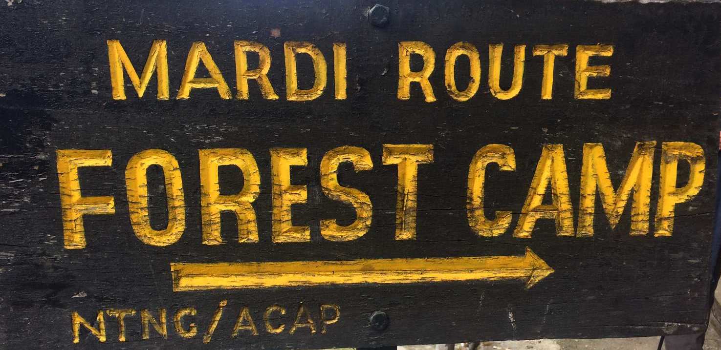
Pitam Deorali is the usual first day’s stop for the Mardi Himal trek but now it is possible to drive here in about 2 to 2.5 hours and go to Forest Camp the same day if you can leave Pokhara by 7 am.

 Mardi Himal Roads

There are the following options for the Mardi trek depending on where you enter or exit the trek:

Pokhara to Siding 2 hours NPR 8000/-

Pokhara to Kalimati  1 hour 30 min

Pokhara to Lawang 1 hour 30 min

 Ghorepani Trek

The road now goes upto Banthanti and it is being steadily pushed towards Ghorepani. From Banthanti to Nayapul would be about 50 min and 1 hour 15 min to Pokhara from there. NPR 10,000/-

 Khopra Trek

There are different approaches and exits for this trek but if you walk from Khopra to Swanta you can get a jeep from here to Pokhara via Beni which takes 4-5 hours. NPR 18,000/-

 Annapurna Circuit Roads

The Annapurna Circuit trek has been impacted by roads on both sides – along the Marsyandi from Besisahar to Manang and along the Kali Gandaki from Pokhara-Beni-Jomsom-Muktinath. The dirt track from Jomsom goes past Kagbeni all the way to Lo Manthang in Upper Mustang possibly changing the standard Mustang trek to a jeep safari. Regarding the circuit the upper route from Pisang to Manang is still spectacular and after two day acclimatisation in Manang you could attempt Tilicho/ Thorung La.  However some alternative walking trails have been built on the other side of the river (referred to as the NAAT trails) and these do by pass the roads to a great extent. The only thing is that th trekking experience in not so enjoyable as you can hear the cars and motorbikes on the other side.

 For more information on our treks and workshops please visit www.southcol.com or contact sujoyrdas@gmail.com 


Thursday, January 30, 2020

Mardi Himal Trek | Nepal | March 23-30 2020

feature Image

HIGHLIGHTS
The Mardi Himal is a relatively new route in the foothills of Annapurna and has developed into a full scale trekking route in the last few years. It now has a series of lodges at different camps and for a short five day trek rivals the traditional Ghandrung-Poon Hill loop. It has great views reaching almost to the bottom of the Fishtail Mountain Macchapucchare along with Annapurna South, Huinchuli and Gangapurna.

Suitability: A good choice for most  walkers, reasonable level of fitness required.

Walking times: average 5 to 7 hours walking per day

Altitude: up to 3550m at High Camp.

Terrain: for most of time following well-travelled trails, there will be daily ascent and descent on steps which are part of any Nepal trek.

 Remoteness: usually not too remote and often there is a reasonable level of infrastructure such as lodge accommodation and cell/ mobile phone reception and wifi reception every day at the lodges.

Wednesday, November 7, 2018

Everest Base Camp Trek | New Permits


There has been some confusion regarding the permits needed for the Everest Base Camp Trek.

Currently, the TIMS permit which is required in other trekking areas of Nepal is not needed for the Everest trek and Gokyo.

Instead a local permit called the Pasang Lhamu Municipality permit costing NPR 2000/- is needed and is available on arrival at both Lukla and Namche checkposts.

Other than this the Sagarmatha National Park permit is needed which is available at the Monjo checkpost for Rs 3000 plus 13% tax for Foreign passports and Rs 1500 plus 13% tax for SAARC countries.

No photographs are needed for either of these permits.


For more information on our treks in the Himalaya do visit www.southcol.com

Monday, February 19, 2018

Tsum Valley Trek | South Col Expeditions April 22nd to May 6th 2018


The remote Tsum Valley  is a  trip  that should not be missed.  Tsum comes from the Tibetan work 'Tsombo', which means vivid and we can only agree. The people are not well off , since they have been bypassed by development for centuries, but this means their unique culture has remained intact.

However a road from China is already pegged out and will cause rapid change. Tsum is said to be a beyul, one of the hidden valleys which Padmasambhava blessed as refuges to be discovered when the planet is approaching destruction and the world becomes too corrupt for spiritual practice. They are valleys reminiscent of paradise, which can only be reached with enormous hardship often referred to as a "Garden of Eden".

Who should join this trek?
A good choice for regular hill walkers, high level of fitness required.
1) Walking times: average 5 to 8 hours walking per day
2) Altitude: up to 4500 metres - there is no pass to be crossed.
3) Terrain: for some of the time following well-travelled trails although also likely to encounter rough and rocky conditions. There are steps to be ascended and descended as in all Nepal treks.
4) Remoteness: the trek is in a remote mountain area and a long distance from the roadhead and the nearest cities.
5) High altitude insurance including emergency evacuation insurance by helicopter is compulsory for this trek.
6) Prior trekking experience is recommended for this trek.

BRIEF ITINERARY

Day 1 – Kathmandu to Arughat 495m by vehicle and then on the Soti Khola 606m
Day 2 – Soti Khola 606m to Maccha Khola 849m 6 – 7 hours
Day 3 – Macchakhola 849m to Jagat 1500 m 7 to 8 hours
Day 4 – Jagat to  Lokpa 2240m  7 to 8 hours
Day 5 – Lokpa 2240m to Chumling 2386m 4 to 5 hours
Day 6 – Chumling 2386m to Chokhang Paro 3031m 4 to 5 hours
Day 7 Chokhang Paro 3031m to Nile 3361m 3 to 4 hours
Day 8 – Nile 3361m to Mu Gompa 3700m 3 hours
Day 9 – Rest Day Mu Gompa
Day 10 – Mu Gompa 3700m to Rachen Gompa 3240m 5 to 6 hours
Day 11 - Rachen Gompa 3240m to Chumling 2386m 6 to 7 hours
Day 12 - Chumling 2386m to Philim 1570m 7 to 8 hours
Day 13 Philim 1570m to Dovan 1016m 5 to 6 hours
Day 14 Dovan 1016m to Lapubesi 823m 5 to 6 hours
Day 15 Lapu Besi 823m to Soti Khola 606m to Arughat 495m to Kathmandu.


COSTS
 USD 1300 for foreign passports and INR Rs 80,000 for Indian passports. (Meals not included). Please budget an additional USD 25-30 per day  for meals, hot water in flasks, battery charging, wi fi charges, gas showers  in lodges etc. 
The cost is per person for Kathmandu to Kathmandu  as per the itinerary given.
Costs given above are at current rates and may change without notice. Changes if any will be notified 2 months before the trek.

Costs include: 

  • Transport from Kathmandu to Arughat and Dharapani/Besisahar to Kathmandu in our own vehicle. 
  • All permits including Manaslu and Tsum  Restricted Area permit, ACAP and MCAP permits and TIMS as applicable. 
  • All accommodation on the trek on twin sharing basis. There are no luxury lodges on this route and accommodation will be basic without attached bathrooms.
  • Hotel accommodation in Kathmandu one night on the way in and one night on the way out is covered in a good mid range hotel with breakfast. 
  • Cost of porters/guides for the trek. Please note that porters will carry one duffel bag or backpack not exceeding 10 kgs in weight for each trekker comprising of personal items, clothing, sleeping bag etc. 


Costs not included

  • Meals in Kathmandu 
  • Breakfast lunch and dinner on the trek is not included. Desserts, drinks, and exotic items listed in the lodge menus are not included. Alcohol, cold drinks (coca cola, sprite, beer), juices, ice cream etc on the trek. Bottled drinks; boiled, filtered or bottled water; alcohol; snacks etc
  • Client travel and medical insurance of any kind. Emergency evacuation costs if needed. 
  • Hot showers (Rs 200-300 per shower); Personal clothing and equipment; sleeping bag; down/ goretek jacket, medicines for personal use etc. 
  • Air fare from residence country to Nepal and back
  • Tips to porters and guide at the end of trek. Please budget USD 50 per head as tips to the common pool


Saturday, February 10, 2018

Ama Dablam | Mountain of Dreams

Ama Dablam from Khumjung - dawn
Ama Dablam (6856 metres) is possibly one of the most beautiful mountains in the world. Located in the Khumbu region of Nepal it is it the "jewel in the crown"   for all trekkers to the Everest Base Camp and Kala Pattar. The mountain was first climbed in 1961 by Mike Gill (NZ), Barry Bishop (USA), Mike Ward (UK) and Wally Romanes (NZ) via the Southwest Ridge. They were part of the Silver Hut expedition led by Edmung Hillary in 1960-61. 

I have been photographing Ama Dablam for more than twenty years now. 
Some photographs of the mountain taken over the years are in this post:

Ama Dablam from Dzongla below the Cho La Pass

Ama Dablam from Pheriche after a winter snow storm

Ama Dablam from Pangboche at dusk
Morning light at Kyanjuma near Namche Bazar

Ama Dablam from the climb to Chukung Ri in the Imja Khola valley

Lammergier floats towards the peak of Ama Dablam on the trail between Pangboche and Dingboche


Reflections in a lodge window - Sonam Lodge Pangboche

For more photographs of the Himalaya do visit www.sujoydas.com

Saturday, December 3, 2016

Rhenjo La Crossing | Everest Trek


The Rhenjo Pass as seen from the third lake of Gokyo

The trail to the top of Rhenjo La

Rhenjo La  - The crossing of the pass from Gokyo to Thami

The Rhenjo La is one of the three high passes on the Everest trek the other two being Kongma La and the most popular one is the Cho La.  The Rhenjo La can be crossed from the Gokyo side as well as from the Thami - Lungden side. However it is advisable to cross the pass from the Gokyo side as the climb from the Lungden side is extremely long and tiring.

Gokyo 4750 metres  to Rhenjo La 5357 metres 
We left Gokyo at around 6 15 am and headed out towards the pass on a trail that skirted the third lake and climbed gently for an hour. The trail then began to climb steeply following a series of switchbacks for another 45 minutes to one hour until it reached a flattish plateau from where there was an excellent view of Everest and the other peaks including Makalu which started peeping over a rock face.  This plateau can get snowed under and there are cairns to show the way. From the plateau the trail swung to the right and began climbing again through rocks and moraine. The pass can be seen from here with a row of prayer flags strung across the rocks. The climb from the meadow to the top of the pass would be another hour.
Gokyo to the top of the pass 3 to 4 hours


View from just below the pass looking down on the plateau

Looking towards the Lungden side of the pass - the trail below can be seen 
Rhenjo La 5357 metres  to Lungden 4400 metres
The pass has an excellent view both to the north and to the south. From the pass a very steep stone staircase leads down to an emerald lake which can be seen from the top. Pass the lake and the trail swings left following the natural contour of the valley. In about an hour or so there is a large lake on the left side - the trail passes this lake and climbs gently until it reaches some yak herders settlements made of stone. This part of the walk can be extremely cold and windy especially if it is foggy and cloudy. From here the path heads downwards and the lodges of Lungden can be seen in the valley below around 30 to 45 minutes away. Lungden has four or five lodges now so accommodation is not usually a problem.
Rhenjo La to Lungden 2 to 3 hours 


Looking back at the pass from about 20 minutes below on the trail to Lungden
The trail down past the first  lake to Lungden - the second lake below on the left


The last portion of the trail down to Lungden

Lungden 4400 metres  to Thami 3800 metres
It is now a pleasant stroll down the valley following the Bhote Kosi river. In around 40 minutes you reach the village of Maralung which has a couple of lodges. The trail continues to lose altitude and reaches the village of Taranga in another half hour. From here it is about  60 to 90 minutes pleasant walking to the lodges of Thami.
Lungden. To Thami  2.5 hours to 3 hours


The village of Thami
Thami  3800 metres to Namche 3450 metres  3 hours to 3.5 hours

For more information on South Col's treks do visit www.southcol.com 

Thursday, November 17, 2016

Pangboche to Gokyo | Everest Trek


Thamserku from the high route between upper Pangboche and Phortse

The High Route from Pangboche to Gokyo

The route between the Gokyo valley and the Khumbu valley is normally done through the high Cho La pass which connects Dzongla in the Khumbu to Thangnak in the Gokyo valley. However for those who do not want to cross this high pass there is a another alternative - using the high route from upper Pangboche to Gokyo. In October 2016 a South Col Expeditions team walked this route on our return from Kala Pattar and Everest Base Camp.

Upper Pangboche 3950m to Phortse 3880m
On returning from Kala Pattar/ EBC before Pangboche village there is a trail with a sign which leads up to Upper Pangboche. This is a beautiful village with a few lodges surrounding a monastery. After a cup of tea at one of the lodges near the monastery follow the trail to Phortse. The trail follows the side of the hill and climbs up and down often making steep ascents and descents on stone staircases some of which are quite steep. As you skirt the hill you can see below the lodges of Devoche which you would have passed on the way up to the EBC. Further south the monastery of Tengboche stands on top of a hill below the high route. This trail has brilliant views of Ama Dablam, Melangphulang, Kangtega, and Thamserku and to the north Everest and  Lhotse as well.
The trail finally climbs to a small chorten from where the village of Phortse lies below.
Upper Pangboche to Phortse 2 hrs 30 minutes to 3 hours

Phortse village

Phortse 3880m  to Na 4400m
The trail from Phortse  climbs  steeply out of the village and  reaches a big chorten on top of a hill at an altitude of 4270 metres. The trail then descends and ascends soon after skirting the hillside and reaches a deserted village Ghengo in around 20 minutes. From here the first lodge is the Kangtega View at Thore at a height of 4390 metres. This is good tea break. If you are walking from Upper Pangboche you could make  a night stop at Thore after lunch at Phortse.
From Thore the trail drops in around 30 minutes to reach the single Tashi Friendship Lodge in Thare. From Thare,  the trail drops gently first and then does a brief climb to an old mani stone whose inscriptions have all but vanished. There is a junction here please take the trail going down into the valley - it is also marked with a white arrow and you can see the single blue roof of the lodge at Na ahead in the valley. The narrow trail now meanders through rocks, scrub, and streams climbing gently up the valley. Towards the end of the walk it climb up through rocky sections and then descends to a small bridge below the single  lodge at Na.
Phortse to Big Chorten 1 hr 30 min to 2 hrs
big Chorten to village of Ghengo 20 minutes
Ghengo Village to Thore Kangtega View Lodge 40 to 50 minutes
Thore to Thare 30 Minutes
Thare to Junction 45 minutes
Junction to Na 1 hour


View from the Big Chorten abover Phortse looking towards Na and Gokyo


Lookinng down at the lodges of Dole on the walk from Phortse to Na
Na 4400m to Gokyo 4750m
From the lodge at Na a small and rocky trail leads down to the river and crosses a bridge in around 30 minutes. Across the river higher up you can see the lodge of Pangka and the peak of Machermo. The trail from the bridge leads up to the main trail to Gokyo. Then comes a number of steep ascents following staircases clinging to the side of the hillside. A sharp bend to the left crosses a small bridge over a foaming stream and the first lake of Gokyo appears. Behind this lake is Kangtega and Thamserku reflected in the still waters.  At the head of the valley, Cho Oyu  one of the 8000 metre giants appears. The trail then climbs  gently for another 30 minutes  to the 2nd lake and ahead the steep climb to the Gokyo Ri can be seen. Passing the second lake the trail follows the hill and in around 45 minutes the 3rd lake and the lodges of Gokyo are visible.
Na to 1st lake of Gokyo 75 to 90 minutes
1st lake to 2nd lake 30 minutes
2nd lake to 3rd lake 45 minutes to 60 minutes

The sole lodge at Na

For more information on our Everest treks do visit www.southcol.com

Thursday, October 13, 2016

Langtang Valley Trek | Lodges Reopen after the Earthquake


The Langtang trek has re- opened after the earthquake and the villagers are happy to welcome tourists once again despite the scaling down of facilities due to the devasation in April 2015. The report below gives the list of lodges which are available:

Syabrubesi
Plenty of lodges available many with wifi, hot showers, attached bathrooms.

Rimche
Both lodges in Rimche are functioning.

Lama Hotel
All the five lodges are functioning here.

Riverside and Woodlands
Both these locations after Lama Hotel had one lodge each and both the two lodges are functioning.


Ghora Tabela
This used to be a popular lunch stop - one hotel is available for lunch.

Thangsyap
Two lodges are running here  - some others are under construction

Gumba before Langtang village
Two lodges have been rebuilt here - two more are in progress.

Langtang Village
Six lodges have been completed. Another four are under progress and will be done soon.

Mundu Village
Two lodges have been rebuilt

Nepali Hard Rock Cafe after Mundu Village
The tea shop is functioning.

Kyanjin Gompa
This was least affected in the earthquake and most of the lodges there are functioning. This is now the biggest settlement in the Langtang valley.


For more links on Langtang after the earthquake please do visit

http://www.worldtravelforums.net/showthread.php/9127-NEPAL-LANGTANG-VALLEY-has-opened

https://www.lonelyplanet.com/thorntree/forums/asia-indian-subcontinent/nepal/langtang-valley-april-2016-trekking-report-including-post-earthquake-status

Do return to the  Langtang valley once again and help to rehabilitate the villagers post earthquake.


For our past treks in the Langtang Valley do visit

http://sujoyrdas.blogspot.in/2013/03/the-langtang-valley-trek-in-nepal.html

http://sujoyrdas.blogspot.in/2014/01/langtang-valley-trek-photos.html

http://www.sujoydas.com/Nepal-Himalaya/Langtang/i-c8nSHK2

Sunday, September 4, 2016

Nepal Himalaya - A Journey Through Time | Book Launch Kathmandu


It gives me great pleasure to inform you that my  new book Nepal Himalaya - A Journey Through Time with Text by Lisa Choegyal, Drawings by Paula Sengupta and a Foreword by Reinhold Messner will be launched in Kathmandu on Sunday September 18th 2016 at the  historic Dwarikas Hotel at 4 pm.
I would be delighted if some of you who are in Kathmandu could attend the launch. Lisa, Paula and I would be present. I would be making a short 20 minute presentation on the book.

Some of the recommendations of our book  are below:

Sympathetically capturing the majestic scenery and evolving lifestyles of Nepal's mountain landscape, I applaud Sujoy Das’ extraordinary images in this glorious celebration of its resilient inhabitants. Lisa Choegyal’s text and captions add context and a personal perspective of how tourism has contributed to the country that is so much part of my life.’
Sir Chris Bonington CVO CBE DL, British mountaineer, writer and philanthropist

I highly recommend this book to anyone who loves the mountains of Nepal. Sujoy Das' arresting black and white images capture the essence of my country and its people. Moreover Lisa Choegyal, who has long been involved with conservation and tourism development in Nepal, vibrantly describes how the country that we hold so dear first opened its door to visitors.’
Dr Hemanta R Mishra, Nepali ecologist, wildlife biologist and conservation leader

This captivating book by Sujoy Das and Lisa Choegyal brought back memories of my fifty five years savouring the beautiful mountains and people of Nepal.’ 
Captain M.S. Kohli, Indian mountaineer and author

Some of the photographs from the book are below: 

Ama Dablam from Pangboche at dusk

The large mani wall above Namche Bazaar

The stupa at Bodhnath 

A monastery courtyard in Kagbeni

Mingma Chopel Gurung, a resident of Nar village

Annapurna II and Gangapurna from Ngawal on the Annapurna Circuit
The details of the book is given below:

NEPAL HIMALAYA 
A JOURNEY THROUGH TIME
Photographs by Sujoy Das Text by Lisa Choegyal
Foreword by Reinhold Messner
Published by VAJRA BOOKS, Kathmandu, Nepal.
ISBN NO 978-9937-623-57-5

Available at 

Sunday, February 14, 2016

Nar Phu Trek | Video from Kang La Pass (5320m)


This is a  short video shot from just below the pass of Kang La which links the valley of Nar to the Annapurna circuit in Nepal.

South Col Expeditions trekked this route in October 2015.


The list of peaks from Kangla is given in this screenshot below:


For the detailed route of the Nar Phu trek do visit
 http://sujoyrdas.blogspot.in/2015/12/the-nar-phu-valleys-of-nepal-i.html

For photographs of the region do visit
http://www.sujoydas.com/Nepal-Himalaya/Nar-and-Phu-Valleys-of-Nepal/


Tuesday, October 20, 2015

Rebuilding the Villages of Kaule and Bhangeri in Nuwakot district Nepal


A pictorial report on a survey conducted for the villages of Kaule and Bhangeri in Sundara Devi VDC, Nuwakot District, from Sept 28 - Oct 2 2015, prior to Prototype Construction Training Workshop scheduled for Oct 25 - Nov 5. Please see the link below

http://thekauleprototype.blogspot.in/

Till Now...


Recce visit by Sujoy Das and Sharan Lal
April - May 2015
I was trying to get my
trekking team back to Kathmandu through the rubble and chaos that followed the shake, when  Sharan offered to help to find a design solution with a traditional approach to reconstruction.

In May 2015 Sharan and I  visited Kaule and Bhangeri - villages in Nuwakot District and home to our friends, porters and guides - led by the indomitable Santaman Tamang.

In this trip, corrugated Zinc Sheets donated by the trekking community from South Col Expeditions were distributed among the villagers. These would provide temporary shelter to the villagers and see them through the monsoon.

A report filed by me on the May 2015 recce visit can be found here: http://sujoyrdas.blogspot.in/2015/05/nepal-earthquake-support-report-on.html

and another one here: http://sujoyrdas.blogspot.in/2015/06/nepal-earthquake-rebuilding-villages.html

Saturday, October 3, 2015

Mustang and Lo Manthang Trek | Photographs in Black and White


South Col Expeditions trekked to Mustang and Lo Manthang in April 2015. The account of our journey and return after the great Nepal earthquake is given in these two blog posts:

1. http://www.sujoyrdas.blogspot.in/2015/09/mustang-and-lo-manthang-itinerary-part-i.html

2.  http://www.sujoyrdas.blogspot.in/2015/09/mustang-and-lo-manthang-itinerary-part.html

These are some photographs from that trek:

The village of Chusang

On the trail between Samar and Shyanbochen

The village of Ghilling

Entering Drakmar

Mani stones near Ghar Gompa

Rock inscription near Ghar Gompa

On the outskirts of Tsarang

Near the village of Drakmar

The Kali Gandaki near Kagbeni

LinkWithin

Related Posts Plugin for WordPress, Blogger...