
Friday, February 2, 2018

Bhutan | Nub Tshona Pata Trek March 25th to April 1 2018

feature Image

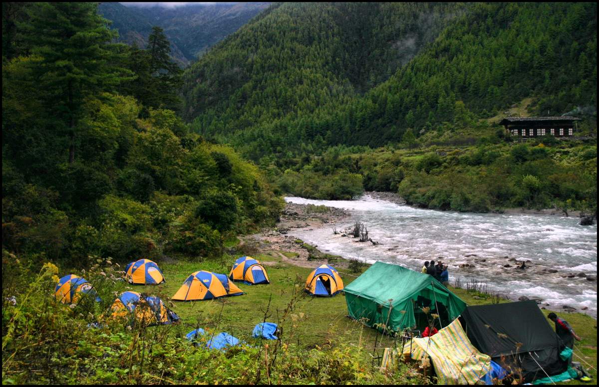
The Nub Tshona Pata Trek is one of the off beat routes in Bhutan located in the Paro-Ha region. This five day walk is an ideal introduction to trekking in Bhutan before taking on the longer walks like the  24 days Snowman trek. The itinerary can be completed within a week with a rest day in Paro on the way in.  Few groups do this camping trek so in all likelihood in March we should have the trail to ourselves. There are some places available for this trek so do get in touch if interested.

Who should join this trek?

A good choice for regular hill walkers, good level of fitness required.  It is a camping trek using tents.
1) Walking times: average  6 to 7  hours walking per day  uphill and downhill.
2) Altitude: up to 4350 metres
3) Terrain: for some of the time following well-travelled trails although also likely to some rocky conditions near the pass .

This is a full support camping trek with kitchen crew, ponies, guide and tents. Mobile phones etc will not work on the trek but will function in Paro and Ha.


Day 1 Fly into Paro
The flight into Paro on the wings of the Dragon, finally lands after making a couple of acrobatic maneuvers while negotiating the high mountains surrounding the small air strip in the Paro valley. We spend the first day acclimatizing and maybe visiting the Paro Rinpung Dzong. Altitude 7330ft/ 2235m.

 Day 2 Excursion to Taksang (Tigers Nest) monastery in the morning and then drive to our hotel at Ha in the evening. 
We spend the morning hiking up to Taksang Monastery, the most famous monastery in Bhutan. Taksang means “Tiger’s Nest” so named because Guru Rimpoche reportedly flew to the site on the back of the flying tigress in the early 8th century. The monastery perches miraculously on a cliff nearly 2,700ft above Paro’s valley floor. Break along the way for tea and snacks in small tea house and after this drive in the evening to our first hotel in Ha. Alt: 9480ft / 2890m

Day 3/ Haa 2890m to Tshokam 3622m: From Kajena (2735m) we leave the car and start walking through the Kajena village. The village has preserved the beauty of its traditional lifestyle and architecture which is unexploited by most visitors. This is just the beginning of a great trekking experience. The trail climbs upward for 2 & ½ hrs through, pine forest and beautiful flowers until we reach the DradenTashiChhoelingShedra (also know as Bjanadingkha monastery). The monastery was built by Lam CholayShacha Tenzin in 1773, the founder of Sangchoko monastery in Paro. The monastery was handed over to the DratshangLhengtshog by the community, when the villagers migrated to Kajena village. At and around the monastery different types of butterflies flutter around while you have a spectacular view of the Haa valley from the monastery. Visit the monastery. Lunch can be served here. From here it’s a gradual up hill climb till you reach a serene meadow of Tshokam (3622m). On the way wild mushrooms grow in the season and one can find edible Rozitescaperata (Dungshishamu), Kato shamu, JichuKangro, waleyshamu and many other edible mushrooms.
Walking Time:Approx 6-7 hrs Difficulty: Moderate with gradual ascend
Highest Elevation: 3622m Campsite:Tshokam (3622m)

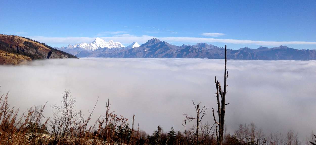
Day4. Tshokam 3622m to Womji 3600m: The Trek starts with the gentle climb to the Talela Pass: 3780m. The trail passes through the forest of Blue pine and rhododendron forest. The gradual ascent continues to the Yak Harders camp at Tshojo, climb further to Gochula pass (4350m) After the pass the trail follows a ridge and then descends gradually to your camp at Womji. Today’s trek is approximately 7 hrs. Overnight at camp.


Day5. Womji 3600m to Tshonapata 3850m : Today’s trek starts with a steep climb through Juniper forest and rhododendron forest to the Gochhila pass (4350m) you will have spectacular views of the whole Tshejala range. Continuing on to Tshejalum, you will pass several Yak herder’s camps , you will enjoy the alpine flowers. After crossing the Tshejalapass and to overnight at Tshonapata.

Day6.  Tshonapata 3850m to Tsojo 3780m:Today we will resume the same trail till the Gochhila pass and take a new trail through the rhododendron forest and scenic views of mountains. Drop down to the camp to the lake Tsojo to the new campsite at the meadow of Tsojo.Alt: (3780m) 6 to 7 hours

Day7..Tsojo – to Haa (trek ends ) drive to Paro . 4 hours walk and 2 hours by car
your trail descends gradually through the forest of Juniper and rhododendron till Talila pass, which you will cross to reenter the Haa valley , Your trek finishes here and you will drive  back to Paro for the night. Alt:2320m.

Day 8 - Fly from Paro to your home country.

Dates
March 25th 2018 to April 1st 2018

COSTS

The cost of the trek is Rs 65,000 for Indian passports including taxes.  The Government of Bhutan charges a fixed sum of US $ 250 per day from all foreign passports or $2000 for this trek. 
 The cost per person for Paro to Paro (8 days ) as per the itinerary given earlier 
Costs given above are at current rates of 2017 and may change without notice. Changes if any will be notified 3 months before the trek.
Costs include:
Pick up from the airport and drop at airport
All Bhutan entry permits and trek permits.
Bhutan visa fees ( for foreign nationals)
Government Royalty and taxes ( for foreign nationals )
Transport from Paro to roadhead and pick up at the end of the trek
Two nights accommodation and breakfast in Paro in good standard hotel on twin sharing basis.
One night accommodation at Ha with dinner and breakfast at the hotel on twin sharing basis.
All accommodation in tents on twin sharing basis  and meals on trek for three days as per itinerary; breakfast, lunch and dinner.
Cost of guides/cook/helper/ponyman and ponies as needed for the trek.

Costs not included
Flight Costs from home country to Paro and back.
Airport taxes if any.
Lunch and Dinner at Paro  and Ha
Client travel and medical insurance of any kind. Emergency evacuation costs if needed.
Bottled drinks; boiled, filtered or bottled water; alcohol; snacks etc
Personal clothing and equipment; sleeping bag; /down/ goretek jacket, medicines for personal use etc.
Tips to guides/cook/helper/ponyman at the end of trek.
There are fights by Druk Air and Bhutan Air from Delhi and Kolkata to Paro. You will have to connect to these flights from your home cities.

 For more details please contact Sujoy Das sujoyrdas@gmail.com or +919831054569
www.southcol.com


Friday, January 26, 2018

Farewell Elizabeth Hawley


Elizabeth Hawley ,94,  passed away in a Kathmandu hospital early this morning. For those who knew her the loss is irreplaceable. A chronicler of the Himalaya for more than four decades her contribution to Himalayan  mountaineering is immense.

A brief account of her life below from Wikipaedia -

"Elizabeth Hawley (born November 9, 1923, in Chicago, Illinois) is an American former journalist and chronicler of Himalayan expeditions. She travelled to Nepal in September 1960 and never left.

She was educated at the University of Michigan. She moved to Nepal after giving up her job as a researcher for Fortune magazine in New York and visiting Kathmandu on a round-the-world trip. Working briefly as a reporter, Hawley went back to San Francisco, returning to Nepal a few years later as journalist for Time.

She found work with the Reuters news agency covering mountaineering news, including the 1963 American expedition that was the first from the United States to traverse Mount Everest.

While she has never climbed a mountain herself, Hawley has been the best-known chronicler of Himalayan expeditions for over four decades. She is respected by the international mountaineering community because of her complete and accurate records, despite their unofficial status. Her records are summarized in a database  used in several analyses of success and death rates for climbers in the Nepal Himalaya

French ice climber François Damilano (fr) named a peak in Nepal after Elizabeth Hawley. Damilano made a solo first ascent of Peak Hawley (6,182 meters) in the Dhaulagiri Group on 9 May 2008, after climbing 7,242-meter Putha Hiunchuli."

Today's obituary from The Himalayan Trust
http://himalayantrust.org/about-us/elizabeth-hawley-nov-9-1923-jan-26-2018/

Some links from interviews and press reports on Miss Hawley:

https://www.outsideonline.com/1825881/high-priestess-posterity

http://adventureblog.nationalgeographic.com/2016/03/11/i-frighten-a-lot-of-people-everest-chronicler-elizabeth-hawley-92-tells-it-like-it-is/

https://www.reuters.com/article/us-india-nepal-everest/elizabeth-hawley-worlds-everest-expert-idUSTRE7480XP20110509

http://www.bbc.com/news/world-south-asia-10268549

Thursday, January 18, 2018

Himalayan Weather

Annapurna South, Huinchuli and Machhapuchhare from Dhampus
If you read any guide book on the Himalaya or on trekking in the Himalayan region, you will invariably be told that the post-monsoon season is the best time to trek in the mountains. Clear blue skies, superb mountain views, mild sunny days and crisp cold nights are all forecast for the trekker.  You will also be told that the pre monsoon season i.e. March to May is the second best time to be in the mountains with mild showers in the evening but clear morning and the weather getting warmer as you approach the monsoon. Further, according to the guide books, trekking in the monsoon is strictly a “no no” and if the heavy rains and landslides don’t make your trek a nightmare, the leeches will! And of course the winter is so cold that no sane individual would venture into the high altitude at that time!

So what is the real story on Himalayan weather?

The trail between Dingboche and Dugla, Everest region
I have trekked in the Himalayas in all seasons, including the winter (Everest 2003-04), the monsoon (Sikkim 2000) and numerous autumn and spring treks.

One October I remember visiting Kathmandu airport every morning for the flight to Lukla and returning to our hotel at lunchtime. It rained for three days incessantly and the Lukla flight could not take off. Finally on the fourth day it did take off  and made a hair raising landing at Lukla narrowly missing the hill in front of the airstrip. Surprisingly the very next day the weather cleared and we did not get any rain for the next two weeks during our trek.

Again, walking the Annapurna circuit in October I remember repeated day after day of afternoon rain up the Marsyandi valley. One downpour near the village of Chame was so heavy that we sheltered in a bamboo hut and managed to stay dry until the rain stopped.

In December 2009 I trekked with a South Col group to Poon Hill in the Annapurna region and surprisingly other than the morning at Ghorepani, the rest of the days had cold, cloudy weather very unusual for December.

Tso Moriri Ladakh

The rain shadow regions of the Himalaya like Ladakh, Zanskar, Lahoul and Spiti possibly get the best weather in the monsoon season July to September.

So in my opinion, good weather is a gamble. What with global warming, rapid deforestation and urbanization, the weather is no longer predictable. Every season has something special to offer so select your season and hope for some great views and weather!

For more information on our treks and photo workshops do visit www.southcol.com

Tuesday, January 9, 2018

Nikon 180-400 Super Zoom with TC 1.4 Teleconverter


Nikon introduces a 180-400 F4 superzoom with 1.4 teleconverter built in at $12,399.95!

The press release from the Nikon USA site says it all:
"Pros who spend time behind a super-telephoto lens know a hard truth: when you need a teleconverter, you often need it in a hurry. For these moments, Nikon proudly introduces the AF-S NIKKOR 180-400mm f/4E TC1.4 FL ED VR, a super-telephoto zoom lens with a built-in 1.4X teleconverter. Capture sports, events and wildlife in lifelike brilliance from 180-400mm, then, without breaking shooting posture, engage the integrated teleconverter and increase your reach to 560mm f/5.6 (840mm equivalent on a DX body). Incorporating remarkable advancements in optical design, autofocus performance, Vibration Reduction and durability, this lens is bound to become the new standard for serious field photographers."

Features

  • Professional super-telephoto zoom with Nikon's first built-in selectable 1.4X teleconverter
  • Advanced optical design with 8 ED glass elements, a Fluorite element and Nano Crystal Coat produces unwavering image quality
  • Blazing fast subject acquisition and locked-on tracking, especially when used with Nikon's 153-point AF system
  • Lightweight, durable construction with advanced weather sealing, internal focus and Nikon's nonstick Fluorine coating
  • Next-generation Vibration Reduction (VR) system that starts immediately and includes three shooting modes
The immediate competition for this lens is the old workhorse 200-400 F4 used extensively by both wildlife and sports photographers and this will be the lens against which the new  180-400 will be compared. As prices go the older lens is around $6,996 street so there is a very significant difference between the two offerings.

We should wait for the test reviews of the new lens and it performance in the field.

In the meanwhile for more information do visit the following links:


Wednesday, January 3, 2018

Annapurna Foothills Trek | The Photographs

Approaching Landrung
South Col Expeditions completed another Annapurna Foothills Trek from December 23-30 2017 amidst speactacular winter weather with clear blue skies and warm sunshine. Some photographs from the trek are below:

Sunrise Ghorepani

The beautiful dining room of Gurung Cottage Ghandrung

Ferns in the forest near Tadapani

On the ridge between Deorali and Ghorepani with Dhaulagiri behind

Tadapani lodges with Annapurna South, Huinchuli and Machhapuchhare behind

Thursday, December 21, 2017

Everest Base Camp Trek | The Best Season ?


I am often asked which is the best time to trek in the Everest region? Is it April and October? Interestingly things have changed a lot including the weather so this post covers the seasons and the pros and cons of trekking in the Everest region.


January 
This is peak winter -  temperatures at Gorak Shep (5150 metres) would be around -20C at night - water would be frozen but in all likelihood the weather would be clear but snow is on the cards. You need good warm down  jackets and a -20C sleeping bag to be comfortable. There will be few trekkers so you would have the lodges to yourself.

February
From mid February the weather would begins to warm up marginally but it can be uncertain - rain and hail lower down and snow above 4000 metres. Some days can also be sunny and exceptionally clear with low humidity. Few trekkers again so the lodges would be free. Not a bad time to go if you want to avoid the crowds and don't mind the occasional snow storm!

March 
The trekking numbers would increase by early March. Warmer weather would see possibility of occasional rain and snow. By end March the trekking season would have picked up and flights would start to become busy. If you want to go in spring then mid to end March is a good start.


April
This is considered to be the second best season after October. It is spring and the rhododendrons and other flowers are in bloom creating a spectacular display of colour. The mornings are generally clear with clouds rushing in by noon and rain and snow possible in the afternoons. The weather is of course much warmer than February- March. This month sees the maximum number of trekkers after October.
May
The numbers of trekkers start going down as the monsoon approaches. There can be regular pre-monsoon showers in May and mountains can be cloudy and foggy especially in late May. Flights to and from Kathmandu to Lukla also can be cancelled due to weather conditions. However, the floral spectacle especially above Namche is spectacular so if you want to see flowers this is the time to go!


June to September
These are the monsoon months. Flights to Lukla will often be delayed or cancelled due to rains and fog. Mountain views are few as the clouds dominate the valleys and peaks. On some days if you are lucky the sun will break through and you can see a peak floating through the clouds. There will be hardly any trekkers so no crowds. It's very green in the Khumbu at this time and flowers in the high meadows.

October
This is the peak season for the Everest trek. Flights are packed and so are the lodges. However for the last few years, it has been raining until mid October due to the delayed monsoon and the first two weeks have seen bad weather and many cancellations of the Lukla flight. I would avoid October if you can both for the weather issues and the crowds. Once the monsoon retreats you can be assured of clear skies and sunny warm days.

November
November in fact is the new October with clear days low humidity few clouds and mountain views every day - this  is the typical post monsoon weather which remains until mid December. It would be the first choice for Everest trekkers - the stability in the weather ensures that the Lukla flight can fly until 11 am on most days. Night temperatures at Gorak Shep would be between -10C and -12C,


December
It would be colder than November but until mid December the clear weather would continue. Crowds would be thinning as most people would be returning - flights would also not be so busy and tickets easy to get. Temperatures in Gorak Shep would be -15C at night. Recommended with a good down jacket and a four season sleeping bag!

The statistics at the entry point Jorsale for 2017 and part of 2018 is below:


For our fixed 2018 departure for the Everest trek in November 2018  do visit http://www.southcol.com/treks-nepal/everest-base-camp-ebc-kala-pattar-october-22nd-november-4th-2017/

Tuesday, December 12, 2017

Yeti | The Myth is dismissed

Edmund Hillary, one of the first two people to scale Mount Everest, and Khunjo Chumbi, a Nepali village elder, hold what was then thought to be the scalp of yeti, in Calcutta, India, on December 9, 1960. AP Photo

Study dismisses myth of the yeti with bear facts

Purported samples from wild man of the Himalayas are found to be from local bear population


Nearly every time Sujoy Das leads a trekking group in the Himalayas, he gets the question, asked half in jest, half in hope. Has he ever spotted signs of the yeti?

Mr Das guides treks on some of the mightiest Himalayan peaks — Everest, Annapurna, Gangapurna — and through the Nepali valleys that lie in between. This is the terrain where the myth of the yeti — or the Abominable Snowman — first arose, and where it still persists. A hirsute, apelike creature, taller than most human beings, the yeti and its legend grew out of old local tales about wild men living in the mountains.

European explorers seized upon the mystery and expanded it, reporting glimpses of the creature or finding outsize footprints in the snow. Every Everest expedition seemed to keep half an eye cocked for the yeti or its tracks; one British mountaineer took photos of footprints twice the size of the average adult human's foot.

The fascination has not died down. “In Nepal and in the Everest region, this question always comes up. Has anyone see a yeti?” Mr Das said, who lives in Kolkata and runs South Col Expeditions. "The local people say they have, but we don’t know if it is actually one. I always say: ‘No, I haven't seen one.’”

A new genetic study of nine purported yeti samples, however, may put the legend into deep freeze forever. The results, published last week in the journal Proceedings of the Royal Society B, suggested that eight of the samples were from a different sort of shaggy, wild creature: a bear. (The one remaining sample came from an even less elusive creature: a dog.)

Charlotte Lindqvist, an associate professor in the department of biological sciences at the University of Buffalo, New York, who led the study, called it “the most rigorous analysis to date” of relics of the so-called yeti.

Ms Lindqvist first became involved in the yeti myth in 2014, when other researchers contacted her to compare the genes in two purported yeti hair samples with those in a 120,000-year-old polar bear fossil she was working on.

“But the data was very limited, and it made me suspicious about the speculation that the yeti legend represented some strange, hybrid bear roaming the Himalaya mountains,” Ms Lindqvist said. “So I agreed to follow up on this study with a more rigorous approach based on more genetic data from more purported yeti samples.”

The samples came from everywhere: hair found in Tibet in the 1930s; a fragment of leg bone, coloured a toasted brown, recovered from a mountain cave; a tooth and a lump of petrified faeces, which had been carefully stored in an Italian museum devoted to the alpinist Reinhold Messner.

Mountaineers and explorers have hunted for the definitive yeti sample throughout the 20th century. In 1961, Edmund Hillary, one of the first two men to climb Everest, led an expedition to Nepal purely in quest of the yeti.

“He went to Khumjung, a monastery above Namche Bazaar [in Nepal], where a yeti scalp was preserved by the headman of the village,” Mr Das told The National. “Hillary got the headman’s permission to take the scalp, to get it tested.”

One of the villagers accompanied Hillary on his trip. “They thought: ‘Hillary is a foreigner. He doesn’t know what this is, or what the value of it is to them,’” he said. “So they did this world tour with the scalp, meeting anthropologists and so on. The net result: the experts said it was the scalp of a Tibetan blue bear.”

Others have also advanced the theory that the various bits of the yeti — footprints, hair, bone samples — came from a species of bear. In his new book yeti: The Ecology of a Mystery, the conservationist Daniel C Taylor, who has searched for signs of the yeti ever since he was a child growing up in India, concludes that the footprints most probably belong to an Asiatic black bear.

Ms Lindqvist and her team compared their nine samples with 15 others that were known to be from local bear populations. Previous research had hinted at an unknown type of bear, but eight of the nine yeti samples proved to belong conclusively to well-known types of black and brown bears.

An inkling of this ursine identity has existed all along. In 1921, the British explorer Charles Howard-Bury, having found footprints in the snow, was told by his Sherpa guides that they belonged to the “metoh-kangmi”, a wild creature living in the snows.

Later writers misinterpreted “metoh” as “filthy” and replaced it with the more elegant “Abominable”. But a knowledge of the Tibetan language would have provided the clue, for the words “metoh kangmi” translate to “man-bear of the snows”.

https://www.thenational.ae/world/asia/study-dismisses-myth-of-the-yeti-with-bear-facts-1.682529

Saturday, December 2, 2017

Mustang Nepal | The Trans Himalaya


Cultivated fields of Chuksang

Mustang (from the Tibetan möntang (Wylie: smon-thang), Nepali: मुस्तांग Mustāṃg "fertile plain"), formerly Kingdom of Lo, is a remote and isolated region of the Nepalese Himalayas. The Upper Mustang was a restricted demilitarized area until 1992 which makes it one of the most preserved regions in the world, with a majority of the population still speaking traditional Tibetic languages. Tibetan culture has been preserved by the relative isolation of the region from the outside world.

The Upper Mustang comprise the northern two-thirds of Mustang District of Dhawalagiri Zone, Nepal. The southern third of the district is called Thak and is the homeland of the Thakali, who speak the Thakali language, and whose culture combines Tibetan and Nepalese elements. Life in Mustang revolves around tourism, animal husbandry and trade.

Mustang's status as a kingdom ended in 2008 when its suzerain Kingdom of Nepal became a republic. The influence of the outside world, especially China, is growing and contributing to rapid change in the lives of Mustang's people. from Wikipedia

Some images from Mustang are below:

Monastery Tsarang

Ploughing the fields outside Drakmar village

Entrance of Drakmar

Man made plantations Gheling

Pass of Mui La 4170 m on the road to Ghar Gompa

Village of Geling

North of Lo Manthang

LinkWithin

Related Posts Plugin for WordPress, Blogger...