Saturday, September 22, 2018

Everest 2018 | Photographs


The autumn treks in the Everest region will soon be underway and October and November 2018 promises to be a very busy season. The lure of Everest is difficult to resist and here are some photographs of the mountain from different locations over the years:


Moorise near Kala Pattar

Everest and the Lhotse - Nuptse wall from Thyanboche

Above the fifth lake of Gokyo

Approaching Kala Pattar

Sunset view Gokyo Ri 
For our treks in Nepal do visit www.southcol.com

Friday, September 14, 2018

Banff Mountain Book Festival Longlist 2018

Selection of book finalists
Photo Courtesy : Banff Mountain Book Festival www.banffcentre.ca

The Banff Mountain Book Festival Long list 2018 has been announced. As usual there is an outstanding collection of books which will make it very difficult for the jury to select the winners. The list of books in the long list is below:

Adventure Travel
$2000 - Sponsored by Fjällräven

Atlas of a Lost World
Craig Childs, Pantheon Books (USA, 2018)

Lands of Lost Borders
Kate Harris, Penguin Random House Canada (Canada, 2018)

The Last Wild Men of Borneo
Carl Hoffman, HarperCollins (USA, 2018)

Mountain Fiction & Poetry
$2000

As Above, So Below
Chris Kalman, Mascot Books (USA, 2018)

Deer at Twilight: Poems from the North Cascades
Paul Willis, Stephen F. Austin State University Press (USA, 2018)

The Eight Mountains
Paolo Cognetti, Penguin Random House - Vintage (UK, 2018)

Mysterium
Susan Froderberg, Farrar, Straus and Giroux (USA, 2018)

Mountain Literature – Non-Fiction
$2000 - Sponsored by the Whyte Museum of the Canadian Rockies

A Mountaineer's Life
Allen Steck, Patagonia Books (USA, 2017)

Edmund Hillary: A Biography
Michael Gill, Potton and Burton (NZ, 2017)

End of the Rope: Mountains, Marriage and Motherhood
Jan Redford, Penguin Random House Canada (Canada, 2018)

Honouring High Places: The Mountain Life of Junko Tabei
Junko Tabei and Helen Rolfe, Rocky Mountain Books (Canada, 2017)

Tides: a climber's voyage
Nick Bullock, Vertebrate Publishing (UK, 2018)

Mountain Environment and Natural History
$2000 – Sponsored by Town of Banff

Bert Riggall's Greater Waterton: A Conservation Legacy
Beth Russell-Towe, Fifth House Publishers (Canada, 2018)

Big Lonely Doug: The Story of One of Canada's Last Great Trees
Harley Rustad, House of Anansi Press (Canada, 2018)

The Wolf: A True Story of Survival and Obsession in the West
Nate Blakeslee, Penguin Random House Canada (Canada, 2017)

Mountain Image
$2000 – Sponsored by Lake O'Hara Lodge

Bergtagen
Claes Grundsten, Bokförlaget Max Ström (Sweden, 2017)

The Canadian Rockies: Rediscovered
Paul Zizka, Rocky Mountain Books (Canada, 2017)

Searching for Tao Canyon
Pat Morrow, Jeremy Schmidt and Art Twomey, Rocky Mountain Books (Canada, 2018)

Guidebooks
$2000 – Sponsored by the Association of Canadian Mountain Guides

Higher Education
Andy Kirkpatrick (Ireland, 2018)

Hiking the Pacific Crest Trail: Northern California
Philip Kramer, Mountaineers Books (USA, 2018)

The Index Town Walls: A Guide to Washington's Finest Crag
Chris Kalman and Matthew Van Biene, Sharp End Publishing (USA, 2017)

Scotland's Winter Mountains with one axe
Garry Smith, Northern Edge Books (UK, 2018)

Squamish Rockclimbs
Kevin McLane and Andrew Boyd, High Col Press (Canada, 2018)

Mountaineering Article
$2000 – Sponsored by the University of Alberta and the Alpine Club of Canada

Contraindications
Alison Criscitiello, Alpinist Magazine (USA, August 2017)

The Force of the Soul
James Edward Mills, Alpinist Magazine (USA, November 2017)

Suicides and Pirates
Andrew Allport, The Climbing Zine (USA, March 2018)

The Other Annapurna
Ed Douglas, Rock and Ice Magazine (USA, July 2018)

Mountaineering History
$2000

All titles that are shortlisted in the categories above that have a theme of mountaineering history are eligible for this award.

Grand Prize – The Phyllis and Don Munday Award
$4000 – Sponsored by the Alpine Club of Canada

The shortlist of category award winners eligible for the Grand Prize will be announced in mid-October.
The Grand Prize will be announced Thursday, November 1, 2018 at Banff Centre Mountain Film and Book Festival and category awards will be presented to winning authors.

For  more information do visit:
https://www.banffcentre.ca/banff-mountain-book-competition


Monday, September 10, 2018

Spiti Homestays in the Left Bank Villages

The village of Lhalung 
The village of Lhalung (3800 metres)  is now connected to the district headquarters of Spiti, Kaza, by a motorable road but is also possible to walk to Lhalung from Komic and Demul. We stayed at Khabrick Homestay in Lhalung run by Tashi Khabrik and his charming wife Dolma.  Tashi is extremely knowledgeable about the region and also works as a trekking guide in summer for treks across Parang La  to Tso Moriri and other areas in Spiti. He can be contacted at tashi.bodh@yahoo.co.in and +91 9418962704. Lhalung has a splendid monastery on top of the hill and for tourists visiting Dhangkar, a visit to Lhalung just an hours drive away is strongly recommended. Alternatively, the Spiti left bank trek starting from Lhangza passes through Komic, Demul, Lhalung and then onto Dhangkar.


Tashi , Dolma and their little girl outside their homestay
 In the village of Komic , we stayed at the Kunga Homestay at an altitude of 4500 metres. Kunga Chorden, a young lad of 23 years who runs the home stay with his wife provides very comfortable accommodation with good food. Kunga later accompanied us on our three day trek from Komic to Dhangkar. His phone nos are 01906 200050 and +91 9459981295. He can be also contacted through Mr Ramesh Lotay of Spiti Holiday  Adventures in Kaza at +91 9418439247/ +91 1906 222711. Ramesh Lotay is also on e mail loteykaza@yahoo.co.in 

A sunny room at Kunga Homestay, Komic

The village of Komic

For more information on Spiti and the Spiti Left Bank trek please do visit  http://sujoyrdas.blogspot.com/2012/05/spiti-left-bank-trek-outlook-traveller.html


Monday, September 3, 2018

Rumtse to Tso Moriri | Trekking in Ladakh


If you are fit, well acclimatised and have been above 5000 metres before,  I recommend this trek. The trails are relatively free of noisy tourists who prefer the great herd at Markha. Here, the rolling, billowing grasslands stretching out as far as the horizon are usually empty, giving one the sense of infinite, almost primordial space. Occasionally you will chance upon a nomad on horseback herding his great lumbering, shaggy yaks. Ranging across the western extension of the high Tibetan or Changthang plateau, the trek starts at over 4000 m at Ponganabu on the shores of Tso Kar Lake , well above that throughout, often peaking over 5000m at the passes. And though this at first may be daunting, once you have acclimatised the walk is surprisingly easy on the legs as the trails— mostly well-defined stone and gravel-free paths— meander gently through velvet-soft pastures. . This area is colder and windier than other treks in Ladakh, so ensure you have a good parka and a warm sleeping bag.

Who should join this trek?
A good choice for regular hill walkers, high level of fitness required. Prior trekking experience is advisable
1) Walking times: average 5 to 8 hours walking per day
2) Altitude: up to 5,450 metres - most of the trek stays above 4000 metres with passes above 5000 metres.
3) Terrain: for some of the time following well-travelled trails although also likely to encounter rough and rocky conditions.
4) Remoteness: the trek is in a remote mountain area and a long distance from the roadhead and the nearest cities. There is no mobile phones and wifi connectivity.

Day 1
Leh to Rumtse by road and then to Kyamar
We left Leh at 8 10 am in two vehicles - one for the trekkers  the other for the support team and equipment. The sun was coming out through the clouds and we hoped it would be a good day after the rain in the previous day.  We reached Rumtse by around 10 30 am and stopped in front of the Rumtse Tourist Centre which was closed. Our ponies were waiting for us and after loading them up we started for Kyamar at around 11 15  am. The trail immediately crosses the river on some rocks and as luck would have it I slipped and fell into the water within 15 minutes of starting our trek - wet boots, wet socks, wet trousers and a torn jacket snagged against a rock  is hardly the most auspicious way of starting a trek ! The trail continued to climb gently near the river following a well defined path. Finally after around 3 to 3.5 hours of walking you come across a couple of large mani walls on the left of the trail. This is the start of Kyamar - the camping spot is around 30 minutes walk away. We reached Kyamar by around 4 pm and no sooner had we reached it started to rain. It was a light drizzle to start with but soon intensified into a fairly heavy downpour quite uncharacteristic for Ladakh. We had a tough job putting up the tents and the sleeping bags were also damp. Finally the rain stopped around 7 pm or so but the temperature had plummeted quite a few degrees by then. We had dinner and turned it
 - it was very cold even in the sleeping bag and I slept with my thermals and down jacket and warm cap to boot !  Always optimistic we hoped for a better day tomorrow .
Rumtse to Kyamar 4 to 5 hours
Rumtse 4250 m 33 37 32 N 77 45 58 E Kyamar 4570 m 33 33 14 N 77 50 32 E


Day 2
Kyamar to Mandachalan
I was up before 6 am and peering out of my tent found the morning was clear with some low clouds. It had snowed higher up and the hills around the valley had a dusting of fresh snow. It was cold - ice had frozen on the tent walls unusual for early September. We started out around 8 15 am after a good breakfast made by our Nepali cook Budhiman.  We crossed the river again on some rocks and followed a fairly wide road on the eastern edge of the valley - the road has some wide and gentle turns but don't follow that - there is a shorter narrower track which will invariably have pony hoof marks - follow that trail climbing gently for about 2.5 to 3 hours.  The last 45 minutes to the top is steep and you don't see the prayer flags of Kumur La until the very end.  From the Kumur La a 30 to 45 minute descent bring you to the camping ground of Mandachalan next to the stream. We were down by 2 pm.  Around 3 pm in the afternoon I spotted Stanzin coming down at high speed to the camp - the three girls who were with him were not there.  Stanzin mentioned that one of them was ill and I should go up - he was coming with one of our ponies to get her down. I set off immediately and within twenty minutes I found  her - she was apparently exhausted and dehydrated.  We got her down to the camp by pony and put her in a warm sleeping bag  - she complained of breathing difficulties - we decided to send her down to Rumtse immediately by pony Stanzin  and the pony man accompanied them - it had started snowing by then by they reached Rumtse by 11 pm at night and got a taxi to Leh immediately. The drop in latitude of around 1300 metres so should have helped her no end - Stanzin and the pony man walked through the night with the two ponies and reached camp at 5 am, a Herculean evacuation attempt which probably saved  her life.
Kyamar to Kumur La 3.5 to 4.5 hours
Kumur La to Mandachalan 30 min to 45 min
Kumur La  5123 m 33 31 52 N 77 53 42 E Mandqchalan Camp 4960 m 33 31 3 N 77 53 59 E


Day 3
Mandachalan to Tisaling
It had started snowing in the evening and it snowed intermittently through the night. It was also very cold and despite wearing my down jacket in the sleeping bag it was still not comfortable -  I slept on and off and around 5 am the snow stopped only to start aria around 7 am. We could not leave then so decided to wait - the Ladakh weather had become extremely unpredictable and extremely unusual for September. The weather cleared up around 10 am and the sun came out so we decided to start for Tisaling around 10 15 am. The trail crossed the stream over some rocks and began climbing steadily on a narrow path in a east south easterly direction. after around 30 minutes it started to climb steeply and reached the top of the Mandachalan la in around 90 minutes. Don't despair if you can't see the prayer flags of the pass on top - it in only visible in the last 20 metres. From the top of the Mandachalan a the trail remains fairly level until it reaches another small pass at the eastern end - from here you can look down at the meadows of Tisaling and the route the next morning to the Shibuk la which is about an hour’s climb above Tisaling. From the second smaller pass it is a steady zig Zag down for  30 minutes to the camp at Tisaling. As we reached the camp we spotted a solitary Kiang (Tibetan wild ass) across the river galloping away.
Mandachalan to the top of Mandachalan la 1 hr 30 min to 2 hours
Mandachalan la to Tisaling 30 min to 45 min.
Mandachalan La 5235m 33 30 18 N 77 54 38E Tisaling 5032 m 33 29 15 N 77 55 59 E


Day 4
Tisaling to Ponganagu
It snowed off and on during the night but not very heavily. The morning had light clouds and we were ready to leave around 8 am. The path went across the broad meadow and crossed a small stream over rocks. It then started to climb the hill in front initially gradually and then made some steep zig zags to a meadow which is not the pass. From here a gradual climb leads to the prayer flags which is the pass and like many Ladakh passes is not visible until the last ten metres. From the top of the Shibuk la we could look right down into Tso Kar lake below as well as the peaks to the south of Tso Moriri like Mentok. The path then went down a beautiful grassy valley where we spotted two kiang prancing on the hillside above us. In about 90 minutes we reached the campsite of Shibuk which did not have much water but was beautifully located on a grassy flat. From here the trail plunged down into a rocky gorge which after an hour came to a mani stone on the right of the trail which is a good lunch spot in the sun. By now the weather had improved and the sun was out with fluffy white clouds typical of a Ladakh September. From the mani stone the trail could be clearly seen ahead in a south westerly direction leading to a small plateau. Crossing the plateau the campsite of  Ponganagu could be seen below and also the new black topped road below coming from Thukche village at the other end of Tso Kar. Our camp was near a stream near the permanent Tso Kar camps which are used in the season for tourists who can drive down from Leh for the night.
Tisaling to the top of Shibuk La 1 hr 15 min to 1 hr 30 min
Top of Shibuk la to Shibuk camp  site  90 min to 120 min
Shibuk camp site to  Mani wall lunch spot 1 hr
Mani wall to Ponganagu 1 hr 30 min
Shibuk La 5282 m 33 28 20 N 77 56 40 E Ponganabu 4570 m 33 21 38N 77 57 35E

Day 5
Ponganagu to Nuruchan
We had planned that if we made it to Nuruchan by 12 noon we would try to cross the Horlam Konga pass and reach Rajankaru  the same evening albeit late. So we left Ponganagu after breakfast at 7.30 am. The weather had cleared up there were no clouds in the sky and bright September sunshine when we started.  There is a permanent jeep track from here to Nuruchan and we had to follow the dry and dusty road which skirts the Tso Kar lake travelling in a southerly direction. We reached Riyul in about two hours and 15 minutes - there is a chorten on the road which marks the entrance of Riyul and some abandoned stone built houses which Stanzin told us we're used in winter when the nomads come down to the Tso Kar basin from the higher grazing grounds.  The road then continues all the way to  Nuruchan and  it can be a very flat and monotonous walk.  We were lucky to spot several herds of kiang - one who gave a dramatic spectacle of sprinting across the Tso Kar plains crossing the road behind us and climbing steeply to a high plateau on the opposite side well out of harm’s way.  The sun beat down on us and there was no shade to be had anywhere. It was typical Ladakh cold desert extreme climate. In around three hours we reached the campsite of Nuruchan which is beautifully situated and possibly one of the best camps of this trek. This camp is located you the side of a fast flowing stream on lush green spongy grass which is a rarity in Ladakh. Just behind my tent was the burrow of a Ladakh pika which came out inquisitively to inspect my arrival and shot back into the burrow once I tried to take a photo. Birds were plentiful and the grey wagtail, white breasted redstart and a variety of high altitude finches flashed through the camp. In the backdrop were the peaks of the Tso Moriri basin their tops crested with snow surrounded by fluffy white clouds - it was a perfect autumn afternoon .
Ponganagu to Riyul 2 hrs to 2.5 hours
Riyul to Nuruchan 2.5 hours to 3 hours
Riyul 4550m 33 17 46 N 77 58 14E Nuruchan 4690 m 33 13 49N 77 5930E

Day 6 Nuruchan to Rajankaru
We left Nuruchan around 8 30 am and had to immediately cross the stream below the camp. The water was about calf deep and the stream around 10 feet wide. After crossing the stream we climbed up to a small plateau and saw the trail to the pass meandering up the hillside. In about 50 min to 1 hrs we reached a small saddle 4825m marked by cairns and then the trail continued gently uphill to a second saddle with a lone cairn in around 25 to 35 min height 4896 metres. From the second saddle the trail climbed steadily until it reached the Horlam Kunga pass in 30 to 40 min 4950 metres.  You cannot see the pass until the very end so Trekkers should not get discouraged! From the pass in a thirty minute downhill walk you reach another stream which also needs to be crossed in calf deep waters. From the stream the path runs along the river climbing very gently and reaches the grazing settlement of Rajankaru in around 90 min to 2 hours.
Note- Rajankaru is the summer grazing settlement for the people of Sumdo village. They spend 2 to 3 months here grazing their yaks, sheep and goats on the high alpine meadows. They erect temporary tents with solar lighting and chimneys to stay warm.
Nuruchan to Horlam Kunga pass 1 hr 45 min to 2 hr 30 min; Horlam Kunga pass to Rajankaru 2 hr to 2 hr 30 min. Two stream crossings.
Horlam Kunga Pass 4950m 33 12 3 N  78 0 7 E Rajankaru 4920m 33 9 53 N 78 2 40 E

Day 7  Rajankaru to Gyama Barma
NOTE: It is possible to combine day 7 and 8 into one  long 8-9 hour day and thereby reduce the trek to 8 days.
From Rajankaru a narrow trail climbs away to the south east - the pass can in fact be seen from below but not the prayer flags which as usual are hidden from the climb until the last moment. When you leave in the morning you will probably have herds of sheep, goats and yaks also climbing with you up to the summer pastures. The trail climbs gently at first and reaches an altitude of 5100 metres in about an hour. It then starts to climb steeply and in about to 3 hours reaches the top of the Kyamayuri la pas 5410 metres. The pass has an extensive view and you can see the flats of Tso Kar in the distance.  From the pass follow the broad main track which runs flat at first and then down - in front of you is a broad valley ringed by snow peaks on the south. You can camp in this valley itself or walk further east cross a stream by wading through calf deep waters and camp below the climb to the Kartse La the next day.
Rajankaru to Kyamayuri la 3 hrs to 3 hrs 30 min Kyamayuri la to campsite below Kartse La 2 hrs. One stream crossing
Kyamayuri La 5410 m 33 8 12 N 78 3 45 E Gyama Barma 5150 m 33 6 13 N 78 6 26 E

Day 8 Gyama Barma to Gyama
The night was cold and windy though surprisingly everyone had a reasonable sleep.  Across our campsite we spotted again a lone kiang grazing on the slopes above our camp. We started out around 8 40 am. The path was just ahead of our campsite and starred climbing gently for the first half hour and then began to skirt the hillside - we spotted in the valley below us large herds of sheep going up to the grazing pastures. The last fifteen minutes to the top of the pass was difficult and heavy going. The pass was at 5390 metres. The trail from the top of the pass is level for a bit and then descends. In front is a big grassy valley running east to west and at the south eastern end there is a stream which has to be crossed to reach the camping grounds of Gyama. We walked down through the valley for about 30 minutes and then there was a steep descend to a stream crossing which was fortunately bridged by stones around 8 feet wide. The trail then climbed for around ten minutes and continued next to a larger stream running south west - northeast which had to be crossed by walking through ankle deep waters. The camping ground of Gyama is a large plain next to this stream and in the eastern side of the valley. It was occasionally drizzling and sunny throughout the afternoon as low clouds caused light passing showers interspersed with mild sunshine.
Gyama Barma to Kartse La 1 hr 15 min to 1 hr 30 min Kartse La to 1st stream 30 min to 40 min ; 1st Stream to Gyama campsite across 2nd stream 45 min to 1 hr. One stream crossing or two if the 1st stone bridge is broken.
Kartse La 5400 m 33 5 21 N 78 7 17 E Gyama 5166 m 33 3 45 N 78 8 38 E

Day 9  Gyama to Korzok
There was a light drizzle in the night but the morning dawned clear with light cloud. Most of the group had not slept too well due to the 5150 metres altitude - on top of this the camp at Gyama was a very windy one especially in the late afternoon to night. We had planned to get away at 7 am but finally left around 7 15 am. The trail initially for the first hour climbed steadily out of the valley following a small stream uphill for most of the way. After about two hours it enters a narrow gorge where you may need to criss cross a shallow stream a number of times. After leaving this narrow gorge the path opens up and turns left or east over a grassy knoll and you can unexpectedly see ahead the prayer flags of Yalung Nyua La. From the pass Tso Moriri can be seen - at a higher spot south of the main pass BSNL connections sometimes work. It is a long way down from the pass a drop of almost 900 metres - you can see a green patch below which is Korzok Phu.  On a clear day Mentok can be seen above Korzok Phu and just above Tso Moriri lake Chamser and Lungser Kangri are visible. The lake is seen for the first part of the descent. The trail passes Korzok Phu and then follows a stream which eventually enters the camping site of Korzok and finally the village itself.
Gyama to top of Yalung  Nyua La 3 hrs to 3 hrs 30 min; Top of Yalung Nyua La to Korzok 3 hrs to 3 hrs 30 min.
Yalung Nyua la 5440 m 33 1 1 N 78 10 43 E Korzok 4560 m 32 57 57 N 78 15 45 E


For more information on our treks do visit www.southcol.com
For photographs of the Himalaya do visit www.sujoydas.com

Monday, August 27, 2018

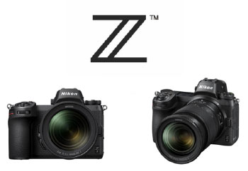
Nikon Z6 and Z7 Mirrorless Cameras


Image result for nikon z6 and 7 nikonusa

Nikon finally takes the plunge and enters the highly competitive mirrorless market with two cameras the Z6 and Z7. These full frame mirrorless cameras will compete directly against Sony's offerings.
To continue using Nikon's F mount lenses, there is a F2Z adapter which allows certain F mount lenses to be used on these mirrorless bodies/

Here is the press release from Nikon USA

Nikon Introduces the New Nikon Z Mount System, and Releases Two Full-Frame Mirrorless Cameras: the Nikon Z 7 and Nikon Z 6

MELVILLE, NY – Nikon Inc. is pleased to announce the release of the full-frame (Nikon FX–format) Nikon Z 7 and Nikon Z 6 mirrorless cameras, as well as NIKKOR Z lenses, featuring a new, larger-diameter mount to enable the next generation of ultimate optical performance.


Mirrorless Reinvented
The new Nikon Z mount system is comprised of mirrorless cameras and compatible NIKKOR Z lenses and accessories. This system has been realized through the pursuit of a new dimension in optical performance. It has inherited Nikon’s tradition of quality, superior imaging technology, intuitive operability and high reliability, all innovated from its digital SLR cameras.

At the heart of the Z mount system is the new, larger-diameter mount, which unlocks further possibilities of lens design. The Z mount system will offer a variety of high-performance lenses, including the fastest lens in Nikon history, with f/0.951. Additionally, the new mount adapter will enable compatibility with NIKKOR F mount lenses, adding to the range of choices for photographers.

The letter “Z” represents the culmination of Nikon’s relentless pursuit of ultimate optical performance, and a bridge to a new chapter. It is about redefining possibilities to provide image makers with tools to pursue greater creativity.

Nikon will expand the value of mirrorless cameras through the pursuit of a new dimension in optical performance, and by upholding Nikon’s tradition of quality while responding to the evolution of imaging technology. By providing image makers with stimulating new products, Nikon will continue to lead imaging culture.

Z 7, Z 6 Product Overview
The Z 7 and Z 6 are equipped with a new backside illumination Nikon FX-format CMOS sensor with built-in focal-plane phase-detection AF pixels, and the latest image-processing engine, EXPEED 6.

The high-resolution Z 7 has 45.7 effective megapixels, and supports a standard sensitivity range of ISO 64–25600. In combination with NIKKOR Z lenses, the camera achieves an outstanding level of sharpness and detail, all the way to the edges of the image.

The versatile Z 6 is an all-purpose FX-format camera with 24.5 effective megapixels, and supports the wide sensitivity range of ISO 100–51200. With superior performance at high ISO sensitivities and full-frame 4K UHD video capture with full pixel readout, the Z 6 responds to a variety of needs, such as shooting in dimly lit environments and high-quality movie recording.

These two models combine legendary Nikon reliability and a familiar interface with the benefits of a mirrorless, including rapid FPS, hybrid AF, silent shooting and advanced multimedia capabilities.

Primary Features of the Z 7 and Z 6
  1. Equipped with a new backside illumination Nikon FX-format CMOS sensor with focal-plane phase-detection AF pixels
The Z 7 and Z 6 are equipped with a new backside illumination, Nikon FX-format CMOS sensor with focal-plane phase-detection AF pixels, and the latest image-processing engine, EXPEED 6. The Z 7 has 45.7 effective megapixels and supports ISO 64–25600 range of standard sensitivities (reduction to the equivalent of ISO 32 and expansion to the equivalent of ISO 102400 is also possible). The Z 6 has an effective pixel count of 24.5 megapixels, and supports a broad range of standard sensitivities, from ISO 100–51200 (additional reduction to the equivalent of ISO 50 and expansion to the equivalent of ISO 204800).

  1. A fast and accurate hybrid AF system with focus points covering approximately 90% of the imaging area
The Z 7 has 493 focus points2 and the Z 6 has 273 focus points2, enabling broad coverage of approximately 90% of the imaging area both horizontally and vertically. This hybrid AF system uses an algorithm optimized for the FX-format sensor, to automatically switches between focal-plane phase-detection AF and contrast-detect AF when focusing to achieve focus. Newly-designed NIKKOR Z lenses take full advantage of this system, providing faster, quieter and with increased AF accuracy than previously possible for both still images and videos.

  1. The new EXPEED 6 image-processing engine for sharp and clear imaging, and new functions that support creativity
The Z 7 and Z 6 are equipped with the new EXPEED 6 image-processing engine. Employing the superior resolving power of NIKKOR Z and NIKKOR F mount lenses, subjects are rendered more sharply than ever before. Noise is also effectively reduced.

Additionally, a mid-range sharpening option has been added to Picture Control sharpness parameters. This option, along with existing sharpening and clarity parameters, allows users to make various textures within the screen sharper or softer, for both still images and video3. The cameras also offer 20 options of Creative Picture Control, supporting creative imaging expression. The effect level is adjustable from 0 to 100.

  1. An electronic viewfinder that utilizes Nikon's superior optical and image-processing technologies to offer a clear and natural view
The electronic viewfinder adopted for the Z 7 and Z 6 is comfortable and easy to use, comparable to optical viewfinders. Both cameras are equipped with an electronic viewfinder for which an approximately 3690k-dot OLED panel has been adopted. The electronic viewfinder has frame coverage and magnification of approximately 100% and 0.8×, respectively, as well as an approximately 37.0° diagonal viewing angle. It draws on Nikon's superior optical technologies and image-processing technologies, ensuring a clear and comfortable view, with reduced aberration and minimum eyestrain, even during extended shoots. Furthermore, a fluorine coat that effectively repels dirt has been applied to the eyepiece protection window. In addition, the <i> menu can be displayed in the electronic viewfinder, allowing users to quickly view and adjust a variety of shooting settings, including ISO sensitivity, AF-area mode, and Picture Control, all while looking through the viewfinder.

  1. An ergonomic design unique to Nikon that enables intuitive and familiar operation
The Z 7 and Z 6 have inherited the superior operability that Nikon has cultivated over the years through its development of cameras. The bodies are compact, while boasting a firm grip that is easy to hold, and the sub-selector and buttons such as AF-ON, ISO, and exposure compensation are all placed so that they can be operated swiftly and easily. Additionally, a display panel has been placed on the top plate of the camera, where information about settings can be displayed, similar to high-end digital SLR camera models.

  1. Video functions such as 10-bit N-Log that enables wide dynamic range, and timecoding that respond to professional needs
The Z 7 and Z 6 support recording of not only full-frame 4K UHD (3840 × 2160)/30p movies using the FX-based video format, but also Full-HD/120p movies. Sharper 4K UHD movies are made possible, using the full-pixel readout4. Additionally, Active D-Lighting, electronic vibration reduction, and focus peaking can be used with 4K UHD and Full-HD movie recording. Nikon’s original N-Log color profile can also be used with 10-bit5 HDMI output. The N-Log setting utilizes extensive color depth and twelve-stop, 1,300% dynamic range to record a wealth of tone information from highlights and shadows for more effective color grading. Timecode support makes synchronizing video and sound from multiple devices easier. Additionally, the control ring built into NIKKOR Z lenses can be used to quietly and smoothly adjust settings such as aperture and exposure compensation.

  1. Nikon's first6 in-camera vibration reduction with approx. 5.0-stop7 effectiveness
The Z 7 and Z 6 are equipped with in-camera vibration reduction (VR). The VR unit provides compensation for movement along five axes. The effects of vibration reduction are equivalent to a shutter speed up to approximately 5.0 stops6. This function can also be used effectively with NIKKOR F lenses, including those not equipped with a VR function, with the Mount Adapter FTZ (sold separately)8.

  1. Other features
  • Same level of strength and durability, as well as dust- and drip- resistance, as the Nikon D850, offered in a compact body
  • A 3.2-in., approximately 2100k-dot touch-sensitive LCD monitor, with a tilting mechanism
  • Silent photography function eliminates shake and noise caused by shutter release,
  • Peaking stack image function9 enables confirmation of the area in focus after shooting using focus shift, which is convenient for focus stacking10
  • High-speed continuous shooting (extended)11 at approximately 9 fps (Z 7) and 12 fps (Z 6) captures fast motion
  • Interval timer photography that makes 8K (Z 7) time-lapse movie creation10 possible
  • An extended low-light metering range12 allows users to easily capture scenes such as the transition from sunset to starry night sky, using aperture-priority auto exposure
  • Built-in Wi-Fi® for direct connection to a smart device using SnapBridge
  • Built-in Wi-Fi® makes the transfer of images and movies to a computer possible
  • Support for existing digital SLR camera accessories such as the EN-EL15/a/b batteries, WT-7/A/B/C Wireless Transmitter (available separately) for transferring images and movies at high speed over a wired or wireless LAN, and radio-controlled/optical controlled Advanced Wireless Lighting, which makes flexible multi-flash photography possible

Development of the MB-N10 Multi-Power Battery Pack
The MB-N10 Multi-Power Battery Pack that is currently in development will hold two EN-EL15b, effectively increasing the number of shots possible and/or movie recording time by approximately 1.8×. It will provide the same level of dust and drip resistance as the Z 7 and Z 6, and will support USB charging using the EH-7P Charging AC Adapter. Information regarding the release of this product will be announced at a later date.

Price and Availability
The Nikon Z 7 will be available September 27 for a suggested retail price (SRP) of $3399.95* for the body-only configuration, or for $3999.95* SRP as a kit with the new NIKKOR Z 24-70 f/4 S lens. The Nikon Z 6 will be available in late November for the $1995.95* SRP for the body only configuration, or for the $2,599.95* SRP with the NIKKOR Z 24-70mm f/4 S lens kit. For more information on these and other Nikon products, please visit www.nikonusa.com.

About Nikon
Nikon Inc. is a world leader in digital imaging, precision optics and photo and video capture technologies; globally recognized for setting new standards in product design and performance for an award-winning array of equipment that enable visual storytelling and content creation. In 2017, Nikon celebrated a legacy of innovation with its 100-year anniversary celebration. Nikon Inc. distributes consumer and professional digital SLR cameras, NIKKOR optics, Speedlights and system accessories, Nikon COOLPIX® compact digital cameras and Nikon software products. Nikon Corporation, the parent company of Nikon Inc., announced the production of 100 million NIKKOR lenses, creating a new milestone in Nikon’s heritage of superior optics. For more information, dial (800) NIKON-US or visit www.nikonusa.com, which links all levels of photographers and visual storytellers to the Web's most comprehensive learning and sharing communities. Connect with Nikon on Facebook, Google+, Twitter, YouTube, Instagram, Vimeo, Flickr and Snapchat (@NikonUSASnap).

# # #

  1. Within interchangeable lenses for Nikon SLR cameras and Advanced Cameras with Interchangeable Lens.
  2. With FX (36×24) image area and single-point AF enabled.
  3. Mid-range sharpness adjustment is only possible at “High quality” movie setting.
  4. DX-based movie format with the Z 7.
  5. Simultaneous recording of 4K UHD movies with 10-bit output to the camera's memory card is not possible.
  6. Among interchangeable-lens cameras.
  7. Measured in accordance with CIPA standards (using the NIKKOR Z 24-70mm f/4 S, with zoom set at the maximum telephoto position)
  8. The level of compensation achieved when a NIKKOR F mount lens is used is not as high as that of a NIKKOR Z lens
  9. Can only be confirmed using the camera with which focus shift was performed.
  10. Third-party software is required.
  11. Continuous H (extended) in 12-bit RAW, JPEG, or TIFF format.
  12. With interval timer shooting or time-lapse movie recording with silent photography and exposure smoothing enabled.

*SRP (Suggested Retail Price) listed only as a suggestion. Actual prices are set by dealers and are subject to change at any time.
Specifications, equipment and release dates are subject to change without any notice or obligation on the part of the manufacturer.

Thursday, August 23, 2018

Galen Rowell


Image result for rowell ron kauk
Photo Courtesy: Ron Kauk
    Galen  Rowell needs no introduction to the photography community, This great photographer would have been 78 years today.   A cruel twist of fate took him away on August 11, 2002 in a plane crash.
 Though Rowell was primarily a landscape photographer, he was not averse to other forms of photography as well. He spent long hours waiting for the right light for his photos. Living in California, the nationals parks like Yosemite, Sequoia, Kings Canyon were his back yard  including Owens Valley in the Sierra Nevada and  it is here that he did some of his most splendid work.

A Rowell photo has a distinctive stamp on it and if you are familiar with his work you would probably recognize the photographs. Some of Rowell's quotes are below:

 "If your artificially lit shadows are as bright as your naturally lit highlights, the resulting image will always appear overlit."

"Is is hard to believe the sense of liberation that comes from debunking the notion that serious photography requires a seriously large tripod."

"I chose 35mm as my sole means of photographic expression because I wanted to be relatively unencumbered. I tried larger cameras , but the bottom line is that my imagination more directly connects with the final image in 35mm."

"I can't wait to go out in the field and search for examples of chaos in clouds, trees and turbulent waters to juxtapose against the more predictable and immutable patterns of nature."

"We usually pass over a photograph devoid of emotional reaction to its subject and say ' This doesn't do anything  for me. ' Of course it doesn't! The photographer didn't have his or her heart in it."


“Photography was a means of visual expression to communicate what I had seen to people who weren’t there. At first I was disturbed that 99 percent of my images didn’t look as good as what I had seen. The other one percent, however, contained some element–a beam of light, a texture, a reflection–that looked more powerful on film than to my eye. Without this I never would have been drawn toward photography as a career. I became fascinated with trying to consistently combine photographic vision and a visualization in my mind’s eye to make images that exceeded the normal perception before my eyes." Galen Rowell

Resources

www.mountainlight.com

http://vault.sierraclub.org/books/photos/rowell/

https://www.naturescapes.net/articles/opinions/working-with-a-legend-galen-rowell/

http://www.outdoorphotographer.com/on-location/featured-stories/lessons-learned-from-galen-rowell/

https://www.youtube.com/watch?v=biHDgrjmQoc


Tuesday, August 14, 2018

Magic of the Markha | Trekking in Ladakh


There was no snow when I stepped on top of the Kongmaru La (5100 metres), the last pass on the Markha Valley trek. Below me was the steep trail which I had just ascended, zigzagging across the hillside. The long line of prayer flags danced crazily in the breeze while to the south-east, the snowy dome of Kangyatse peak (6400 metres) dominated the horizon.  To the north west, were a long range of mountains – the Karakoram? Could K2, the second highest peak in the world be amongst them, I wondered? The silence at the pass was soon shattered by the shrill neighing of the ponies and the cries of the pony men guiding their wards across this divide and down into the valley.

Six days ago, our team of six trekkers accompanied by the indomitable Stanzin and his crew had started out from Leh. The Markha Valley, wedged between the Stok Kangri range to the north and the Zanskar peaks to the south, is the most popular trek in Ladakh.


We left Leh on a sunny September morning with a hint of autumn in the air. The drive along the Indus and then along the Zanskar river to Chilling took around two hours. The crossing of the river at Chilling is an experience in itself which is not for the faint hearted as there is no bridge!   There is a trolley which holds three people at the most and is run by a winch which drags the trolley across the foaming Zanskar.

Once across the river, our ponies were waiting and with Stanzin, our guide, cook and “Man Friday” in the lead we set off for our trek. The days walk to Skiu was mostly on level ground and in about three hours we arrived at a spectacular campsite on the banks of the Markha river. The hot sun had been beating down on us for most of the afternoon so without much adieu we plunged into the icy waters for a well deserved bath!


The next day’s walk from Skiu to Markha is the longest – we passed a small lodge at Pendse which sells handicrafts made by the Ladakh Womens Alliance Group.  Just before Markha we crested a small pass with a fantastic array of chortens and yak horns.

That night at Markha we were rewarded by one of the most wondrous night skies. With my camera on a tripod I waited for the stars.  The last light of the setting sun faded from the sky and then the shadows of the night took over. Sirius, the brightest star in the sky shone like a beacon while higher up overhead was the Great Bear.


Fifteen minutes uphill from the Markha campsite lies the Markha gompa. The view from the monastery reveals a series of terraced fields in neat checker-board patterns above the river.  The villagers are able to grow one crop in summer and we saw ripened barley ready to be harvested.

The walk to Hankar the following morning took us past the impossibly high Tacha monastery clinging to a cliff which seemed more like a mountaineering challenge than a walk – we decided not to attempt the climb!


Stanzin proposed that we camp the next day near a small lake rather than continue to Nimaling. The lake camp below Kangyatse peak is Markha valley’s best kept secret.  Our tents were pitched on the shores of the lake which is rich in birdlife. We spotted sandpipers, wagtails, redstarts, accentors, dippers and many other species. In the background, the peak of Kangyatse stands sentinel over this pristine location.  The evening ended with a superlative Chinese dinner of hot and sour soup, fried rice and mushrooms with vegetables all cooked by Stanzin:  this was possibly the most perfect campsite on the trail!


The walk to Nimaling is through meadows where we saw marmots and the Ladakh pica scurrying in and out of their burrows. The giant golden eagles were soaring with the thermals and we tried in vain to spot bharal (blue sheep) perched high up on seemingly inaccessible crags.  A sharp wind blew across the pastureland and at this altitude of 4,500 metres we felt that we were finally above the clouds.  Ridge after ridge of the Ladakh ranges were behind us now, the gnarled rocks lit up in extraordinary colours of red and russet.

A steady two hour climb from Nimaling the next morning brought our group to the top of the pass. This was followed by a knee cracking descent of more than a thousand metres all the way down to the campsite of Chukirmo!


The last day’s walk through a canyon follows the valley past neatly manicured villages, a school and finally to the road head at Shang Sumdo. A welcome tea tent served us a meal and chilled juice while we waited for our transport back to Leh.

 Sculpted canyons, fantastic rock formations, ancient villages, Buddhist gompas and above all, the snowy mountains, the Markha valley could well be the ideal short trek in the Himalaya!


For more information on our treks in the Himalaya do visit www.southcol.com and for photographs from the Himalaya do visit www.sujoydas.com

And for details on the best gear, equipment and national parks in 2020 do visit this link
https://www.theskateboarder.net/trekking/

Sunday, August 5, 2018

Tso Kar to Tso Moriri Trek | Ladakh


Though the longer and traditional trek in Ladakh is from Rumtse to Tso Moriri, many trekkers now are taking advantage of the road to Tso Kar and trekking from Tso Kar to Tso Moriri which can be done in 5-6 days comfortably. A South Col team will be trekking this route from August 8th to 19th 2018. The itinerary of the trek is below along with some photographs from the region. 


Day 1 8th August 2018: Delhi to Leh by flight and rest in Leh.
Days 2 and 3 9th and 10th August 2018: Acclimatization days in Leh and around monasteries.

Day 4 11th August 2018 Drive from Leh to Tso Kar lake 4 hours and then to Ponganabu to camp for the night (4500 metres).  


Day 5 12th August 2018: Ponganagu to Riyul Time: 2-3 hours Level: Easy Riyul to Nuruchan (4350m) 3-4 hours 16 km moderate
The first part of the trail skirts the lake of Tso Kar. It is a flat walk well suited for acclimatization. Jeeps also ply on this flat route but are few and far between. Along the right or western edge of the lake will lead you to a large chorten beside lush pasture land which marks the campsite of Riyul. You can have lunch here.  Then, follow the jeep road which runs on the right of the pasture moving south. The road traverses soft, sandy soil which makes the first few hours difficult walking. Some 4x4 have made tracks moving south-east. Do not follow this. Carry on south until you reach the fields of Nuruchan (4350 metres). If you are walking from Ponganagu you may want to camp here. The campsite is further south from the village. The track follows the river upstream, curving to the right.

Day 6 13th August 2018 17th Nuruchan to Rajankaru (4900 metres) 8 km 4 to 5 hours Level: Moderate
Cross the river at some point upstream. Wherever you cross you will have to take your boots off and wade across the calf-deep waters. Climb onto the other bank and climb up the plateau in front. Walk in a south easterly direction. The path is well defined and climbs very gradually to the top of the Horlam Kunga pass. From Nuruchan it should have taken no more than three to four hours to the top. From the pass follow the path which goes down rapidly to the base of the valley in a south-easterly direction to Rajungkaru. There are many places to camp here. It’s also a favourite with the nomads. Although their camps are picturesque watch out for their large, fierce dogs.

 Day 7 14th August 2018 : Rajankaru to Gyama Barma ( 5100 metres) 9 km  Level: Moderate 4 to 5 hours
From Rajungkaru, follow the river upstream until you see a rocky plateau with nomad camps. You’ll need to climb up to the plateau, cross the stream and head straight south towards the Kyamayuri La 5410 m (17,853 ft.). Do not head towards the south west which leads over the Barma Pass. Instead, follow the well-defined track, keeping to the left or east side of the mountain. The last hour is difficult as the track becomes steep and the soil is soft and crumbling. It often snows on this pass so keep a jacket handy. From the top follow the track which runs along the left or east side of the mountain down to a vast, grassy valley ringed by snow peaks on the south west. A river runs east-west. Either camp here at Gyama Barma for the night or if you aren’t knackered then continue upstream until the track moves south east up a rocky mountain. You will have to cross the stream to get to this.

Day 8 15th August 2018  Gyama Barma to Gyama (5100m) 3 to 4 hours 9 km Level: Moderate
From Gyama Barma it is a steep one hour climb up to Kartse La which is again well over 5000 m. From the top the path runs down a meadow gradually reaching the bottom of the hill at Gyama after another hour or two. There are two streams here. A small stream running west-east (right-left) and a larger one running southwest-northeast. Camp along the small stream as it is well sheltered. The larger stream runs through a windy plain which would get cold at night.

Day 9 16th August 2018  Gyama to Korzok (4500m) Time: 6-7 hours 14 km Level: Moderate to Difficult
At Gyama cross the large southwest-northeast stream which will take you to the eastern side of the valley. The pony track which runs below the Mani wall on the left leads south-east up a smaller valley. Climb steadily for a couple of hours, traversing a small grassy plain and then entering a narrow gorge. You will need to cross the shallow stream in the gorge at several points. When the gorge opens up again find the path turning left or east over a grassy knoll until you come upon the prayer flags and cairns marking the Yalung Nyau La. From Gyama this would have taken about three hours. You can catch a glimpse of Tso Moriri from the pass. The track moves down steeply towards the east onto a broad, dry plain, eventually turning into a small pleasant green valley traversed by a stream. This area provides excellent campsites. A little further down towards Korzok and you will again run into campers from Leh who have made the journey to Tso Moriri by jeep.
Tip: Check out the Gompa at Korzok which houses a tooth relic of Kashyapa Buddha in the Heart Chakra of the Buddha statue in the main prayer hall.

Day 10 17th August 2018:  Rest Day Tso Moriri 

Peaks from Tso Moriri

Day 11 18th August 2018  Drive to Leh by road Time: 6 hours
Day 12 19th August 2018 : Leh to Delhi by flight

For more information please do visit our web sites www.southcol.com and www.sujoydas.com


LinkWithin

Related Posts Plugin for WordPress, Blogger...