Showing posts with label 8000 metres. Show all posts

Saturday, June 10, 2023

Gokyo Ama Dablam Base Camp Trek via Phortse October 2021 -Route and Timings


Namche to Gokyo to Phortse to Pangboche to Namche October 2021

Route details and timings for this route is below
October 21 Namche to Dole 

We left Namche on a sunny clear morning after the rain with all the peaks  visible - the broad trail mostly level with a few ups and downs was a lovely walk with all the peaks from Taboche to Thamserku visible including Everest, Lhotse and Ama Dablam. We reached the beautiful Ama Dablam Lodge at Kyanjuma in about less than two hours with many photography stops on the way. After a tea break at the lodge we started out for Mong la. Within five minutes there was a sign posted trail junction - the upper trail went to Gokyo and the lower trail to Everest Base Camp. A new trail had been constructed in the initial part of the climb with proper hand railings and steps - this steep climb took about half an hour with mesmerizing mountain views all around. On reaching the top there was a small resting spot from where Mongla could be seen as well as the trail leading upwards. We followed the trail climbing uphill contouring the hillside and had great mountain views all the way. We stopped for lunch at the Hilltop lodge in Mongla. After lunch we started out on the rapid descent to Phortse Tenga. The trail dropped fairly sharply for the first 20 minutes before easing out into a gentler descent - in about an hour from Mongla we came to the two lodges of Phortse Tenga and the trail diversion which was marked - the upper trail led to Dole and the lower trail led to Phortse. The Dole trail initially climbed very gently and in about 20 minutes reached the Dole National Park check post where the permits are checked. Soon after the trail crosses a waterfall and then begins to climb steeply fir about 30 minutes before the trail levels off and reaches a resting spot with a stone bench which provides a welcome break. After this the climb continues through the rhododendron forest. Across the valley the village of Phortse is your constant companion in about an hour another waterfall is reached and ahead you can see the trail contouring up the hillside. Finally the trail skirts the hillside takes a turn and the lodges of Dole come suddenly into view. 
Namche 3450m to Kyanjuma 3615m 27 49 22N 86 43 52E 1 hr 45 min to 2 hrs Kyanjuma to Mongla 3980m 27 50 22N 86 44 12E 2 hrs Mongla to Phortse Tenga 1 hour to 1 hour 15 min Phortse Tenga 3650m to Dole 4110m 27 52 4N 86 43 50 E 
2 hrs to 2 hrs 15 min

Monday, May 29, 2023

Everest Seventy Years After the First Ascent May 29th 1953


A condensed version of this article appears in The Hindu May 28th 2023

https://www.thehindu.com/society/everest-70-years-later/article66873075.ece

On 28th May 1953, two men started out from the South Col of Everest at around 26,000 feet to set up Camp Nine at 27,900 feet. Tenzing Norgay, a Sherpa had attempted Everest six times and failed. Edmund Hillary, a bee keeper from New Zealand, was on the mountain for the second time, having accompanied Eric Shipton on the Everest Reconnaissance in 1951. The British had made eight attempts on Everest since 1921 and this could well be their last chance.  In the year of the coronation of Queen Elizabeth II, it was imperative that they succeed. Camp IX at 27,900 feet would be the highest that men had ever slept.  The next morning dawned clear and still as Tenzing pointed out the tiny dot of Tengboche monastery, 16,000 feet below, where the Rimpoche had prayed for the safe return of the team. “God of my father and mother be good to me today” prayed Tenzing. Hillary’s boots were frozen and he had a tough job trying to unfreeze them for the climb. The duo started out at 6.30 am and at 11.30 am on 29th May 1953 history was made as the two men stood on the summit of Everest.

Saturday, August 29, 2020

Green Lakes Trek Zemu Valley | Sikkim

Photo from the Zemu Valley with the peaks courtesy www.himalayan-info.org


The north east  base camp of Kangchenjunga in the Zemu Valley has been "out of bounds" due a rigid permit system imposed by the Government of India and Sikkim. However, if you can manage the hassles associated with getting the permits then it is one of the most rewarding walks in the Himalaya. South Col  has trekked this route twice the last time in October 2014. The details of the route are below:

October 27th 2014 Gangtok to Lachen 2750 metres 6-7 hours
We left Gangtok on a sunny autumn morning with Kangchenjunga floating in the clouds. The road followed the North Sikkim highway and we followed the valley of the Teesta river all the way to Chungthang where the permits were checked. Travelling along this road I thought of the early pioneers like Paul Bauer, Douglas Freshfield, and Vittorio Sella who has walked along Teesta valley on their way to Lachen. We stayed the night at the very luxurious and comfortable Apple Orchard Hotel.


October 28th 2014 - Drive Lachen to Zema and then trek Zema to Tallem 3250 metres  4½ hrs.
 The morning was cold and cloudy and the group had breakfast at Apple Orchard at 8 AM and left by 9.30 AM.  There was a problem with one of our vehicles so we walked part of the way until Zema.  There was another problem at Zema about the weight of porter loads but this was also sorted out. We left Zema at 10.30 AM after receiving Khadas for our full group.   The trail went down from Zema to the river and there were a lot of landslides to be crossed on the trail in the first two hours – the upper trail has been damaged by landslides and the current lower trail follows the Zemu Chu river. In many sections there is no trail and the path requires clambering from boulder to boulder using both hands. There is a steep section like a chimney which needs to be climbed up with cascading water spraying the trekker from a nearby waterfall.  We stopped for lunch around 1.20 PM in a clearing near the river. There is a proper trail after lunch which climbs above the Zemu Chu through some very pleasant forest of ferns and rhododendrons. Just before the camp site of Tallem, the trail passes through a large meadow which at this season had plenty of dried flowers. It would have been a spectacular site in summer. Tallem was reached around 3 PM – the walk took 4½ hours with a half hour lunch stop. The weather remained cloudy in the evening with low mist covering the tree tops.

Friday, May 29, 2020

Everest | 67th Anniversary of the First Ascent May 29th 1953


Hillary and Tenzing about to leave the South Col to establish Camp IX on the south east ridge - May 28th 1953 - Photo By Alf Gregory / Copyright Royal Geographical Society
Today is sixty seven  years since the first ascent of Everest. And due to the cornavirus global pandemic there will be no ascents of the mountain from the Nepal side in 2020. As I write this post news has just come in that a Chinese team have climbed Everest from the Tibet side. 


On 29th May 1953 at 11.30 am, a Sherpa and a New Zealander became the first men to stand on top of the highest peak on this planet.  However the intervening years has seen a sea change as far as Everest is concerned. The mountain   has now become a playground for guided expeditions, with clients paying between thirty thousand  to  eighty thousand dollars or more to stand on the highest point on earth. The South Col route climbed in 1953 is now disdainfully referred to as the “yak trail”. The dangerous icefall below the Western Cwm is maintained by a team of sherpas right through the season led by a senior “Icefall Doctor.” 


In order to make it possible for the clients to summit Everest, the entire mountain has fixed rope from bottom to top and the first to summit each year is a Sherpa team. 


Kami Rita Sherpa created a new record in 2019 by summiting Everest 24  times - week he has summitted Everest twice in the 2019 season -  the most by any climber breaking his own record of 22 summits. I wonder if anyone will break Kami's record - maybe Kami himself  in 2021. 


 However, this post recounts through photographs,  the 1953 climb, the historic ascent of the first two men to summit Everest and the team of climbers and sherpas who supported them through this endeavour.

Wednesday, May 27, 2020

Annapurna South Face | 50 Years of the First Ascent May 27th 1970

Don Whillans and Mick Burke at a snowed under Base Camp

The route of the 1970 British Annapurna South Face expedition 
On 27th May 1970 just before the monsoon was going to break Don Whillans and Dougal Haston reached the summit of Annapurna I by the difficult south face route. This climb by a  British expedition led by Sir Chris Bonington   was a landmark one  in the sense that it was the start of big wall climbing in the Himalaya especially on 8000 metre peaks by the difficult routes. For the British, it was possibly the most important climb after the successful ascent of Everest in 1953.

Sadly, on the descent  from the mountain an ice avalanche without any warning  below Camp II killed Ian Clough, one of the climbers.

Interestingly, the year 1970  saw a number of  big wall climbs  in the Himalaya and Karakoram- The Rupal Face of Nanga Parbat was attempted by the Germans, The Japanese on the south west face of Everest, the French on the  west ridge and buttress of Makalu and the British on the south face of Annapurna.

This post shows some historic photographs from the 1970 climb very kindly shared with me by Sir Chris Bonington. 

Wednesday, March 18, 2020

South Col Expeditions | Treks suspended until 30th April 2020


In view of the Covid-19 crisis and considering the safety and health of our clients, we have decided to postpone all our treks in March and April 2020. Treks scheduled in May 2020 will run as usual unless the situation changes for the worst. We will take a call on this sometime in mid April 2020.

We thank all our clients for their loyalty and support over the years and hope to be back with all of you in the mountains very soon. All deposits and payments made will be rolled over to future treks.

Do stay at home and  be safe in these difficult times.


Om mane peme hung 


For more information on our treks and workshops do visit www.southcol.com

Tuesday, October 1, 2019

Moods of Ama Dablam


Monsoon dawn - Khumjung
Ama Dablam (6856 metres) is possibly one of the most beautiful mountains in the world. Located in the Khumbu region of Nepal it is it the "jewel in the crown"   for all trekkers to the Everest Base Camp and Kala Pattar. The mountain was first climbed in 1961 by Mike Gill (NZ), Barry Bishop (USA), Mike Ward (UK) and Wally Romanes (NZ) via the Southwest Ridge. They were part of the Silver Hut expedition led by Edmung Hillary in 1960-61. 
Ama Dablam from Pangboche at dusk
Morning light at Kyanjuma near Namche Bazar

Ama Dablam from the climb to Chukung Ri in the Imja Khola valley

Lammergier floats towards the peak of Ama Dablam on the trail between Pangboche and Dingboche
Dawn Khumjung 

Reflections in a lodge window - Sonam Lodge Pangboche


For our treks to the Everest region do visit www.southcol.com

Wednesday, May 22, 2019

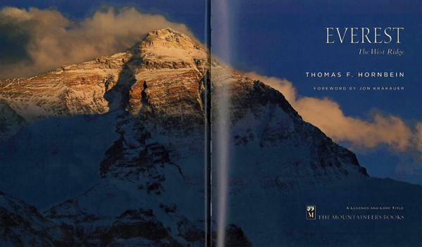
Everest | The West Ridge & the First Traverse May 22nd 1963


Today is the 56th anniversary of the first ascent of the West ridge of Everest and the first traverse of the mountain.

On 21st May 1963 at six o’clock in the evening two climbers reached 27,205 feet (8300 metres) to set up Camp 5W on the west ridge of Everest. Tom Horbein a US anesthesiologist then 32 years old and Willi Unsoeld , a mountain guide then 36 years of age were poised for the final push to the summit of Everest by a new route.

It had not been easy for these two men. The 1963 American Everest Expedition led by Norman Dyhrenfurth had squarely set its sights on a first American ascent by the South Col route. On May 1st 1963, Jim Whittaker accompanied by Sherpa Nawang Gombu, Tenzing’s nephew, made the first American ascent to become the fifth and six men to stand of the summit after the British in 1953 and Swiss in 1954.

Photo Courtesy - outsideonline.com
But Horbein and Unsoeld had other ideas. Working doggedly with the meager resources including limited oxygen the duo set up camps on the virgin west ridge route.

On the day of their summit climb, Barry Bishop, a National Geographic photographer, and Lute Jerstad were also attempting the summit by the South Col route. Bishop and Jerstad reached the summit around 4 pm but did not find any evidence of the west ridge team who were still two hours below the top.

Horbein on the West Ridge- Photo Courtesy Willi Unsoeld
The West ridge pair  reached the summit at 6.15 pm on 22nd May 1963 and became the 11th and 12th men to climb Everest and the fifth and sixth of their expedition. But in the context of the history of Everest it was an enormous “first”:  a climb by the West Ridge for the first time and more was to follow.  They had been climbing for more than eleven hours since dawn.  They saw the boot prints of Whittaker and Gombu and fresh prints which they knew must be of Bishop and Jerstad.

Maynard Miller and Jimmy Roberts at Advance Base (around 23,500 feet) below had scanned the heights throughout the day and kept the radio open. Around 7 pm when it was almost dark and anxiety had risen, Willi Unsoeld’s voice came through the radio. They had just summitted Everest he said and were descending by the south east ridge in the dark on a route known to neither.


“Roger, Roger” Maynad called back through the crackle and wind.
  And then he heard Willi’s voice again faint and indistinct reciting:
“…. I have promises to keep,
And miles to go before we sleep,
And miles to go before we sleep….”

The “promises” were to Willi’s wife Joelene that Everest would be his last big mountain.

The west ridgers left the summit around two hours behind the south col team. With a flickering flashlight whose batteries were fast waning, the two climbers descended, following the boot prints and ice axe marks of Jerstad and Bishop. But soon the last light faded from the sky and night descended on the slopes of Everest. The climbers reduced the 150 feet rope into half so that they could remain closer to each other.

Jerstad and Bishop’s descent of the south east ridge earlier was also not without drama. The seventy mile gusts were dragging the climbers  towards the edge of the ridge and in Bishop’s words “ A section of the cornice at my chest gave way and I had a sudden hair raising view of the Kangshung glacier  10,000 feet below”.  Bishop unroped himself and managed to return to the trail.

Suddenly they began to hear voices in the wilderness “Helloo, Helloo” and thought it was a rescue party from Camp VI coming up in searching for them.  Then they realized that the voices were from above. The West ridge climbers had descended in record time and caught up with the South Col team!

The four climbers then descended together down the south east ridge. The torch which Unsoeld had finally gave way and in the glimmer of starlight the climbers stumbled down. Finally at 12.30 midnight it was not possible to continue any further and the four Everesters sat down for what would be the highest bivouac at that time.

In 1953 Herman Buhl on his descent from Nanga Parbat and in 1955 Walter Bonatti and his porter had also spent the night at around 26,000 feet on K2 and survived though not without loss.

But the bivouac of the Americans was around 28,000 feet. However, luck was on their side. It was one night in fifty that the jet stream winds were silent on Everest!

 In Everest- The West Ridge, Horbein wrote:
 "The night was overpoweringly empty. Stars shed cold, unshimmering light. The heat lightning dancing along the plains spoke of a world of warmth and flatness. The black silhouette of Lhotse lurked half-sensed, half-seen, still below. Only the ridge we were on rose higher, disappearing into the night, a last lonely outpost of the world."

Climbers on the West Ridge of Everest Photo:
Barry Bishop from Everest The West Ridge
Amazingly, despite all odds the climbers survived to greet the icy dawn.  National Geographic photographer Barry Bishop writes that it was one of finest mornings he had ever seen  but he  and his camera was too frozen to take a single photograph.

But the bivouac took a heavy toll. Unsoeld lost nine toes to frostbite and Bishop six. Jerstad and Horbein were extremely lucky to get away unscathed.

Since the first West Ridge climb in 1963, there have been about sixty attempts on the route with about half a dozen successful climbs including the West Ridge direct. The number of deaths and the number of summiteers on this route have been about the same making it one of the hardest routes on Everest.

In 2012  two teams from the USA  including crack climbers like Conrad Anker, Cory Richards, Jake Norton and David Morton  attempted the west ridge to commemorate the 1963 expedition. Unfavourable conditions forced both teams to give up the west ridge route.

In 1979 Unsoeld died on an avalanche on Mount Rainier - one of the peaks he used to guide. Horbein recollects that Unsoeld and he spoke each year on May 22nd, the anniversary of their west ridge climb. After Unsoeld’s death Horbein speaks to his widow Jolene on that day.

In the end, expedition leader Norman Dyhrenfurth, though pushing for the South Col ascent gave the west ridge team full credit. Dyhrenfurth said “For years it had been the dream of mountaineers to do a major Himalayan traverse. We were particularly happy and proud that this was not only the first Himalayan traverse but that it was on Everest.”

Friday, April 12, 2019

Three Passes of Everest Trek

The top of the Rhenjo La pass - one of the three passes crossed on this trek 
The trek across the three passes in the Everest region the Kongma la, Cho la and Rhenjo la has become quite popular of late owing to the better infrastructure in terms of lodges and facilities below the passes. Having said that it can be quite an ardous trek as all the passes are well over 5000 metres in altitude and good acclimatisation is a key to this trek.

For the complete photo essay  please do visit http://old.outlooktraveller.com/printarticle.aspx?285825


THE INFORMATION


GETTING THERE
There are a number of flights every morning from Kathmandu to the mountain airstrip of Lukla, the start of the trek. Tara Airways (www.yetiairways.com), Summit Air and Sita Air  all run the maximum number of flights to Lukla. The fare is presently USD 360 for foreigners and USD 270 return for Indian citizens.  In bad weather, Lukla flights get disrupted and the only option then is to take a seat on a helicopter (www.simrikair.com.np) back to Kathmandu (USD 450-500 one way). 
Update - Due to the Kathmandu airport being closed from April 1 2019 from 10 pm to 8 am daily Lukla flights are going from Manthali airport Ramechap. It takes 4-5 hours to drive from Kathmandu to Manthali. There are basic hotels in Manthali where you can spend a night. 

PREPARATIONS
The best season for the trek is April to Mid May and again from Mid October to early December. Though the passes are crossed later in the season as well, there is always the possibility of heavy snowfall closing down the route. If there is heavy snow during the trek, the passes are best avoided and the route can be done by following the valleys instead. We trekked in late April and were rewarded with a riot of mountain flowers including the rhododendron in the valleys capped by the soaring peaks. Bottled mineral water is available but very expensive, so please carry iodine/chlorine water purification tablets. You need to carry enough water with you at least one litre at a time and this can be refilled at the lodges. Trekking poles are a must as there are three passes to cross with slippery trails and scree.  The tea houses (lodges) will provide beds and quilts but a warm three season plus sleeping bag is essential. The trek crosses 5400 metres so do not underestimate the effects of the altitude or the walk. This is a difficult trek and you need to be fit and properly acclimatized to succeed.

Saturday, September 22, 2018

Everest 2018 | Photographs


The autumn treks in the Everest region will soon be underway and October and November 2018 promises to be a very busy season. The lure of Everest is difficult to resist and here are some photographs of the mountain from different locations over the years:


Moorise near Kala Pattar

Everest and the Lhotse - Nuptse wall from Thyanboche

Above the fifth lake of Gokyo

Approaching Kala Pattar

Sunset view Gokyo Ri 
For our treks in Nepal do visit www.southcol.com

Saturday, May 12, 2018

Manaslu/Tsum Valley Updates May 5 2018


A South Col team trekked Manaslu and Tsum valley in April - May 2018. Some updates from this trek which are useful for fellow trekkers in the next season:

Trail Updates
Due to the construction of a new road all the way from Soti Khola up the Tsum Valley to Tibet the existing trails between Lapu Besi and Tatopani which is the approach for both the Manaslu and Tsum Valley treks are in a precarious condition.

The existing road upto Soti Khola from Arughat which now has small buses plying on it has been extended to Lapubesi. However private vehicles have permission to drive only to Hawa Danda which is 30 minutes walk from Lapubesi.

From Lapubesi due to the road construction on the old trail, a newer trail has been made along the river. However due to the blasting of rocks above, parts of this newer trail is only rocks and boulders and walking on this trail is difficult but compared to the trail conditions further up it can somehow be managed.
Short section of trail around 2 minutes between Maccha Khola and Lapubesi
From Machha Khola to Khorlabesi the old trail along the river is totally devastated. The road building along parts of this trail is on in full swing and there is a possibility of rock fall rendering this trail unsafe. We did not find most locals, trekkers and mule caravans using this old trail. There is now a new trail across the river which climbs around 400 metres from Maccha Khola reaches a high point above Khorla Besi and then plummets around 300 metres to the valley to reach Khorla Besi in 2.5 to 3.5 hours depending on your walking speed. This is against the normal 1 hour 15 min which it used to take between Machha Khola and Khorla Besi on the old trail.  It is likely that this new trail will continue to be used even for the upcoming October- November season as the monsoon rains will wreak more havoc on the road construction during June to September 2018.

Road timings Khorlabesi to Tatopani
From Khorlabesi to Tatopani the road construction is taking place on the old trail and the Nepal Army only allows the trail to open between 11 am and 12 noon and again between 5 pm in the evening and 7 am in the morning.  Even when the trail is open due to blasting of rocks and debris all over the trail it is difficult to cross many sections where now no trail exists.


Logistically the longer route between Machha Khola and Khorlabesi and the trail open timings between Khorlabasi and Tatopani need to be considered when drawing up an itinerary for this trek. It is now possible to reach Soti Khola on the same day from Kathmandu and stay the night in Soti Khola. If you are in a private vehicle you can drive past Soti Khola to Hawa Danda and reach Lapubesi on the same day from Kathmandu which is what we did. The Hotel Laxmi is a good stop in Lapubesi far better than the lodges of Soti Khola. From Lapubesi it is possible to reach Khorlabesi by around 2 pm but the trail only opens at 5 pm so either you stop in Khorlabesi for the night or hit Tatopani around 6 pm where there are very basic lodges. Continuing on to Dobhan, where there are better lodges, in the dark is not a very good option.
If you are walking from Soti Khola then Khorlabesi on the first day is a hard walk considering the additional climb of 400 metres up and 300 metres down which would be quite exhausting in the mid day sun at this low altitude.
This is the current trail situation – it is possible that timings and routes will change for the autumn season 2018 so try to get local information from the trekking companies in Kathmandu and the lodges en route before planning the trek itinerary.

Mules on the trail


I was quite amazed to see the increase in mule traffic on this trail since my last visit a year ago. The only reason I could find for this increased traffic is the building of new lodges all along the trail and the building materials being carried up by the mules. We also found many houses which had been damaged by the earthquake being rebuilt and this could also be one of the reasons. I estimated around 300 to 400 mules on one day between Tatopani and Jagat and it would be the same or nearabouts on most days. The mules are a constant danger to trekkers – arriving unannounced around a cliff and often at a fast pace. They don’t usually stop so you have to wedge yourself between a rock and the trail to somehow avoid them.  On narrow sections this if often quite difficult. One of our trekkers was kicked by a mule as there was no space for her to get away from the trail.  Mule jams are also not uncommon especially across bridges where sometimes fifty to sixty mules crossing over can cause long delays.  You may need to add forty five minutes to an hour to your trekking day to consider these delays.

Trekking Numbers


We found fewer trekkers in the region this spring compared to the earlier year. Our findings were borne out at the Manaslu Conservation Area Project in Jagat where the officer  in charge informed us that only 2000 or so trekkers had come in so far in 2018 ( upto May 2nd 2018). This is a far cry from the Everest and Annapurna treks where 20,000 to 30,000 trekkers visit each season. One of the reasons for this could well be the poor road condition Dhading Besi/Gorkha to Arughat coupled with this new road building exercise along the trail.

For detailed information on the Manaslu Circuit Trek route do  visit  http://sujoyrdas.blogspot.in/2017/07/manaslu-circuit-part-i-route-and-timings.html

Wednesday, April 18, 2018

The Cost of an Everest Base Camp Trek


There has recently been  a flurry of articles on the internet and also in print medium on the cost of climbing Mount Everest as part of a guided group with full support.

But, more often that not, I am asked the question" how much does it cost to trek to Everest Base Camp?"

So this post attempts to answer that question given the many options available! I have assumed that the trekker will fly in and out of Lukla as that is the route majority of trekkers would take. In case you walk in and out of Jiri you would save your air fare but spend another ten days or so on lodge accommodation, food and porters/guides!

1 Luxury Trek with  an  International Trekking Company
These treks are usually run by leading  international companies and provide you with all the frills:
  • Five star accommodation in Kathmandu
  • Best lodges in Namche often with plush attached toilets, abundant hot showers for free and heated electric blankets!
  • Best possible lodges on the trail many with attached bathrooms and nice sunny rooms
  •  Knowledgeable English speaking guides from overseas, many of whom have done the Everest route many times and once in a while you may get an Everest summiteer guiding you!
  • Special food, snacks, freshly ground coffee from overseas to supplement the lodge meals - once in Gokyo I found that cognac was also being served after dinner!
  • Boiled or filtered water would be provided every day to the group!
The cost of one of these treks could range between US $ 3000 to 4000 depending on the facilities!

Kwangde from the airstrip of Shyanboche

2 Trek with Local Nepal Trekking Company
These treks are usually run by Kathmandu based trekking companies. They could be fixed departure treks where you sign on to an existing trek or they could be customised for your group only provided you have a decent number - four is usually acceptable.
You would usually get:
  • Three star hotels in Kathmandu usually located in Thamel.
  • Reasonable lodges on the route, some with attached bathrooms in Namche and Lukla usually.
  • A local Nepali guide who would lead the team along with the porters to carry your bags - he would speak some English!
  • Meals would be usually at the lodges and would be fixed in some manner. 
  • Flights in and out to Lukla, airport transfers, permits etc would all be covered.
The cost of one of these treks would be between US $ 1500 to 2500 depending on the company concerned!

3 Do it Yourself Trek hiring a Guide/Porter as you need
You could decide to do your own trek to EBC and work out your own cost as under:
  • Sagarmatha Permits and TIMS-  US $35 for foreigners and US $15 for SAARC citizens; TIMS US $20 for independent foreign trekkers and US $10 for SAARC citizens.
  • Flight to and fro Lukla return - US $356 for foreign passports holders and USD $212 for  Indian citizens presently.
  • Room at lodges - can vary from US $ 5 to 35 per night depending on where you stay - this excludes the top end lodges like Yeti Mountain Home, Summit Lodges etc. In Namche good lodges like Hotel Namche would charge between $25 to $35 for rooms with attached bathrooms, hot showers etc.
  • Food at lodges - You can budget US $ 25-30 per day on an average, This does not include cokes, beer, apple pies and yak steaks! It includes three good meals, tea, coffee, hot water etc.
  • Guide - the cost of a guide with his meals and stay included would be between US $ 25 to 30 per day. A guide would not carry your load.
  • Porters - The cost of a porter would be US $ 18 to 20 per day with meals and stay.
So if two trekkers are doing a fifteen day Kathmandu to Kathmandu trek with one guide and one porter and sharing an ordinary  room,  the cost should be around US $ 1300-1400 per head or so per person. For Indian/Nepali  trekkers you can budget US $ 1100-1200 per head. Hotels in Kathmandu are not covered in this cost. If you take the guide from Kathmandu then you have to add his Lukla return fare as well!

4 Do it Yourself Trek carrying your own Backpack
You could eliminate the cost of the guide/porter from No 3 above- for two persons it would be US $ 900-1000 per  person  and for  Indian/Nepali citizens US $ 800-900 per person due to the differential in the Lukla air fare.

View from Luza - Thamserku
5 Speciality Photography Treks and Workshops 
  • These treks to the Everest region are often conducted by companies who specialize in photography tours, treks and workshops. They are sometimes conducted by individual photographers who have vast experience in the Himalayas in general and Everest in particular. Like the luxury treks these treks are top end as they provide for fifteen days, the services of a dedicated top notch photographer on the trail who mentors and assists the team of trekkers. Other than the photography leader, the  team would have a Nepali guide and porters who would look after local logistics, loads, lodges, meals and other creature comforts for the team! The photography leader would know the best spots for photographs, the time of the day, off the beaten track locations, local colour, interaction with the local population, monastery interiors, night photography etc.
These photo treks would be around US $ 3000 to 4500 per person including hotels in Kathmandu on the way in and out and would include most of the luxuries of No 1 above maybe with the cognac left out!

So which of the options is for you?
------------------------------------------
South Col Expeditions runs treks and photo workshops in the Everest region every year personally led by Sujoy Das. Our next Everest trek is November 11th to 24th 2018.   For more details do visit www.southcol.com.

Monday, October 23, 2017

Annapurna Foothills Trek December 23-30 2017


The Annapurna foothills provide tremendous trekking with delightful trails connecting villages and ridge tops. This picturesque trek winds through enchanting villages with ochre thatched houses, terraced rice fields and rhododendron forests, which are spectacular in the spring when whole hillsides are cloaked in colourful flowers. The ridge top village of Ghandrung provides one of the finest viewpoints of the Annapurna Mountains with magnificent views of the four Annapurnas, and Machapuchare with its fishtail summit. It is a  good walk to the top of Poon Hill 3150 metres with a dress circle view over the Annapurnas and Dhaulagiri as well. 
Who should do this trek?

  • Suitability: A good choice for most  walkers, reasonable level of fitness required.
  • Walking times: average 5 to 7 hours walking per day 
  • Altitude: up to 3150m
  • Terrain: for most of time following well-travelled trails, there will be daily ascent and descent on steps which are part of any Nepal trek.
  •  Remoteness: usually not too remote and often there is a reasonable level of infrastructure such as lodge accommodation and cell/ mobile phone reception and wifi reception every day at the lodges.

Trek Leader: Sujoy Das


ITINERARY
Day 01   Kathmandu to Pokhara  by early morning flight and the drive to Kande and trek to Tolka  
We fly into to Pokhara 30 min and then drive for 75 min to Kande.   From Kande we climb to Austrian camp in around two hours and then walk to Pothana in half an hour for lunchh. . From Pothana the trail climbs uphill to Deorali from where it makes a steep descent to Bichok. From Bichok it is a level walk to Tolka where we stop for the night.  
Day 02 Trek to Ghandrung  (1950 metres) 5-6 hours walking 
The large village of Ghandrung can be seen directly across the valley from Landrung.  It is a n hours walk in the morning from Tolka to Landrung. This is a short walking day allowing time to explore Landrung and Ghandrung. From Landrung we descend to the Modi Khola River and cross on a large suspension bridge. The ascent through terraced fields to the picturesque town takes around 2 hours. Ghandrung is largely a Gurung town and is the headquarters of the Annapurna Conservation Area Project (ACAP). Many of the lodges here have the more environmentally friendly features that ACAP encourages such as back boilers, solar panels, etc.  The views of the Annapurna Mountains and Machapuchare from here are stunning.
Day 03 Trek to Tadapani (2595 metres) 4 hours walking 
From Ghandrung the trail climbs gently to the village of Baisi Kharka where we stop for a cup of tea and then make the final ascent to Tadapani. Overnight at a lodge in Tadapani. The views of the Annapurna Mountains and Machapuchare from here are stunningly close.  
Day 04 Trek to Ghorepani  (2750 metres) 6-7 hours walking 
The trek from Tadapani to Ghorepani involves a number of ups and downs! We pass through the villages of Banthanti and Deorali before reaching Ghorepani. Overnight at a lodge at Ghorepani.  
Day 05  Ghorepani to Tirekedhunga/Hille  (1515m) -5 to 6  hours walking We visit Poon Hill at sunrise to watch the views over Annapurna and Dhaulagiri. After breakfast we begin our walk down to Ulleri (1960m)  We stop for lunch at Ulleri and then start descending the 3000 steps to Tirkedhunga ( take it easy!). Night at Tirkedhunga or the neighbouring village Hille.


Day 06   Tirekedhunga/Hille to Birethanti to Pokhara to Kathmandu (885 metres)  2.5 hours  walking 
We leave early for Birethanti around 7 am. We gte there by 9 am and then cross the river to Nayapul. We drive from Nayapul to Pokhara 90 min and are in Pokhara for lunch. After an early lunch we go to the airport and board the afternoon 3 pm flight to Kathmandu. Night at a hotel in Kathmandu. 
Day 07   Kathmandu to home destination by flight 


COSTS

 The cost of this trek is  USD 900 for foreign passports and INR Rs 46,500  for Indian  citizens. Meals not included. Please budget an additional US $ 200-250 for meals, battery charging in lodges, wifi charges, hot water in flasks etc.  Exclusions apply. 
  • Costs include:
  • Two internal flights Kathmandu to Pokhara return. 
  • Micro bus from Kathmandu to Pokhara
  • ACAP national park permit and TIMS permit for trekking in the Annapurna region
  • Travel from Pokhara to start of trek and back
  • One  night accomodation at Pokhara (Hotel Gurkha Haven) and   two nights  accomodation in Kathmandu on the way in and out  on twin sharing basis
  • All accommodation on the trek on twin sharing basis
  • Cost of porters/guides for the trek. Please note that porters will carry one duffel bag or backpack not exceeding 10 kgs in weight for each trekker comprising of personal items, clothing, sleeping bag etc.
  • Please budget an extra USD 25 per day for meals not included in the cost above
Costs not included:
  • Meals in Kathmandu and Pokhara and fooding on the trek is not included
  • Airport taxes at Kathmandu and Pokhara airports in case of flights
  • Desserts, drinks, and exotic items listed in the lodge menus are not included.
  • Alcohol, cold drinks (coca cola, sprite, beer), juices, ice cream etc on the trek and in Pokhara.
  • Client travel and medical insurance of any kind.
  • Emergency evacuation costs if needed.
  • Video camera fees in National Parks (where applicable).
  • Bottled drinks; boiled, filtered or bottled water; alcohol; snacks; tea/coffee;
  • Hot showers (Rs 200-300 per shower);
  • Personal clothing and equipment; sleeping bag; douvet/down/goretek jacket, medicines for personal use etc.
  • Air fare from home country to Nepal and back
  • Tips to porters/guides at the end of trek estimate at US $ 50 per person
For more details email sujoyrdas@gmail.com or call +919831054569.

Friday, April 28, 2017

Annapurna Base Camp Trek | Harini Chandra


Harini Chandra trekked the Annapurna Base Camp route with South Col Expeditions in April 2016. In this interesting and evocative post Harini describes her experiences on the ABC trek. This is an ideal post for first time trekkers wanting to find out what trekking in Nepal is all about!
 - Sujoy Das

Hike, Eat, Sleep, Repeat…By Harini Chandra

It’s been a year now since I went on the trek to Annapurna Base Camp, a unique, mind-blowing experience that I’ve been meaning to write about ever since. I’ve always thought of writer’s block as a problem of mind over matter—until, of course, I sat down to pen my thoughts on this trip and couldn’t proceed beyond two paragraphs! This time, though, I’m more determined to get this all out—a fitting tribute, hopefully, to a memorable trip.

Some time around July 2015, I decided I wanted to get away for some much-needed “me time”—away from work and family—to do something I really enjoy. A trip to Darjeeling around the time, followed by the movie "Everest," sealed the decision in my unsettled mind: I wanted to do a trek. After some research, I settled on the Annapurna Base Camp trek, which would be challenging enough given my appalling fitness levels, but at the same time, not so challenging that it seemed crazy and out of reach. I had fond memories of a trek I’d done way back in college to the Kuari pass, which served as inspiration as I began my journey of getting fit physically and, this time, toughening up mentally (it would be the first time I’d be away from my younger son for so long).

After many months, which actually flew by much quicker than I’d expected, I landed in Kathmandu with my best friend, Ranjani, who had decided, to my delight, to join me. We felt excited--mostly in an I-can’t-believe-we’re-actually-doing-this way--as we spent our day buying last-minute supplies: hiking poles, iodine tablets, sun hats, head lamps, and other items suggested by our organizer Sujoy.

Then came the challenge of packing our duffel bag. For those of you who’ve never been trekking before, this is the point at which you realize two things: first, you have way more in your suitcase than you can ever imagine taking with you; and second, every inch of space counts! What to do? Cram in that extra packet of nuts, or sneak in that one additional pair of tracks that Sujoy specifically told us not to bother carrying? We called it a night early after an enjoyable dinner at a delightful outdoor restaurant, listening to live Nepali music and stories from earlier treks of Sujoy, and slowly beginning to wonder in what state we would return from our own expedition.

Day 1: Of hailstorms and expanding lungs
Ever since the earthquake of 2015, Kathmandu has been terribly dusty, with all the construction work going on, and a layer of smog constantly hung over the city. This always resulted in some uncertainty in flight schedules, and we had chosen to fly from Kathmandu to Pokhara, a journey that can also be made by road over 6-7 hours. Although the road journey is quite picturesque and enjoyable, we had chosen to fly to save ourselves that one additional day of travel. Thankfully, our flights were perfectly on time (contrary to the worrying newspaper article we saw in the paper that morning) and we reached Kande, our trailhead, a one-hour minibus ride from Pokhara, as planned.


The worrying newspaper article we saw before we flew to Pokhara

We began our adventure from Kande, climbing our way up hill (oh wait, I meant huffing my way uphill!) for the large part to Pothana, our lunch stop. We stopped by a beautiful Australian camp for tea, where the weather gods decided to give us a taste of their fickle mindedness, sending heavy, dark clouds our way. Luckily, we made it to our lunch stop just before the hail started pelting down (that’s right--hail on our very first day there). After a hot lunch of dal-bhaat (the traditional Nepali meal, consisting of rice, dal, veggies, pickle, and papad), we all scrambled to our duffel bags for the extra layers of clothing that had been packed deeply away, in the assumption that they wouldn’t be needed until Day 3 or 4, in the colder, higher altitudes. After making sneaky visits into the kitchen to warm up our frozen hands, we stepped outdoors to catch our first spectacular glimpses of the mountains—the sight that would egg us on through our weariness.


First sights of the glorious Annapurna
Just as Indian bowlers know their home pitches, the Nepalese have a way of looking at the clouds and knowing which way the weather will swing. So when our guide, Shyam, gave us the green signal, we headed out again towards our first camp for that night at Tolka. It was a lovely walk, mostly downhill or flat, and barring a couple of falls due to the slippery rocks and stones, we made it to Tolka just before the light started to fade.

Stones piled up as a symbol of good luck        


  End of Day 1 at Tolka

We were pleasantly surprised by the cozy and convenient lodging facilities throughout our trip—comfortable rooms with enough blankets to keep us warm, more-than-decent bathroom facilities, a centrally heated dining area where most people spent their time after the day of trekking (I’ll come back to these dining areas in a bit), and great food options. Honestly, one can’t ask for more when in the mountains. But there was more! It came at a nominal cost (with the value of “nominal” increasing with altitude!) but was absolutely worth it: hot showers, WiFi, phone charging, and even washing machines at some of the lodges to give your clothes a quick spin! Clearly, we were trekking in style.

Day 2: The last time I ever felt my back
We woke up in Tolka to the sight of looming snow-capped mountains and realized that every morning was going to look like that for the next 10 days! Sure, the water would freeze our hands while we brushed our teeth, but those mountains made every bit of it worth it!

We set out after breakfast towards Chhomrong, which became one of our favorite villages by the end of our trip. The first two or three hours that day were rather peaceful, the walk being largely flat and partly downhill, with gorgeous views of the Annapurna South. We were in a cheery mood despite the blazing sun, chatting away and making friends with the extremely cute Nepali children along the way. Then, all of a sudden, we didn’t know what hit us; it just got steep! We climbed for over an hour and finally got to our lunch stop, Jhinu, where our guide (very reassuringly) told us after we gulped down our nimbupani (lemon juice) that we had at least another 3 hours of climbing post-lunch!

That day was easily one of the hardest uphill climbs. We’re not sure if it was because our bodies were still getting used to the climbing, or whether it really was that hard! We realized over the next couple of days that every day would have a downhill walk followed by an uphill one, since we were essentially crossing over from one mountain to another. So we would have to lose some elevation, get across either on a bridge or some sort of river crossing, and then ascend the next mountain (what joy!). We left Jhinu after lunch, still exhausted but wanting to get done for the day rather than relax too long there. After plodding on for another hour, we met another couple with their guide who pointed out that Chhomrong, our destination for that night, was within view. Our delight knew no bounds; we quickened our pace and made it to our lovely guesthouse in Chhomrong well in time for a hot evening shower, hot chai, and pakoras. Heck, we earned it that day!


Gorgeous views that egged us on                           


View from our guesthouse in Chhomrong

There was something very quaint and appealing about Chhomrong. It was a village full of steps, with colorful little shops and cafes lining the sides like banisters. We even tried cinnamon rolls and chocolate croissants at a German bakery on our way back--not the best we’ve had, but a refreshing change nonetheless! Although it got cold late in the evening, we could still sit outdoors and enjoy the stillness and silence of the mountains, something we could not do as we went higher up. We met an adorable couple from Munich who, despite our warnings, ordered and gave their stamp of approval to the pizza at that guesthouse!

Day 3: Through bamboo forests and rain-filled clouds
After breakfast at Chhomrong, we set out towards Dovan. Our bodies clearly felt better adjusted by this day, and the walking felt less strenuous. The downhill stretches, at times, felt hard on the knees, but by the time the pain actually started making its way into the mind, the terrain changed and it would be flat or inclined upwards. To be precise, there’s no flat terrain; it’s all “Nepali flat”—a term that amused us to begin with but grew on us so much that by the end of the trip, we were correcting our guide every time he said "flat." "Nepali flat" refers to a constant sequence of ups and downs, none of them too steep. We walked under overcast skies through the villages of Lower and Upper Sinua, followed by bamboo forests, to land up for lunch in a village called Bamboo.

As we got done with lunch, the heavy rain clouds again decided to shower their fury on us. We ended up staying put for a couple of hours after lunch, watching the steady inflow of drenched trekkers of various nationalities, listening to fun retro music, and waiting for the rain to abate. Once it had settled down to a drizzle, we made our way in single file through another forest, focussing on our every step through the slushy path, all our moods seemingly reflecting the somber and grey skies. We reached Dovan much earlier than we expected, gulped down some hot chocolate, and settled down in the warm dining hall for the rest of the evening, since the temperature outside had plummeted thanks to the non-stop rain.

                                                          Long and shaky bridges                                                             


After reaching Dovan under rain-filled skies

This might be a good time to talk about the dining halls, as our trekking days after Dovan got shorter because of the altitude (3200+ m) and we began spending more time in these halls. These halls are basically designed with tables and benches in the center for people to sit and eat, and the sides lined with inviting diwans, complete with mattresses and cushions thrown around. You are more than welcome to nap there after lunch! We came across so many interesting people in these dining areas: a teacher for autistic children from America, students of medicine from Germany, a delightful retired couple from America, a Nepali man attempting to summit in three days, an extremely well-travelled Frenchman who visited Nepal every year, and many others. It was always fun to strike up a conversation with these people, understand what brought them there, and of course, answer the many questions that they had about India: its new Prime Minister, the beaches in Goa, and of course, Rajnikant!


The dimly lit, cozy dining hall packed with trekkers

Days 4 & 5: Upward to MBC
While MBC does bring to mind certain offensive expletives in Hindi, I assure you, this MBC was truly majestic! From Dovan, we made our way further up, stopping for a night at Deorali and then proceeding to the Machhapuchhare Base Camp (around 3700 m). As the altitude got higher, we trekked only for 4-5 hours in the morning and had the rest of the day to acclimatize and get used to the thinning air. Dovan to Deorali was again a climb through forests; this time, rhododendron forests colored in beautiful reds and pinks. Our views of the Machhapuchhare peak, commonly also known as the Fish Tail peak, became more stunning with each passing day.

The hike from Deorali to MBC was another hard one, the trail punctuated with avalanche-prone areas that we darted across without looking up! The guide had advised us to leave early that morning, so that we could get across these areas before the sun got too high and started melting all the mountain snow, thereby increasing the chances of an avalanche. We therefore reached MBC well before lunch, giving us sufficient time to take in the jaw-dropping panoramic views and even get some clothes washed (in that order!). By the time we could get done with the washing and drying, the clouds had moved up all the way, completely blanking out our view. I had a mild headache by this point (presumably the altitude doing its thing), so we settled down in the dining hall for the rest of the day to relax and give our bodies enough rest before the final climb up the next day.

Day 6: Heave ho, and up we go!
After having pep talk Whatsapp calls with the family the previous night (a surreal experience in itself, given where we were), we woke up fresh and excited to head to the summit. The final climb up to ABC (around 4100 m) was more of a mind game than actual physical strain. It was only a short two-hour walk up through snowy slopes, powered by adrenaline and jaw-dropping views. With the oxygen thinning further, we made our way up slowly, huffing every few steps and pausing to take in our surroundings. We soon made it to the top, bundled in various emotions as we stopped to strike many crazy poses with the "Welcome to ABC" signboard.

After we got over that dreamlike sequence, we made our way up to the lodge to get their WiFi password and inform the folks back home. To our disappointment, their WiFiwasn’t working, and we had to make our peace with not being able to relay our achievement that day. We grabbed a hot drink and then stepped out near the campsite to see some glaciers and enjoy the feeling of being surrounded by nothing but mountains. As we sat there taking in everything in disbelief, we would hear a loud crack every now and again--the sound of an avalanche making its way down some mountain slope.

When we took another stroll after lunch, the clouds decided to close in around us, leaving even our guide perplexed for a while on the route back to our lodge. With the views disappearing, we made our way back to the cozy dining hall for the rest of the day, retiring early that night so that we could wake up in time for the glorious 5 am sunrise.

Made it!  


We couldn’t get enough of those views

Day 7: A palette in the sky
We woke up early the next morning and rushed outside to see the sky filled in hues of orange, purple, golden and blue. Now, it’s at this point where I must emphasize that absolutely no words or pictures will ever do justice to the real thing. I’m sure you’re thinking, "It’s just a sunrise, what’s the big deal?" But that sunrise was really something else, and I’m sure I’m going to run out of adjectives in my attempt to describe it. The grey-blue pre-dawn skies blended themselves gracefully with the orange and purple hues that the sun was beginning to throw out. Gradually, as though someone was running you through a shade card in a paint store, those oranges melted into multiple shades of yellow and gold, as those first rays started to make their way upon the snow-clad peaks. It was beyond stunning, and standing there, I’ll never forget the shiver I felt run down my spine--this time, not because of the cold, but because of how tiny one felt amidst these regal, imposing mountains. Any problems or challenges felt miniscule and insignificant, as I watched nature work her incredible magic with such ease. With a slightly heavy heart and clearer mind, we finally made our way in to get ready and head back down once the sun had come out in all its fiery splendor.
 

A paintbrush sweeps the sky

All good things must come to an end…
While I can easily go on about the rest of the trek with many more details, I realize that this post has become much longer than I imagined it to be. The journey down was again a test of mental strength, as we had planned a slightly longer way back down in order to cover Ghorepani and Poon Hill as well. Aches and pains started feeling more pronounced but again faded away as we were rewarded with more spectacular sights (something we didn’t think was possible!) as we caught a dress circle view of the Annapurna range from Poon Hill, with the royal Dhaulagiri adding another gem to the already studded crown. I must make a special mention at this point of the (in)famousUlleri steps that we encountered on our way back down on the final day. A series of 3,500-odd uneven stone steps between Ulleri and Tirkhedunga, these steps had me convinced that I would tear a ligament in my knees by the time I made it down. If you’re someone who already has knee trouble, then you should seriously consider and reconsider taking this route. But, as they say, all was well that ended well. We made it back in great shape and raring to go again!

For treks organised by South Col do visit http://www.southcol.com/treks-nepal/
LinkWithin

Related Posts Plugin for WordPress, Blogger...