Shang Sumdo to Stok Trek
If you are looking for a short trek in Ladakh and don't want the crowds of Markha then the four day route from Shang Sumdo to Stok village is extremely attractive. The route walks in the shadow of the Matho Kangri and Stok Kangri peaks with typical rolling grasslands, fast flowing rivers, wildlife and nomadic settlements of sheep and yak. The trek approach is close to Leh making this an ideal one week vacation.
July 29th 2019 Leh to Shang Sumdo by vehicle
We left Leh at around 9 am in a Tempo Traveller and headed to Hemis monastery . The weather had cleared up and it was bright summers day with temperatures around 27 Celsius. After seeing the monastery including the impressive Hemis museum we headed out to our camp site at Shang Sumdo around 15 km away. We reached Shang Sumdo at lunchtime and found our camp was ready for the night - tents neatly pitched in a clearing next to the road with the river running below. Our ponies were already at camp grazing contentedly on the lush grass. We had decided to take the first nights stop at Shang Sumdo to further aid acclimatisation and it was a good decision being another 250 metres above Leh. The group spent the day in the mellow afternoon sunshine reading, lazing around and sleeping. The trek would start tomorrow. Shang Sumdo used to be the pick up point for the end of the Markha Valley trek but with now the road being extended to Chogdo, Shang Sumdo has lost its importance and the Markha trek has been scaled down to five days only.
Leh 3450 metres Shang Sumdo 3700 metres 33 51 18 N 77 42 23 E
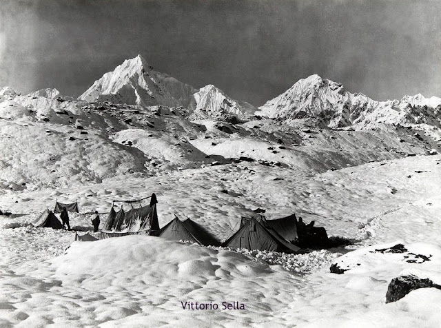
July 30th 2019 Shang Sumdo to Shang Phu
It was a brilliant clear summer morning when we left Shang Sumdo around 8-30am. The intitial two hours were on the motor able road - in an hour and about 3.5 km we reached a village with a fortress like monastery on top. The road then continued to climb steadily and in another hour crossed a stream and reached another small village with prayer wheels and chortens and fields full of green barley and yellow mustard seeds. It was a very pretty location. The road one ended and the trail crossed through some scrub and rubble before crossing the river on a wooden bridge. In about three hours there were two river crossings back to back in knee deep water with a dry swift current flowing downstream. These two crossings took us about an hour and we decided to have lunch around 12 30 pm - the altitude at the second river crossing at lunch was about 4100 metres 33 52 14 N and 77 38 12E. After this the trail follows a rocky bed of the river continuing to climb gently until it reached a small pass with prayer flags and a small temple on the right of the trail. From here it continued to meander following the river on the left and reached a clearing with a few houses and a tea tent which is Shang Phu.
S
hang Sumdo 3700 metres Shang Phu 4350 metres 33 52 51 N 77 36 38E
6 hours 13 km 3 river crossings - river crossing change depending on the season and the volume of water time of day etc.
July 31 Shang Phu to Shang La 4940m and down to Gangpoche
We left Shang Phu around 8 30 am and followed the trail gently up the valley. We spotted a large herd of yaks and dzopkios grazing on the luxuriant vegetation . Due to the heavy snowfall and rain Ladakh was looking much greener than usual. We crested the top of the pass in around 3.5 hours - there was an impressive spectacle of peaks on all sides. We dropped down from the pass in around 20 minutes and stopped for lunch in a grassy meadow. After lunch we continued down the valley - there were some river crossings which we did not have to take off our shoes and wade through the water. In about two hours from lunch we reached a grazing station which had many hundred sheep and goats. From here the trail started combing again and reached another small pass - from here there were three more river crossings until we came to a ridge from where our camp could be seen far below - it is another one hour to the camp from here. This is a long day so to complete it by say 5 pm an early start is advisable by 7.30 am if possible.
Shang Phu 4350 metres Shang La pass 4940 metres Gangpoche 4434 m 33 57 6 N 77 32 50 E
19 km Shang Phu to Shang La 3 to 3.5 hours Shang La to sheep grazing station 3 hours sheep grazing station to final ridge where Gangpoche is visible 2.5 hours final ridge to Gangpoche camp site 1 hour - five river crossings which also cause delays.
August 1 Gangpoche to Matho La to Mankarmo
We left Gangpoche at 8 10 am and within 10 minutes came to a river crossing where we had to wade through the water - we walked gently up the valley for another 45 minutes and then came to another river crossing. From here the path started climbing steadily across a wide valley towards the pass. In about an hour we reached around 4730 metres at the foot of a short climb which then joined a trail which skirted the hillside and finally reached the pass in around two hours or so from the last river crossing. The views from Matho La were excellent with Matho Golep and StokmKangri visible . The walk down from the Matho La was a steep descend of an out 150 metres before the path levelled out and followed the river down the valley - the trail kept losing altitude for about 90 minutes when we saw the camp site below us at Mankarmo - it was still another 30 minutes away crossing another stream - Stok Kangri was visible at the Mankarmo camp.
Gangpoche to Matho La 4957 metres 33 59 0 N 77 31 40 E 3 hrs to 3.5 hours Matho La to Mankarmo 4336 metres 34 0 8 N 77 29 59 E - 2.5 to 3 hours
Three river crossings 13.1 km distance.
August 2 Mankarmo to Stok village
It had drizzled during the night and the morning was cloudy with the Stok range also partially in clouds. We left around 8 15 am and within 20 minutes crossed a stream near the camp site of Chorten Chen. The trail then entered a beautiful rock canyon reminiscent of the film Mackennas Gold with stunning jagged rock spires and the river running through the canyon. The path carried on for an hour and finally left the canyon and climbed gently to a small pass in about two hours. The trail then went down for a while before entering an area of scrub jungle with bushes and the river running through - two stream crossings later we entered the final descent to Stok. It took around 45 minutes to walk on the rocky river bed and two crossings before we left the river and joined the upper trail. From this point it is around 45 minutes to the tea tents of Stok village. From Stok a 45 minute drive returned us to Leh
Mankarmo to Stok 4 hours to 4.5 hours 13.5 km Stok 39 59 59 N 77 30 00 E 3650 metres
For more information on our treks and photo tours please do visit
www.southcol.com