Tuesday, December 24, 2019

Kangchenjunga North Base Camp Trek Pangpema | Route and Timings Part II


Jannu and Sobidonge at sunset from above Kangbachen
A South Col team trekked to Kangchenjunga North Base Camp Pangpema in November 2019.
For details of the first part of our journey do visit  https://sujoyrdas.blogspot.com/2019/12/kangchenjung-north-base-camp-pangpema.html
This is the second and final part.

November 16 2019 Ghunsa to Kangbachen 11.5 km
We left Ghunsa at 7.30 am on a cold morning with the temperatures well below zero Celsius. Ghunsa must be one of the coldest places in the Himalaya with an altitude of only 3415 metres primarily due to the limited sunshine hours just five and a half hours in November. The trail travelled north past the hospital and in around 45 minutes reached a log bench with prayer flags.  For most of the way the trail meandered through rhododendron forests which would be a riot of flowers in the spring season April - May. It then dropped to a landslide section in 15 minutes and then skirted the river. Looking up due east in about an hour and a half we could see the peak of Khabur above us. The trail then crossed a second landslide section in about 2 hours with a log bridge across a stream.

Friday, December 13, 2019

Kangchenjunga North Base Camp Pangpema Trek | Route and Timings Part I


A South Col Team trekked the North Pangpema Base Camp of Kangchenjunga in November 2019. The details of the trek with day wise itinerary and timings are below.

HIGHLIGHTS
  • The start of both the north base camp trek and south base camp trek had rough jeepable roads for fair weather use. For our detailed post of these roads do visit  http://sujoyrdas.blogspot.com/2019/12/kangchenjunga-trek-nepal-north-and.html
  • Lodges are available on the trek but these are basic below Ghunsa and also have few beds. In case you are a large group (8-10 persons) during season time April and October  you may be better off camping. Above Ghunsa the quality of the lodges improve dramatically and is some of them you can get attached toilets. There are also many more lodges.
  • Phone connectivity is there in some of the locations – only Nepal Telecom not Ncell.
  • There is no wifi available on the route excepting at Ghunsa Hospital.
  • The trekking numbers are also  low – from the Kangchenjunga Conservation Area Project records for 2019 I found that the spring season March to May 2019 had 202 trekkers while the autumn season September until 20th November 2019 had 634 trekkers out of which October alone had 407 trekkers. In comparison the Everest route has around 45,000-50,000 trekkers in a year!
  • The approach from Kathmandu is usually through Bhadrapur airport a 45 min flight and then a long drive from Bhadrapur to Taplejung. There is an airport at Suketar but the thrice a week Nepal Airlines flight is not very regular and is often cancelled.
  • There has been a lot of changes in the routes mentioned in the guide books some due to landslides and some new trails being developed and the guide books need updation e.g. Lelep often mentioned as a night stop is not required to be visited any more there is a direct trail now to Sekathum so do not follow the guide books blindly.

Wednesday, December 4, 2019

Kangchenjunga Trek Nepal | North and South | Road Construction

The Kangchenjunga group including Jannnu on the left and Kabru in front seen from a ridge above Ilam on the drive to Taplejung
A South Col team recently did the Kangchenjunga trek in Nepal in November 2019. A detailed day by day schedule and route will follow on this blog but in this post we deal with the roads now being used  on the approach to the Kangchenjunga trek.

We found that dirt track roads suitable for four wheel drive vehicles have been built on the approach to both treks north and south. These roads  are fair weather - hence it is doubtful if during heavy rain in the monsoon months they would be clear for traffic. However, we were informed by our jeep drivers that from middle October to middle May these roads are operating and can be used by trekkers to shorten their treks by 2-3 days. The journey, of course, like most Nepal dirt track roads is bone rattling but it does shorten 2 days walking into a four hour jeep journey.


Sunday, November 24, 2019

Ladakh Summer 2019


South Col Expeditions did two treks in Ladakh this summer in the Shang Sumdo to Rumbak region.
For detailed itineraies and route planning please do visit
http://sujoyrdas.blogspot.com/2019/09/ladakh-shang-sumdo-to-rumbak-trek.html

http://sujoyrdas.blogspot.com/2019/08/ladakh-shang-sumdo-to-stok-across-shang.html

 Here are some photos from our treks.


For more details on our treks and photo workshops do visit www.southcol.com

For more photos do visit www.sujoydas.com

Thursday, November 14, 2019

Short 3-5 day Treks in the Indian Himalaya


Stok Kangri range from the Delhi to Leh flight
Rumtse to Tso Kar  / Ladakh  4 days
The popular trek crosses some high passes and then comes to Tso Kar Lake from where there is a motorable road to Leh. It is also possible to extend this trek further to Tso Moriri by adding three days to the trek. The route is Rumtse 4325m - Kyamar 4055m- Tisaling 4215m- Ponganagu 4500m-Tso Kar. The best season for this trek is July to August. You should acclimatise in Leh for two days before starting out and you need to carry full camping gear, tents and food.

The shores of Tso Kar lake, Ladakh
Indrahar Pass  / Himachal 5 days
This trek starts from Mcleodganj crosses the Indrahar Pass 4300 metres and then ends at Machetar which is a four hour drive from Chamba. The route is Mcleodganj 1650m-Triund 3000m- Lahesh Cave 3600m- Indrahar Pass 4300m- Laka Got 3850m- Chata Kuarsi 2200m-Machetar 1950m. The best season would be April-May and again September to November. You need to carry your own camping gear, tent and food.


Rupin Valley Himachal  5 days
The scenic Rupin valley is a very under trekked area which is  a pity as it offers a lot in terms of fast flowing rivers, bird life, mountains and lush forests.  The route is Netwar 1350m- Sewa 2025m- Jakhu 2600m- Camp below Rupin Pass 3500m- Rupin Pass 45400m- Kanda 3425m- Sangla 2675m. The best season would be April-May and again September to November. You should carry camping gear and food.


 Tunganath and Chandrashila / Uttarakhand  3 days
This is probably the shortest and most popular of all the easy treks in the Garhwal but with a great view from the top. The route would be Ukhimath 1300m - Deoria Tal 2100m- Chopta 2900m- visit Tunganath 3685m and Chandrashila 3900m- Dugalbitta 2347m.

Late afternoon Sandakphu - Jannu and Kangchenjunga
Sandakphu West Bengal  4 days
Though a jeepable road goes to Sandakphu it still remains a popular trek especially with first timers. It is possible to combine this with Phalut and make it a seven day trip. There are different route options but the most popular one is Manebanjan- Tumling-Jaubari-Gairibash-Kalapokhri-Bikebhanjan-Sandakphu-Rimbick.  This is one of the few locations which has views of four of the five highest peaks in the world – Everest, Lhotse, Makalu and Kangchenjunga. . The best time would be March to May and again October to December. You can stay in the home stays/bungalows on the way.

Shang Sumdo to Stok Village Ladakh  4 days
This trail crosses two 4950 metres passes before descending into Stok village. The route is Leh-Shang Sumdo- Shang Phu- Gangpoche-Mankarmo-Stok. It walks in the shadow of Stok Kangri and the other peaks of the range like Golep Kangri, Matho Kangri, Pyramid etc. A good season is July to September but there may be many stream crossings in July - September would be better if you want to avoid the crossings. A detailed itinerary is here  http://sujoyrdas.blogspot.com/2019/08/ladakh-shang-sumdo-to-stok-across-shang.html

For more information on trekking in the Himalaya do visit www.southcol.com

For my photographs on the Himalaya do visit www.sujoydas.com

Monday, November 4, 2019

Everest Reflections on the Solukhumbu | Photos Book Launch Kolkata


The book launch of Everest Reflections on the Solukhumbu was held at The Harrington Street Arts Centre on October 31st 2019.

Everest Reflections on the Solukhumbu, launched to celebrate the centenary of the birth of Sir Edmund Hillary and dedicated to the sherpas reveals the historical influences, hidden seasons and current pressures in the land of Everest. Photographer Sujoy Das and writer Lisa Choegyal have collaborated in their second volume, this time capturing the essence of the majestic scenery and reality of daily life in the Solukhumbu in the shadow of Mt. Everest. A foreword by leading mountaineer Sir Chris Bonington, preface by cultural scholar Dr Lhakpa Norbu Sherpa and drawings by artist Paula Sengupta adds depth to this unusual book about a familiar destination.
In the words of Sir Chris Bonington in his Foreword “This is not just one more book about Everest, but a special celebration of the haunting beauty of Solukhumbu and its people. Civilisation depends on the health of our high places, and I wish my Sherpa friends all the best with successfully navigating their future course.”
Sujoy Das, founder of South Col Expeditions which runs treks and photo workshops in the Himalaya www.southcol.com has spent more than two decades in the Everest region and is the co-author and photographer of a number of books including Nepal Himalaya A Journey Through Time, Sikkim A Travellers Guide and Lonely Planet Nepal for the Indian Traveller.
British-born Lisa Choegyal has made Kathmandu her home since 1974, deeply involved with Nepal tourism and conservation. Author and editor of Nepal Himalaya A Journey Through Time, Kathmandu Valley Style, The Nepal Scene Chronicles of Elizabeth Hawley and Offerings from Nepal, she produced the South Asian Insight Guides series, and contributes a fortnightly column to the Nepali Times.
The book is available on line at www.amazon.comwww.vajrabookshop.comwww.amazon.in

Some photos and videos from the launch:


Thursday, October 24, 2019

Everest Reflections on the Solukhumbu | Book Launch Kolkata


The third book launch of Everest Reflections on the Solukhumbu will be held in Kolkata on October 31st 2019 - address in the invite. All are welcome.
Everest Reflections on the Solukhumbu, launched to celebrate the centenary of the birth of Sir Edmund Hillary and dedicated to the sherpas reveals the historical influences, hidden seasons and current pressures in the land of Everest. Photographer Sujoy Das and writer Lisa Choegyal have collaborated in their second volume, this time capturing the essence of the majestic scenery and reality of daily life in the Solukhumbu in the shadow of Mt. Everest. A foreword by leading mountaineer Sir Chris Bonington, preface by cultural scholar Dr Lhakpa Norbu Sherpa and drawings by artist Paula Sengupta adds depth to this unusual book about a familiar destination.

In the words of Sir Chris Bonington in his Foreword “This is not just one more book about Everest, but a special celebration of the haunting beauty of Solukhumbu and its people. Civilisation depends on the health of our high places, and I wish my Sherpa friends all the best with successfully navigating their future course.”

Sujoy Das, founder of South Col Expeditions which runs treks and photo workshops in the Himalaya www.southcol.com has spent more than two decades in the Everest region and is the co-author and photographer of a number of books including Nepal Himalaya A Journey Through Time, Sikkim A Travellers Guide and Lonely Planet Nepal for the Indian Traveller. 

British-born Lisa Choegyal has made Kathmandu her home since 1974, deeply involved with Nepal tourism and conservation. Author and editor of Nepal Himalaya A Journey Through Time, Kathmandu Valley Style, The Nepal Scene Chronicles of Elizabeth Hawley and Offerings from Nepal, she produced the South Asian Insight Guides series, and contributes a fortnightly column to the Nepali Times.

Links to some reviews of the book


The book is available on line at www.amazon.comwww.vajrabookshop.comwww.amazon.in


Saturday, October 12, 2019

Bhutan | Mountain Echoes Literary Festival Aug 22-25 2019


The 10th edition of the Mountain Echoes Literary Festival was held in Thimpu Bhutan from August 22-25th 2019.  Our book Everest Reflections on the Solukhumbu was showcased at the festival and an interesting group discussion was held between Lisa Cheogyal, Tenzing Choegyal Sherpa and myself on our book and the current pressures and problems facing Mount Everest.

Some photographs from the three day event:


Tuesday, October 1, 2019

Moods of Ama Dablam


Monsoon dawn - Khumjung
Ama Dablam (6856 metres) is possibly one of the most beautiful mountains in the world. Located in the Khumbu region of Nepal it is it the "jewel in the crown"   for all trekkers to the Everest Base Camp and Kala Pattar. The mountain was first climbed in 1961 by Mike Gill (NZ), Barry Bishop (USA), Mike Ward (UK) and Wally Romanes (NZ) via the Southwest Ridge. They were part of the Silver Hut expedition led by Edmung Hillary in 1960-61. 
Ama Dablam from Pangboche at dusk
Morning light at Kyanjuma near Namche Bazar

Ama Dablam from the climb to Chukung Ri in the Imja Khola valley

Lammergier floats towards the peak of Ama Dablam on the trail between Pangboche and Dingboche
Dawn Khumjung 

Reflections in a lodge window - Sonam Lodge Pangboche


For our treks to the Everest region do visit www.southcol.com

Saturday, September 21, 2019

Ladakh | Shang Sumdo to Rumbak Trek

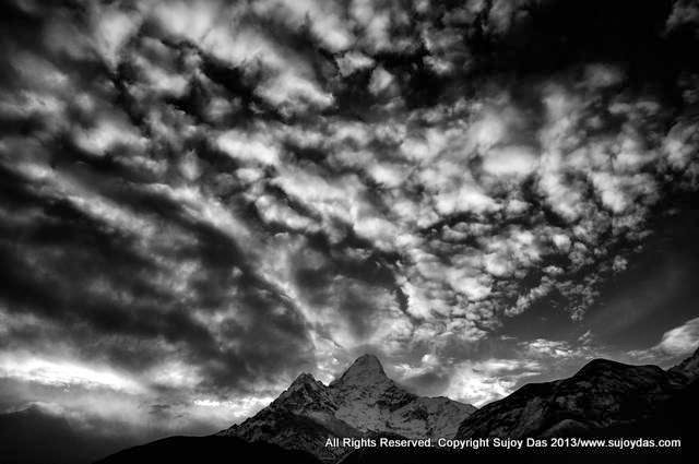
The Stok Kangri range from the Leh flight - our trek travelled along these mountains from east to west

Shang Sumdo to Rumbak September 2nd to 6th 2019

In July-August 2019 we did a shorter route from Shang Sumdo to Stok village crossing two passes. This time we completed the third and more difficult pass Stok La and ended our trek in Rumbak. To compare the two seasons end July-August is warmer, has more flowers, is more green with more of clouds and some rain. The rivers are also higher at this time and there are many more river crossings throughout the trek. In September we were down to only two or three crossings - most of the rivers had receded and we could cross on the rocks. The September weather was also spectacular - clear, blue skies, white mountains all day and warm sunny days. 

For our earlier route and description do visit 
http://sujoyrdas.blogspot.com/2019/08/ladakh-shang-sumdo-to-stok-across-shang.html

September 2nd 2019 Leh to Shang Sumdo
We left Leh at around 9.20 am and headed for the monastery of Hemis. We reached Hemis around 10-45 am - the monastery was not very busy and the light was excellent. After spending a couple of hours at the monastery including the very impressive museum, we headed to Shang Sumdo - the drive to Shang Sumdo took around 45 minutes  from Hemis and we reached in time for lunch.  The campsite was next to the road in a grassy clearing. After lunch we decided to go for an acclimatization walk along the trail from Shang Sumdo to Chogdo  - the end of the Markha valley. We walked along the road for about 20 minutes and then crossed the river on a small wooden bridge and headed across to a cluster of houses with some chortens in the middle. Fields of barley were being harvested and most of the villagers were working in the fields. After chatting with a husband and wife couple who were working in their fields we returned back to our campsite by following an alternative trail on the other side of the river. It was a very pleasant walk with yellow flowers in bloom all along the hillside. 
Leh 3450 metres Shang Sumdo 3700 metres 33 51 18 N 77 42 23 


September 3rd 2019  Shang Sumdo to Shang Phu to camp below Shang La
We left Shang Sumdo at around 8-30 am by our vehicle as we wanted to gain some time and not walk on the motorable road. In 15 minutes we had covered the distance which had taken us two hours by walking on our last trek. We started out at around 8-45 am past the houses of Shang village and within 15 minutes crossed a wooden bridge across the river. In another 30 minutes we came to the river across stones and boulders and made two back to back river crossings - the water levels had reduced it was about calf deep now. The trail then continued across the boulders and we crossed the river again - we did not have to wade into the water.  Finally we crossed the river again for the fourth time and then climbed up to a small shrine with prayer flags. This was about two hours from the start of our walk.  From here the trail continued to climb gently meandering around the valley until we could see ahead the single tea house of Shang Phu. We reached Shang Phu by 11-45 am in three hours which was only due to the fact we have shaved off two hours by  not walking on the motorable road. As we had the whole afternoon free we took a decision to walk up another 75 minutes or so to a high camp below the Shang la and camp on a yak pasture. This would reduce the climb the next morning and make the very long day to Gangpoche doable by early evening. We left Shang Phu after lunch around 1-15 pm and the trail started to climb out of the valley. Within a few minutes we crossed  a small stream using the rocks and then started climbing steadily following the river upstream.  In about an hour we reached a clearing which was actually a yak pasture with thick luxuriant grass and decided to camp here. We could see the pass ahead of us.
Shang Sumdo 3700 metres Shang Phu 4350 metres 33 52 51 N 77 36 38E Yak pasture camp 4624 metres 33 53 44 N 777 36 13 E
Shang Sumdo to End of motorable road by vehicle 20 min End of motorable road to Shang Phu 3 hours Shang Phu to Yak pasture camp 1 hr 15 min


September 4  2019 Yak pasture camp to Shang la to Gangpoche 
It was a very clear morning and we left by 7.30 am for the pass. The trail continued to climb steadily for about an hour until it reached the final steep section at the bottom of the pass. The last push took around 30 to 45 minutes - the prayer flags of the pass are not visible till almost at the top.  Due to the good weather there was an excellent view of Matho Kangri peak dominating the valley. We left the pass around 9-30 am and started the steep downhill route . In about 75 minutes which reached a stream which we were able to walk across the boulders - 4485 metres . A little ahead there was another stream,  we could walk across this as well as the water levels had receded substantially since end July.  The trail then traversed the hillside for another 45 minutes before coming down to the third stream which we also walked across. We then climbed up 10 minutes to a grazing station - we had seen the sheep and goats from this station heading up to the high mountain pastures to graze. This took us around two hours 15 min from the pass. The trail now climbed gently for about 30 minutes and reached the fourth stream crossing - we jumped across the rocks and started a steep climb which eased up in 15 minutes  and followed a trail skirting and traversing the hillside. This continued for about an hour until two reached a small pass with cairns- from here we could look down on Gangpoche and we could see our tents pitched neatly in a green grazing meadow. From this point the trail traversed once again the hillside to the west before descending to a stream crossing. It then climbed up to a small meadow, descended again to another  stream and made the final 10 minute climb to the meadows of Gangpoche.  
 Yak pasture camp 4624 metres 33 53 44 N 777 36 13 E Shang La pass 4940 metres  33 54 18 N 77 35 21 E Gangpoche 4434 m 33 57 6 N 77 32 50 E
Yak pasture camp to Shang La 1 hr 30 to 1 hr 45 min Shang La to shepherds camp 2 hr to 2 hr 15 min Shepherds camp to Gangpoche 2 hrs 45 min to 3 hr 30 min

September 5 2019  Gangpoche to Chorten Chen via Matho La
We left Gangpoche around 7.45 am on another brilliant autumn day - the rains seemed to have faded away and there was a sharp crisp nip in the air. In 10 minutes we crossed a stream which we could jump across and in another 50 minutes came to another stream which we also managed to cross without entering the water. The trail then started to climb from here and reached the top of the pass in around 2 hrs to 2 hrs 15 min. We had an excellent view of Matho Golep and the Pyramid on our climb up to 
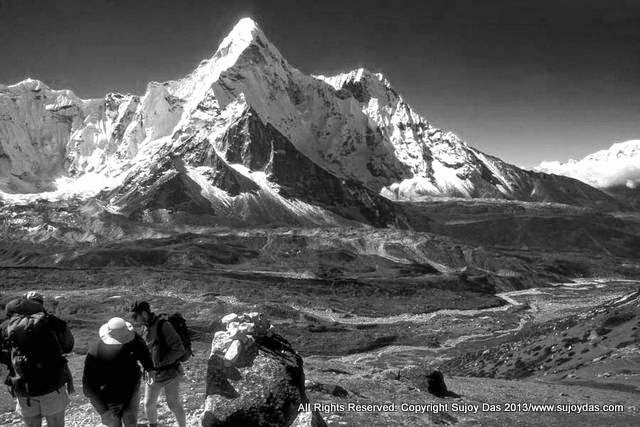
the pass and finally from the pass Stok Kangri came into view the highest peak of the group. We started down at around 11 30am   and stopped for a leisurely lunch on the way. In about 90 minutes (excluding lunch) we saw the campsite of Mankarmo below us. It was 30 minutes away and we had to cross by wading through the fast flowing stream in our sandals - the more intrepid amongst us managed to jump across. From Mankarmo we carried on 20 minutes down to Chorten Chen which was our campsite for the night. It was a beautiful evening and far above us on the craggy rocks we saw a herd of Bharal  about 10-12 animals grazing peacefully in the evening sunshine. 
Gangpoche to Matho La  4957 metres  33 59 0 N  77 31 40 E 3 hrs to 3.5 hours  Matho La to Mankarmo  4336 metres  34 0 8 N 77 29 59 E - 2.5 to 3 hours  Mankarmo to Chorten Chen 4294 metres 34 0 37 N 77 29 56E 20 min


September 6 2019  Chorten Chen to Rumbak via Stok La 
We decided to start out at 6 am because it was a long day across the pass and two false passes before the main pass. The trail started out by following the main trail to Stok but within 10 minutes swung left and climbed very gently for about 40 minutes to the foot of a steep climb to the first pass. There is a full airtel signal on top of this pass. The trail to the second pass is clearly visible. From here a 1 hr 15 min push including a steep 30 minutes zig zag climb brings you to the top of the second pass. Then another 25 minute climb finally reaches the top of Stok La. Rumbak is visible far below in the valley around 1000 metres below. The sheer steep drop to Rumbak loses around 400 metres in 30 minutes before the trail eases out in a wide valley and loses altitude more gently - it takes around 2 hr or so to reach Rumbak. From Rumbak another 45 minute downhill walk comes to a bridge above the river where the cars can pick up the Trekkers. The road to Rumbak will in all likelihood be finished within the next year.  
Chorten Chen to bottom of 1st pass 50 min Bottom of first pass to top of 1st pass 40 min 4584 metres  34 1 22 N 77 29 11 E First Pass to 2nd pass 1 hr 20 min 4820 metres 34 1 56 N 77 28 39 E 2nd pass to Stok La 25 min 4875 metres34 2 5 N 77 28 27 E  Stok La to bottom of pass 40 min  4580 metres Bottom of pass to Rumbak 3860 metres  1 hr 30 min Rumbak to bridge for car pick up 45 min 3712 metres 

For more information on our treks and photoworkshops do visit www.southcol.com


Wednesday, September 11, 2019

Travel and Leisure India | Interview Sujoy Das September 2019 Issue


1. Tell us about your association with Mountain Echoes?

I was invited by Mountain Echoes to speak at the 10th edition of their festival in Bhutan that took place between August 22-25, 2019.  Our new book co-authored with Lisa Choegyal was showcased at the festival.

2. How important do you think platforms like these are for today’s youth?

I think they are very important as they give an opportunity to the youth to interact with different personalities from different professions from all over the world.

3. Photography has taken you around the world. What is your favourite place to shoot?

It would be in the mountains of Nepal, Himalaya. I have spent around two decades shooting in Nepal and the opportunities it has offered me have been incredible. I have done three books on Nepal.

4. Do you remember the first photograph you took? Where was it?

It was on a trek to Sandakphu near Darjeeling, I think in 1976 when I had just finished school from the bungalow of Tonglu looking at the Kanchenjunga range floating above the clouds. This, in fact, fired my interest in photography.

5. Tell us one crazy experience you have had while shooting.

I was trying to reach the Sikkim-Tibet border in North Sikkim at an altitude of 5,000 metres riding a yak; unfortunately, the yak had other ideas and as I was about to shoot some photos it started racing up the valley and threw me off! Luckily, the camera did not suffer any lasting damage!

6. In today’s digital age, everybody owns a high-quality camera. How does one stand out?

You are right. All cameras can take great photos, but it’s the eye behind the lens that’s important; you need to see things in a different way, in a different light, at different times of the day, and to create something different from the run-of-the-mill photo.

7. What kind of traveller are you?

I like to travel light, usually carrying my own backpack.

8. Do you prefer solo or group travel?

I usually travel in small groups, maybe with a few like-minded photographers.

9. What are the three things you must have while travelling?

Well, since most of my work is in the mountains, I would never leave home without a sleeping bag and a warm jacket —  both are essential for survival.

10. What is your most favourite destination in India?

It would be Sikkim, a state where I have spent many months photographing, especially the unspoilt Zemu Valley of North Sikkim in the shadow of Mount Kangchenjunga.

11. What does it take to be a successful travel photographer?

You must be prepared to spend time in the field often in very difficult and arduous conditions. You must also focus on weaving a story around your photos, just isolated images are not good enough and they won’t find a market; most editors will reject them.
During all my time spent in the Himalayas, it’s always been a search for the right light, the right time of the day, the right perspective and the right second, which transforms an ordinary or mundane view. In many of my photographs, there is a story waiting to be told. I hope I have been able to tell it well.

LinkWithin

Related Posts Plugin for WordPress, Blogger...